Enable Location

We need your location to show you interesting places around you

Discover nearby places

Find interesting locations and hidden gems around you

Precise directions

Get accurate directions and distances to places

Your location is never shared with other users. It's only used when you tap the location button.

Cobbs Creek

Log in to your account

Start exploring — it's free

Trusted by 61,674 travelers worldwide

Continue with Google
Continue with Apple
or

We will send you a code to connect

By continuing, you accept our Terms and Conditions and our Privacy Policy

Check your inbox

We've sent a pincode in your inbox. Please enter the code below.

Cobbs Creek

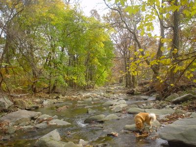
Cobbs Creek, Brook in Darby Township, United States

Description

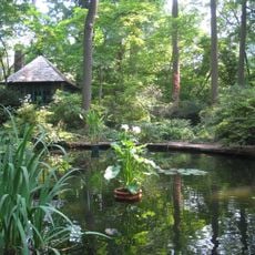
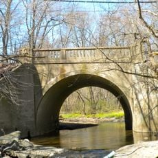
Cobbs Creek is a brook that flows approximately 12 miles through Delaware County, forming natural boundaries between Montgomery County, Delaware County, and Philadelphia County. It is fed by several tributaries including Naylors Run, Indian Creek, Thomas Run Creek, and Paschall Creek, functioning as a key water management system for the region.

History

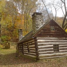
The area around the creek was originally inhabited by the Lenape Native Americans, who named it Karakung, a reference to the wild geese population. Governor Johan Printz established one of Pennsylvania's first water mills at this site in 1645, marking an important point in the region's early industrial development.

Culture

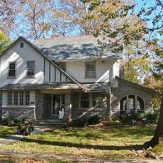
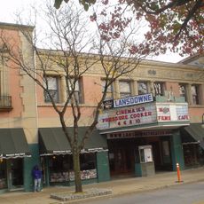
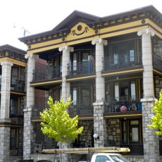
The creek flows past several cemeteries and separates distinct neighborhoods, serving as a natural geographical reference for local residents. This waterway shapes the urban landscape and creates clear boundaries between different communities.

Practical

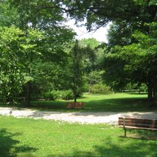
The creek is easily accessible from various parks and green spaces located along its course. Visitors should note that some areas have wetland terrain and should be approached with sturdy footwear.

Did you know?

The creek was historically home to a large goose population that inspired the waterway's name in the Lenape language. These waterways were essential to early settlers, providing the power needed to run mills that drove the region's economy.

Location
GPS coordinates
39.96522,-75.26539
Latest update
December 10, 2025 16:02

AroundUs brings together thousands of curated places, local tips, and hidden gems, enriched daily by 60,000 contributors worldwide. Discover all places nearby (Darby Township).

Around this place
Tower Theatre
United States of America

Tower Theatre

712 m
Mann Center for the Performing Arts
United States of America

Mann Center for the Performing Arts

4.1 km
Suntop Homes
United States of America

Suntop Homes

4.5 km
Ohio House
United States of America

Ohio House

4.7 km
Catholic Total Abstinence Union Fountain
United States of America

Catholic Total Abstinence Union Fountain

4.3 km
Temple Adath Israel of the Main Line
United States of America

Temple Adath Israel of the Main Line

4.5 km
Wynnestay
United States of America

Wynnestay

4.4 km
Arboretum of the Barnes Foundation
United States of America

Arboretum of the Barnes Foundation

4.2 km
Paul Robeson House
United States of America

Paul Robeson House

3.8 km
Pont Reading
United States of America

Pont Reading

4.7 km
Calvary United Methodist Church, Philadelphia
United States of America

Calvary United Methodist Church, Philadelphia

4.4 km
Nitre Hall
United States of America

Nitre Hall

2.7 km
Narbrook Park Historic District
United States of America

Narbrook Park Historic District

4.7 km
Pinehurst Apartments
United States of America

Pinehurst Apartments

4.7 km
City Line Avenue Bridge
United States of America

City Line Avenue Bridge

2.3 km
St. Cyprian Roman Catholic Church
United States of America

St. Cyprian Roman Catholic Church

2 km
Lansdowne Theatre
United States of America

Lansdowne Theatre

3 km
Lansdowne Park Historic District
United States of America

Lansdowne Park Historic District

3 km
Armenian Martyrs' Congregational Church
United States of America

Armenian Martyrs' Congregational Church

3.9 km
Monte Vista
United States of America

Monte Vista

2.3 km
Henry Albertson Subdivision Historic District
United States of America

Henry Albertson Subdivision Historic District

2.6 km
City of Conquerors, Philadelphia
United States of America

City of Conquerors, Philadelphia

1.6 km
Twentieth Century Club of Lansdowne
United States of America

Twentieth Century Club of Lansdowne

3.7 km
La Blanche Apartments
United States of America

La Blanche Apartments

3.6 km
Hanson Haines House
United States of America

Hanson Haines House

4.6 km
Breslyn Apartments
United States of America

Breslyn Apartments

4.4 km
Merion Botanical Park
United States of America

Merion Botanical Park

3.5 km
Lower Swedish Cabin
United States of America

Lower Swedish Cabin

4.2 km
Show the full map
« Cobbs Creek - Brook in Darby Township, United States » is provided by Around Us (aroundus.com). Images and texts are derived from Wikimedia project under a Creative Commons license. You are allowed to copy, distribute, and modify copies of this page, under the conditions set by the license, as long as this note is clearly visible.

Discover hidden gems everywhere you go!

From secret cafés to breathtaking viewpoints, skip the crowded tourist spots and find places that match your style. Our app makes it easy with voice search, smart filtering, route optimization, and insider tips from travelers worldwide. Download now for the complete mobile experience.

Around Us App Screenshot

A unique approach to discovering new places

Le Figaro

All the places worth exploring

France Info

A tailor-made excursion in just a few clicks

20 Minutes

Around Us
Travel Guide & Maps
Download

Send to your phone

QR Code
1

Open the camera app on your mobile.

2

Point at the QR code with your camera. A notification will appear.

3

Tap the notification to open the link.