Enable Location

We need your location to show you interesting places around you

Discover nearby places

Find interesting locations and hidden gems around you

Precise directions

Get accurate directions and distances to places

Your location is never shared with other users. It's only used when you tap the location button.

Harriman Historic District

Log in to your account

Start exploring — it's free

Trusted by 61,321 travelers worldwide

Continue with Google
Continue with Apple
or

We will send you a code to connect

By continuing, you accept our Terms and Conditions and our Privacy Policy

Check your inbox

We've sent a pincode in your inbox. Please enter the code below.

Harriman Historic District, National Register historic district in Bristol, United States

Description

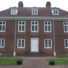
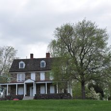
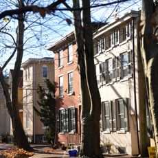
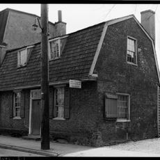
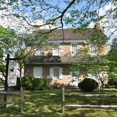
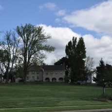
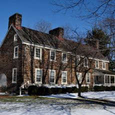
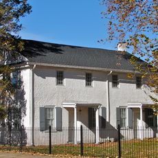
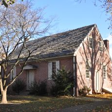
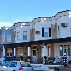
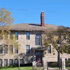
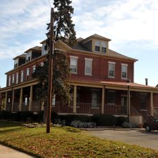
The Harriman Historic District is a historic neighborhood in Bristol containing 109 buildings across about 17 acres, encompassing residences and a school. The development from the early 20th century forms a cohesive residential area laid out with a planned street grid.

History

The neighborhood began in 1917 when railroad businessman W. Averell Harriman founded the Merchant Shipbuilding Corporation to build ships for World War I. The residential area was created to attract and house workers needed for the shipyard operations.

Culture

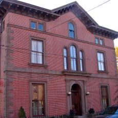
The neighborhood streets carry the names of American Presidents, giving the area a patriotic character. The buildings blend Colonial Revival and Tudor-style elements with brick and stucco facades that define the streetscape.

Practical

The neighborhood is easily explored on foot and accessible for visitors interested in learning about historic architecture and street layout. The school facility in the center remains active and shapes the daily rhythm of the area.

Did you know?

The area was one of the largest residential projects built by the Emergency Fleet Corporation during the wartime effort to house shipyard workers. Its planned structure with presidential street names reflects a deliberately designed workers' community rather than organic neighborhood growth.

Location
GPS coordinates
40.10861,-74.84417
Latest update
December 14, 2025 15:01

AroundUs brings together thousands of curated places, local tips, and hidden gems, enriched daily by 60,000 contributors worldwide. Discover all places nearby (Bristol).

Around this place
Sesame Place Philadelphia
United States of America

Sesame Place Philadelphia

8.8 km
Delaware River – Turnpike Toll Bridge
United States of America

Delaware River – Turnpike Toll Bridge

1.5 km
Pennsbury Manor
United States of America

Pennsbury Manor

7 km
Burlington–Bristol Bridge
United States of America

Burlington–Bristol Bridge

3.7 km
Burlington Island
United States of America

Burlington Island

1.9 km
Neshaminy State Park
United States of America

Neshaminy State Park

8.3 km
St. Mary's Episcopal Church
United States of America

St. Mary's Episcopal Church

3.8 km
Vapor Trail
United States of America

Vapor Trail

8.9 km
Phineas Pemberton House
United States of America

Phineas Pemberton House

5.8 km
Dorrance Mansion
United States of America

Dorrance Mansion

1.7 km
Bristol College
United States of America

Bristol College

5.9 km
Burlington Historic District
United States of America

Burlington Historic District

3.7 km
Grundy Mill Complex
United States of America

Grundy Mill Complex

846 m
Revell House
United States of America

Revell House

3.7 km
Church of St. James the Greater
United States of America

Church of St. James the Greater

1.5 km
Fallsington Historic District
United States of America

Fallsington Historic District

4.6 km
Sotcher Farmhouse
United States of America

Sotcher Farmhouse

7.8 km
Peachfield
United States of America

Peachfield

8.9 km
St. Stephen's Episcopal Church
United States of America

St. Stephen's Episcopal Church

8.2 km
Bristol Historic District
United States of America

Bristol Historic District

1.4 km
Quaker School
United States of America

Quaker School

3.3 km
Bristol Industrial Historic District
United States of America

Bristol Industrial Historic District

1.1 km
Coopertown Meetinghouse
United States of America

Coopertown Meetinghouse

8.4 km
Providence Presbyterian Church of Bustleton
United States of America

Providence Presbyterian Church of Bustleton

5.6 km
Hulmeville Historic District
United States of America

Hulmeville Historic District

6.8 km
Jefferson Land Association Historic District
United States of America

Jefferson Land Association Historic District

922 m
Jefferson Avenue School
United States of America

Jefferson Avenue School

902 m
Roebling Historic District
United States of America

Roebling Historic District

6 km
Show the full map
« Harriman Historic District - National Register historic district in Bristol, United States » is provided by Around Us (aroundus.com). Images and texts are derived from Wikimedia project under a Creative Commons license. You are allowed to copy, distribute, and modify copies of this page, under the conditions set by the license, as long as this note is clearly visible.

Discover hidden gems everywhere you go!

From secret cafés to breathtaking viewpoints, skip the crowded tourist spots and find places that match your style. Our app makes it easy with voice search, smart filtering, route optimization, and insider tips from travelers worldwide. Download now for the complete mobile experience.

Around Us App Screenshot

A unique approach to discovering new places

Le Figaro

All the places worth exploring

France Info

A tailor-made excursion in just a few clicks

20 Minutes

Around Us
Travel Guide & Maps
Download

Send to your phone

QR Code
1

Open the camera app on your mobile.

2

Point at the QR code with your camera. A notification will appear.

3

Tap the notification to open the link.