·

Enable Location

We need your location to show you interesting places around you

Discover nearby places

Find interesting locations and hidden gems around you

Precise directions

Get accurate directions and distances to places

Your location is never shared with other users. It's only used when you tap the location button.

Log in to your account

Start exploring — it's free

Trusted by 62,672 travelers worldwide

Continue with Google
Continue with Apple
or

We will send you a code to connect

By continuing, you accept our Terms and Conditions and our Privacy Policy

Check your inbox

We've sent a pincode in your inbox. Please enter the code below.

Union, county seat of Union County, South Carolina

Union is a town in Union County in northern New Jersey, located along major roads such as the Garden State Parkway and Interstate 78. It consists of neighborhoods and streets that have grown over generations, with local parks, schools, and small businesses that shape daily life here.

Union developed as a connecting point between different parts of the region and grew because of its central location on major routes. Over time, it became an established residential place where families lived for generations and infrastructure was steadily built up.

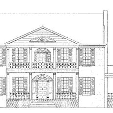
Union takes its name from the historical joining of communities in this region. The streets show a mix of older homes and small shops where neighbors know each other and regularly gather in local parks or at community events.

Getting there is easy via the Garden State Parkway or Interstate 78, which run directly through the town. Buses and public transportation connect Union with nearby towns and larger centers, making it possible to get around without a car.

Union sits just a few miles from New York City, making it an ideal starting point for visitors wanting to explore the metropolis. This proximity has shaped the place and makes it a practical gateway to the larger region.

The community of curious travelers

AroundUs brings together thousands of curated places, local tips, and hidden gems, enriched daily by 60,000 contributors worldwide.

Start exploring
Location
Elevation above the sea
196 m
GPS coordinates
34.71722,-81.62500
Latest update
February 7, 2026 09:32
Around this place
Rose Hill Plantation State Historic Site
United States of America

Rose Hill Plantation State Historic Site

13 km
Corinth Baptist Church
United States of America

Corinth Baptist Church

93 m
Woodland Plantation
United States of America

Woodland Plantation

15.8 km
Buffalo Mill Historic District
United States of America

Buffalo Mill Historic District

4.8 km
Cross Keys House
United States of America

Cross Keys House

16.5 km
Fair Forest Hotel
United States of America

Fair Forest Hotel

313 m
Means House
United States of America

Means House

13.2 km
McCollum Mound
United States of America

McCollum Mound

16.5 km
Nathaniel Gist House
United States of America

Nathaniel Gist House

13.6 km
Merridun
United States of America

Merridun

518 m
Cedar Bluff
United States of America

Cedar Bluff

12.4 km
Judge Thomas Dawkins House
United States of America

Judge Thomas Dawkins House

414 m
Meng House
United States of America

Meng House

243 m
McWhirter House
United States of America

McWhirter House

13.9 km
Gov. Thomas B. Jeter House
United States of America

Gov. Thomas B. Jeter House

538 m
Union Community Hospital
United States of America

Union Community Hospital

319 m
Culp House
United States of America

Culp House

373 m
Herndon Terrace
United States of America

Herndon Terrace

887 m
Main Street Grammar School
United States of America

Main Street Grammar School

474 m
Union Downtown Historic District
United States of America

Union Downtown Historic District

276 m
South Street-South Church Street Historic District
United States of America

South Street-South Church Street Historic District

615 m
Central Graded School
United States of America

Central Graded School

331 m
Clinton Chapel AME Zion Church
United States of America

Clinton Chapel AME Zion Church

355 m
East Main Street-Douglass Heights Historic District
United States of America

East Main Street-Douglass Heights Historic District

830 m
United States of America

East Main Street-Douglass Heights Historic District

717 m
United States of America

Duncan Theatre

262 m
United States of America

Union Theatre

328 m
United States of America

South Street-South Church Street Historic District

475 m
Show the full map
« Union - county seat of Union County, South Carolina » is provided by Around Us (aroundus.com). Images and texts are derived from Wikimedia project under a Creative Commons license. You are allowed to copy, distribute, and modify copies of this page, under the conditions set by the license, as long as this note is clearly visible.

Discover hidden gems everywhere you go!

From secret cafés to breathtaking viewpoints, skip the crowded tourist spots and find places that match your style. Our app makes it easy with voice search, smart filtering, route optimization, and insider tips from travelers worldwide. Download now for the complete mobile experience.

Around Us App Screenshot

A unique approach to discovering new places

Le Figaro

All the places worth exploring

France Info

A tailor-made excursion in just a few clicks

20 Minutes

Around Us
Travel Guide & Maps
Download

Send to your phone

QR Code
1

Open the camera app on your mobile.

2

Point at the QR code with your camera. A notification will appear.

3

Tap the notification to open the link.