Enable Location

We need your location to show you interesting places around you

Discover nearby places

Find interesting locations and hidden gems around you

Precise directions

Get accurate directions and distances to places

Your location is never shared with other users. It's only used when you tap the location button.

Little Falls

Log in to your account

Start exploring — it's free

Trusted by 62,404 travelers worldwide

Continue with Google
Continue with Apple
or

We will send you a code to connect

By continuing, you accept our Terms and Conditions and our Privacy Policy

Check your inbox

We've sent a pincode in your inbox. Please enter the code below.

Little Falls, County seat in Morrison County, Minnesota

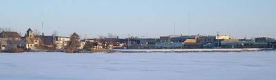
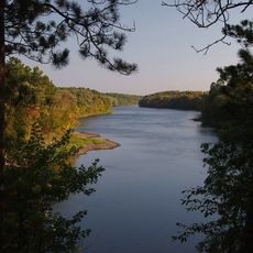
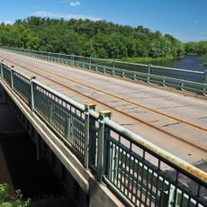
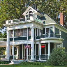
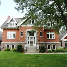
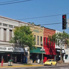
Little Falls is the county seat of Morrison County, Minnesota, situated along both banks of the Mississippi River. The town combines residential neighborhoods with industrial buildings that line the riverbanks.

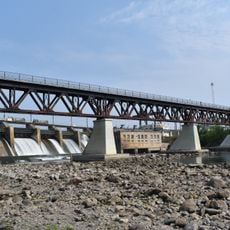
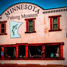
The settlement began in 1848 when water-powered mills transformed the location into a regional manufacturing hub. The river drove the area's economic growth for many decades.

The Parks and Recreation Department organizes year-round events including LegoRama, Dungeons and Dragons sessions, and a Christmas Tree Lighting that bring residents together. These activities shape the community's social life and show how people spend their leisure time.

The city operates water safety programs and recycling initiatives that reflect its commitment to resident well-being. Regular town meetings offer visitors insight into how the community functions and its priorities.

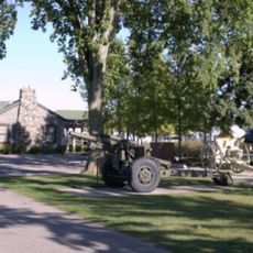
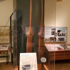
The Little Falls Veterans Project preserves records and honors military personnel from Morrison County who served in the armed forces. This archive reflects how conflicts have shaped the lives of people in this small community.

The community of curious travelers

AroundUs brings together thousands of curated places, local tips, and hidden gems, enriched daily by 60,000 contributors worldwide.

Start exploring
Location
Inception
1848
Elevation above the sea
339 m
GPS coordinates
45.97639,-94.36250
Latest update
December 20, 2025 14:39
Around this place
Charles A. Lindbergh State Park
United States of America

Charles A. Lindbergh State Park

3.2 km
Crow Wing State Park
United States of America

Crow Wing State Park

33 km
Minnesota Military Museum
United States of America

Minnesota Military Museum

11.7 km
United States of America

Crane Meadows National Wildlife Refuge

12.4 km
Church of St. Stephen-Catholic
United States of America

Church of St. Stephen-Catholic

31.3 km
Church of Our Savior-Episcopal
United States of America

Church of Our Savior-Episcopal

367 m
Camp Ripley Bridge
United States of America

Camp Ripley Bridge

11.1 km
Grey Eagle Village Hall
United States of America

Grey Eagle Village Hall

34.4 km
Charles A. Weyerhaeuser and Musser Houses
United States of America

Charles A. Weyerhaeuser and Musser Houses

670 m
Nature Road Bridge
United States of America

Nature Road Bridge

16.8 km
St. Joseph's Church-Catholic
United States of America

St. Joseph's Church-Catholic

20.1 km
Burton-Rosenmeier House
United States of America

Burton-Rosenmeier House

638 m
United States of America

Broadway Bridge

458 m
Soo Line Rail Bridge at Blanchard Dam
United States of America

Soo Line Rail Bridge at Blanchard Dam

12.9 km
Morrison County Courthouse
United States of America

Morrison County Courthouse

177 m
Pine Tree Lumber Company Office Building
United States of America

Pine Tree Lumber Company Office Building

913 m
Little Falls Carnegie Library
United States of America

Little Falls Carnegie Library

295 m
Little Falls Commercial Historic District
United States of America

Little Falls Commercial Historic District

11 m
Bridge L7075
United States of America

Bridge L7075

35.8 km
Charles A. Lindbergh State Park WPA/Rustic Style Historic Resources
United States of America

Charles A. Lindbergh State Park WPA/Rustic Style Historic Resources

3 km
Charles Lindbergh House and Museum
United States of America

Charles Lindbergh House and Museum

2.6 km
Minnesota Fishing Museum
United States of America

Minnesota Fishing Museum

876 m
United States of America

Nokasippi River Historical Monument

22.7 km
United States of America

Sponsa State Wildlife Management Area

24.8 km
United States of America

August Glockzin Reservoir

34 km
United States of America

D Stoerzinger Pond

32.5 km
United States of America

Eagle's Landing Golf Club and Grill

18.2 km
United States of America

Paul Bunyan Statue

31.8 km
Show the full map
« Little Falls - County seat in Morrison County, Minnesota » is provided by Around Us (aroundus.com). Images and texts are derived from Wikimedia project under a Creative Commons license. You are allowed to copy, distribute, and modify copies of this page, under the conditions set by the license, as long as this note is clearly visible.

Discover hidden gems everywhere you go!

From secret cafés to breathtaking viewpoints, skip the crowded tourist spots and find places that match your style. Our app makes it easy with voice search, smart filtering, route optimization, and insider tips from travelers worldwide. Download now for the complete mobile experience.

Around Us App Screenshot

A unique approach to discovering new places

Le Figaro

All the places worth exploring

France Info

A tailor-made excursion in just a few clicks

20 Minutes

Around Us
Travel Guide & Maps
Download

Send to your phone

QR Code
1

Open the camera app on your mobile.

2

Point at the QR code with your camera. A notification will appear.

3

Tap the notification to open the link.