Old Fort Harrod State Park

Log in to your account

AroundUs is a community-driven map of interesting places, built by curious explorers like you. It grows with every review, story, and photo you share.
Connect to save your favorite spots, contribute locations, and create personalized routes.
Continue with Google
Continue with Apple
Continue with X
Continue with Facebook
Continue with email
By continuing, you accept our Terms and Conditions and our Privacy Policy
Create an account
Add to collection
Map
Suggest a change
Share

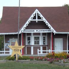
Old Fort Harrod State Park, Pioneer settlement museum and state park in Harrodsburg, United States.

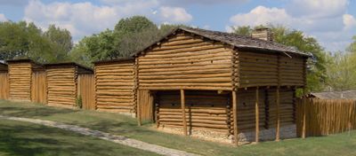
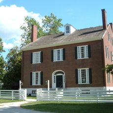
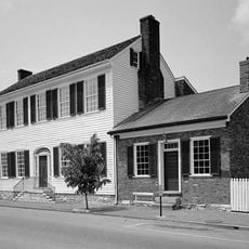
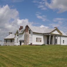
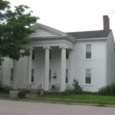
Old Fort Harrod State Park is a reconstructed settlement with log structures including military quarters, family cabins, a schoolhouse, and period-accurate frontier buildings set within stone walls. The grounds also feature a mansion-style museum displaying artifacts and collections from the region's early years.

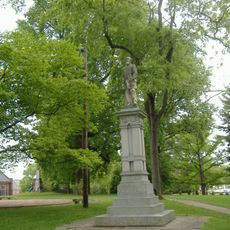
James Harrod founded this settlement in 1774 as the first permanent American community in Kentucky, with thirty pioneers building the original fort. This early outpost became a significant location during the period of westward expansion.

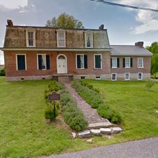
The Mansion Museum displays regional artifacts from the Civil War era and items connected to pioneering families who shaped the settlement. Visitors encounter the everyday objects and possessions that tell stories of frontier life.

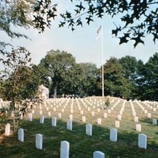
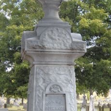
The site is open from sunrise to sunset, allowing visitors to explore the fort layout and surrounding grounds at their own pace. An old cemetery on the property provides insight into the early settlement's history.

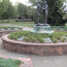
A cabin on the property preserves the location where Thomas Lincoln and Nancy Hanks, the parents of President Abraham Lincoln, were married. This connection to one of America's most significant historical figures draws visitors interested in the country's leadership history.

Location: Kentucky

Opening Hours: sunrise-sunset

Website: https://parks.ky.gov/harrodsburg/parks/historic/old-fort-harrod-state-park

GPS coordinates: 37.76190,-84.84890

Latest update: December 9, 2025 18:47

Photos
Around this place
Pleasant Hill
United States of America

Pleasant Hill

11.4 km
High Bridge of Kentucky
United States of America

High Bridge of Kentucky

12.9 km
Herrington Lake
United States of America

Herrington Lake

13 km
Perryville Battlefield State Historic Site
United States of America

Perryville Battlefield State Historic Site

14.4 km
Pioneer Playhouse
United States of America

Pioneer Playhouse

15.9 km
Rocky Point Manor
United States of America

Rocky Point Manor

110 m
Constitution Square State Historic Site
United States of America

Constitution Square State Historic Site

14.7 km
Confederate Monument in Danville
United States of America

Confederate Monument in Danville

14.3 km
Ephraim McDowell House
United States of America

Ephraim McDowell House

14.7 km
Danville National Cemetery
United States of America

Danville National Cemetery

14.3 km
Elmwood Inn
United States of America

Elmwood Inn

15.5 km
Confederate Monument in Perryville
United States of America

Confederate Monument in Perryville

14.5 km
Carry A. Nation House
United States of America

Carry A. Nation House

12.5 km
Confederate Monument in Harrodsburg
United States of America

Confederate Monument in Harrodsburg

968 m
Union Monument in Perryville
United States of America

Union Monument in Perryville

14.4 km
First Presbyterian Church
United States of America

First Presbyterian Church

14.4 km
Beriah Magoffin Monument
United States of America

Beriah Magoffin Monument

1.1 km
New Providence Presbyterian Church
United States of America

New Providence Presbyterian Church

11.5 km
East Main Street Historic District
United States of America

East Main Street Historic District

15.1 km
Perryville Historic District
United States of America

Perryville Historic District

15.4 km
St. Peter's AME Church
United States of America

St. Peter's AME Church

374 m
St. Philip's Episcopal Church
United States of America

St. Philip's Episcopal Church

410 m
Carnegie Library
United States of America

Carnegie Library

14.4 km
Beaumont Avenue Residential District
United States of America

Beaumont Avenue Residential District

761 m
Cardwellton
United States of America

Cardwellton

571 m
Brightleaf Golf Resort
United States of America

Brightleaf Golf Resort

5.6 km
Kentucky School for the Deaf
United States of America

Kentucky School for the Deaf

15 km
Great American Dollhouse Museum
United States of America

Great American Dollhouse Museum

13.9 km
Show the full map
Reviews

Visited this place? Tap the stars to rate it and share your experience / photos with the community! Try now! You can cancel it anytime.

« Old Fort Harrod State Park - Pioneer settlement museum and state park in Harrodsburg, United States » is provided by Around Us (aroundus.com). Images and texts are derived from Wikimedia project under a Creative Commons license. You are allowed to copy, distribute, and modify copies of this page, under the conditions set by the license, as long as this note is clearly visible.

Discover hidden gems everywhere you go!

From secret cafés to breathtaking viewpoints, skip the crowded tourist spots and find places that match your style. Our app makes it easy with voice search, smart filtering, route optimization, and insider tips from travelers worldwide. Download now for the complete mobile experience.

Around Us App Screenshot

A unique approach to discovering new places

Le Figaro

All the places worth exploring

France Info

A tailor-made excursion in just a few clicks

20 Minutes