Enable Location

We need your location to show you interesting places around you

Discover nearby places

Find interesting locations and hidden gems around you

Precise directions

Get accurate directions and distances to places

Your location is never shared with other users. It's only used when you tap the location button.

Welch

Log in to your account

Start exploring — it's free

Trusted by 61,991 travelers worldwide

Continue with Google
Continue with Apple
or

We will send you a code to connect

By continuing, you accept our Terms and Conditions and our Privacy Policy

Check your inbox

We've sent a pincode in your inbox. Please enter the code below.

Welch, Coal mining city in McDowell County, West Virginia, United States.

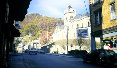
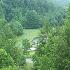
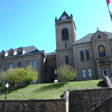
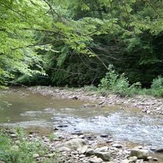
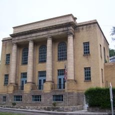
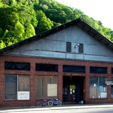
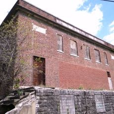
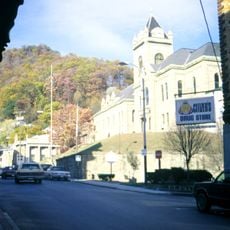
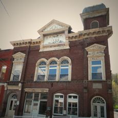
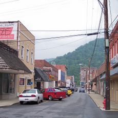
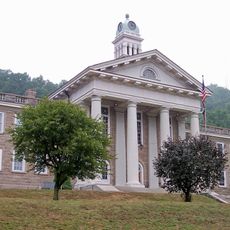
Welch is a town in McDowell County, West Virginia, spreading at the confluence of Elkhorn Creek and Tug Fork amid forested mountains at 403 meters elevation. The historic courthouse district with its early 20th-century brick building forms the center of the settlement and stands listed on the national heritage register.

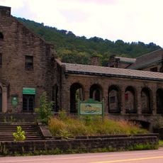
The settlement experienced its rise after the arrival of the Norfolk and Western Railway in 1891, which enabled coal transport from the Pocahontas field. Mining shaped life and economy of the community for decades until the decline of the coal industry began.

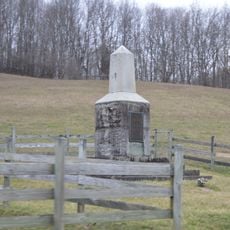
The town carries the first memorial building for World War I veterans on American soil, erected in 1923. This commemoration site still shows the deep connection the community holds with its fallen soldiers from that time.

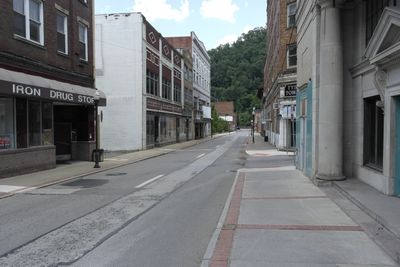
The courthouse district in the town center offers a look into the architectural past and can be explored on foot. The mountainous location requires attention when walking, as some streets rise or drop steeply.

In 1961, a family here received the first federally issued food stamps as part of a program by the Kennedy administration. This action made the town the starting point of a nationwide welfare initiative that would reach millions of households.

The community of curious travelers

AroundUs brings together thousands of curated places, local tips, and hidden gems, enriched daily by 60,000 contributors worldwide.

Start exploring
Location
Inception
1893
Elevation above the sea
403 m
GPS coordinates
37.43722,-81.57889
Latest update
December 13, 2025 16:16
Around this place
Twin Falls Resort State Park
United States of America

Twin Falls Resort State Park

23.3 km
U.S. Coal and Coke Company Store
United States of America

U.S. Coal and Coke Company Store

9.9 km
McDowell County Courthouse
United States of America

McDowell County Courthouse

703 m
Panther Wildlife Management Area
United States of America

Panther Wildlife Management Area

26.3 km
Itmann Company Store and Office
United States of America

Itmann Company Store and Office

20.8 km
World War Memorial
United States of America

World War Memorial

6.5 km
Pocahontas Fuel Company Store and Office Buildings
United States of America

Pocahontas Fuel Company Store and Office Buildings

21.3 km
Ashland Company Store
United States of America

Ashland Company Store

20.1 km
Wyco Church
United States of America

Wyco Church

27.5 km
Carter Coal Company Store
United States of America

Carter Coal Company Store

14.3 km
Page Coal and Coke Company Store
United States of America

Page Coal and Coke Company Store

14.1 km
Welch Commercial Historic District
United States of America

Welch Commercial Historic District

793 m
Capt. James Moore Homestead
United States of America

Capt. James Moore Homestead

24.9 km
United States of America

John Harriman House

18.6 km
Pocahontas Historic District
United States of America

Pocahontas Historic District

25.4 km
Pocahontas Exhibition Coal Mine & Museum
United States of America

Pocahontas Exhibition Coal Mine & Museum

25.2 km
James Ellwood Jones House
United States of America

James Ellwood Jones House

19.9 km
Mullens Historic District
United States of America

Mullens Historic District

23.6 km
John J. Lincoln House
United States of America

John J. Lincoln House

15.8 km
United States of America

Tolliver Branch Lake

24.5 km
United States of America

Horse Creek Public Fishing Area

19.2 km
United States of America

R D Bailey Lake Wildlife Management Area

21.3 km
United States of America

Panther State Forest

26.3 km
Wyoming County Courthouse and Jail
United States of America

Wyoming County Courthouse and Jail

16.7 km
United States of America

Black Wolf Links Golf Course

14.4 km
United States of America

Clear Fork Valley Golf Course

25.1 km
United States of America

Mural, Work of art

669 m
United States of America

Scenic viewpoint

21.6 km
Show the full map
« Welch - Coal mining city in McDowell County, West Virginia, United States » is provided by Around Us (aroundus.com). Images and texts are derived from Wikimedia project under a Creative Commons license. You are allowed to copy, distribute, and modify copies of this page, under the conditions set by the license, as long as this note is clearly visible.

Discover hidden gems everywhere you go!

From secret cafés to breathtaking viewpoints, skip the crowded tourist spots and find places that match your style. Our app makes it easy with voice search, smart filtering, route optimization, and insider tips from travelers worldwide. Download now for the complete mobile experience.

Around Us App Screenshot

A unique approach to discovering new places

Le Figaro

All the places worth exploring

France Info

A tailor-made excursion in just a few clicks

20 Minutes

Around Us
Travel Guide & Maps
Download

Send to your phone

QR Code
1

Open the camera app on your mobile.

2

Point at the QR code with your camera. A notification will appear.

3

Tap the notification to open the link.