Chest opened
+${chestReward.xp} XP
Explorer
NOUVEAU ×${chestReward.collectible.quantity}
tapez pour fermer
Chest locked

Open chests in the app

Around Us is built for your phone — chests unlock when you walk, explore and capture nearby places.

Enable Location

We need your location to show you interesting places around you

Discover nearby places

Find interesting locations and hidden gems around you

Precise directions

Get accurate directions and distances to places

Your location is never shared with other users. It's only used when you tap the location button.

Southborough

Log in to your account

Start exploring — it's free

Trusted by 72,882 travelers worldwide

Continue with Google
Continue with Apple
or

We will send you a code to connect

By continuing, you accept our Terms and Conditions and our Privacy Policy

Check your inbox

We've sent a pincode in your inbox. Please enter the code below.

Discussion Reviews 1 Photos
23.7k Popularity

Southborough, Historic town in Worcester County, Massachusetts

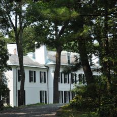
Southborough is a town in Worcester County, Massachusetts, characterized by rolling terrain, water bodies, and a mix of older and newer residential areas. The landscape features wooded sections and open spaces that define its suburban feel.

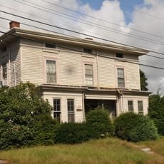
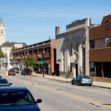
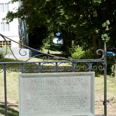
The settlement began in 1660 as Stony Brook and remained primarily agricultural for its first centuries. Manufacturing industries emerged along river valleys during the 1800s, transforming the local economy.

The town holds Heritage Day each Columbus Day with a parade and community activities that bring locals together. These celebrations remain central to how residents connect and mark the changing seasons.

The town is served by MBTA Commuter Rail and crossed by Interstate 495 and the Massachusetts Turnpike for easy access. These connections make it straightforward to reach nearby cities or explore the surrounding region.

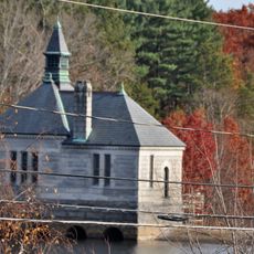
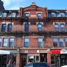
The area contains three separate villages: Cordaville once housed important blanket manufacturing, Fayville is marked by a historic dam. These distinct settlements give the town its dispersed, multi-centered layout.

The community of curious travelers

AroundUs brings together thousands of curated places, local tips, and hidden gems, enriched daily by 60,000 contributors worldwide.

Start exploring
Location
Inception
1660
Elevation above the sea
93 m
Shares border with
Northborough
GPS coordinates
42.30556,-71.52500
Latest update
December 20, 2025 13:50
Around this place
Hopkinton State Park
United States of America

Hopkinton State Park

6.3 km
Callahan State Park
United States of America

Callahan State Park

5 km
Dennison Manufacturing Co. Paper Box Factory
United States of America

Dennison Manufacturing Co. Paper Box Factory

4.2 km
Framingham Reservoir No. 3 Dam and Gatehouse
United States of America

Framingham Reservoir No. 3 Dam and Gatehouse

5.5 km
Hopkinton Dam and Spillway
United States of America

Hopkinton Dam and Spillway

5.5 km
Sudbury Dam Historic District
United States of America

Sudbury Dam Historic District

2.7 km
J.D.C. Bradley House
United States of America

J.D.C. Bradley House

1.9 km
Paul Gibbs House
United States of America

Paul Gibbs House

4.5 km
Marlborough Center Historic District
United States of America

Marlborough Center Historic District

5.1 km
Marlborough Brook Filter Beds
United States of America

Marlborough Brook Filter Beds

2.8 km
Brigham Cemetery
United States of America

Brigham Cemetery

4.9 km
South Union School
United States of America

South Union School

4.2 km
John Cotting House
United States of America

John Cotting House

4.9 km
West Main Street Historic District
United States of America

West Main Street Historic District

5.1 km
Southborough Center Historic District
United States of America

Southborough Center Historic District

304 m
United States of America

Cedar Hill

5.9 km
United States of America

Williams Lake

5.2 km
Lake Chauncy Public Beach
United States of America

Lake Chauncy Public Beach

7.2 km
Hopkinton Reservoir Beach
United States of America

Hopkinton Reservoir Beach

5.3 km
Temple Building
United States of America

Temple Building

5 km
United States of America

Hopkinton Country Club

5.6 km
United States of America

Southborough Golf Club

622 m
United States of America

Framingham Country Club

4.4 km
United States of America

Hopkinton Reservoir

5.6 km
Spring Hill Cemetery
United States of America

Spring Hill Cemetery

5 km
United States of America

Horseshoe sculpture

174 m
United States of America

Scenic viewpoint

5.9 km
United States of America

Scenic viewpoint

7.1 km
Show the full map
Reviews
Share your experience

No review yet

Discussions
Start a discussion...

No discussion yet

« Southborough - Historic town in Worcester County, Massachusetts » is provided by Around Us (aroundus.com). Images and texts are derived from Wikimedia project under a Creative Commons license. You are allowed to copy, distribute, and modify copies of this page, under the conditions set by the license, as long as this note is clearly visible.

Discover hidden gems everywhere you go!

From secret cafés to breathtaking viewpoints, skip the crowded tourist spots and find places that match your style. Our app makes it easy with voice search, smart filtering, route optimization, and insider tips from travelers worldwide. Download now for the complete mobile experience.

Around Us App Screenshot

A unique approach to discovering new places

Le Figaro

All the places worth exploring

France Info

A tailor-made excursion in just a few clicks

20 Minutes

Around Us
Travel Guide & Maps
Download

Send to your phone

QR Code
1

Open the camera app on your mobile.

2

Point at the QR code with your camera. A notification will appear.

3

Tap the notification to open the link.