Enable Location

We need your location to show you interesting places around you

Discover nearby places

Find interesting locations and hidden gems around you

Precise directions

Get accurate directions and distances to places

Your location is never shared with other users. It's only used when you tap the location button.

Theodore Roosevelt Bridge

Log in to your account

Start exploring — it's free

Trusted by 62,015 travelers worldwide

Continue with Google
Continue with Apple
or

We will send you a code to connect

By continuing, you accept our Terms and Conditions and our Privacy Policy

Check your inbox

We've sent a pincode in your inbox. Please enter the code below.

Theodore Roosevelt Bridge

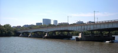
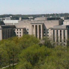
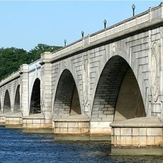
Theodore Roosevelt Bridge, Road bridge across Potomac River in Washington, D.C., United States.

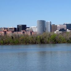
Theodore Roosevelt Bridge is a road bridge carrying eight traffic lanes across the Potomac River and connecting Washington, D.C., with Virginia by way of Interstate 66. The structure features a reversible center lane that changes direction based on the time of day to match traffic demand.

The bridge was planned and built to carry Interstate 66 across the Potomac, with construction beginning in the early 1960s. It was named after the American president who served during the early 1900s and was known for his work on land preservation.

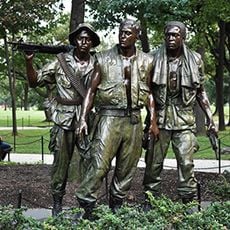
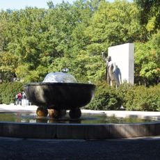
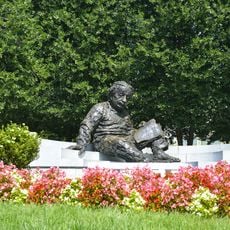
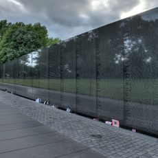
The bridge carries the name of a former president whose conservation legacy is visible in the green space it crosses. Visitors often notice the planted island below and see how this crossing represents the balance between transportation and protecting natural areas.

Drivers should know that the center lane changes direction based on the time of day to support morning and evening traffic flow. It is important to watch for signs as the lane direction is not always obvious.

The bridge's name refers to a green island directly below it that shares the same name and serves as a memorial space. Many commuters drive over the bridge daily without realizing a significant historical site sits beneath them.

The community of curious travelers

AroundUs brings together thousands of curated places, local tips, and hidden gems, enriched daily by 60,000 contributors worldwide.

Start exploring
Location
Official opening
June 23, 1964
GPS coordinates
38.89250,-77.05750
Latest update
December 8, 2025 19:55
Around this place
Vietnam Veterans Memorial
United States of America

Vietnam Veterans Memorial

856 m
Watergate complex
United States of America

Watergate complex

768 m
John F. Kennedy Center for the Performing Arts
United States of America

John F. Kennedy Center for the Performing Arts

382 m
Harry S. Truman Federal Building
United States of America

Harry S. Truman Federal Building

816 m
United States of America

Three Soldiers

669 m
Theodore Roosevelt Island
United States of America

Theodore Roosevelt Island

781 m
Albert Einstein Memorial
United States of America

Albert Einstein Memorial

785 m
Arlington Memorial Bridge
United States of America

Arlington Memorial Bridge

618 m
Washington National Opera
United States of America

Washington National Opera

407 m
Old Naval Observatory
United States of America

Old Naval Observatory

556 m
Benito Juarez
United States of America

Benito Juarez

775 m
John Ericsson National Memorial
United States of America

John Ericsson National Memorial

907 m
Don Quixote
United States of America

Don Quixote

555 m
National Museum of American Diplomacy
United States of America

National Museum of American Diplomacy

944 m
National Academy of Sciences building
United States of America

National Academy of Sciences building

851 m
Construction of Arlington Memorial Bridge
United States of America

Construction of Arlington Memorial Bridge

613 m
St. Mary's Episcopal Church
United States of America

St. Mary's Episcopal Church

777 m
Bernardo de Gálvez
United States of America

Bernardo de Gálvez

852 m
American Institute of Pharmacy Building
United States of America

American Institute of Pharmacy Building

695 m
Tidewater Lock
United States of America

Tidewater Lock

786 m
The Wall
United States of America

The Wall

859 m
Little Island
United States of America

Little Island

229 m
Vietnam Veterans Memorial Information Kiosk
United States of America

Vietnam Veterans Memorial Information Kiosk

790 m
Sacrifice
United States of America

Sacrifice

624 m
East and West Potomac Parks Historic District
United States of America

East and West Potomac Parks Historic District

780 m
Korean War Veterans Memorial Information Kiosk
United States of America

Korean War Veterans Memorial Information Kiosk

860 m
Aspiration and Literature
United States of America

Aspiration and Literature

552 m
Valor
United States of America

Valor

652 m
Show the full map
« Theodore Roosevelt Bridge - Road bridge across Potomac River in Washington, D.C., United States » is provided by Around Us (aroundus.com). Images and texts are derived from Wikimedia project under a Creative Commons license. You are allowed to copy, distribute, and modify copies of this page, under the conditions set by the license, as long as this note is clearly visible.

Discover hidden gems everywhere you go!

From secret cafés to breathtaking viewpoints, skip the crowded tourist spots and find places that match your style. Our app makes it easy with voice search, smart filtering, route optimization, and insider tips from travelers worldwide. Download now for the complete mobile experience.

Around Us App Screenshot

A unique approach to discovering new places

Le Figaro

All the places worth exploring

France Info

A tailor-made excursion in just a few clicks

20 Minutes

Around Us
Travel Guide & Maps
Download

Send to your phone

QR Code
1

Open the camera app on your mobile.

2

Point at the QR code with your camera. A notification will appear.

3

Tap the notification to open the link.