Enable Location

We need your location to show you interesting places around you

Discover nearby places

Find interesting locations and hidden gems around you

Precise directions

Get accurate directions and distances to places

Your location is never shared with other users. It's only used when you tap the location button.

Log in to your account

Start exploring — it's free

Trusted by 65,323 travelers worldwide

Continue with Google
Continue with Apple
or

We will send you a code to connect

By continuing, you accept our Terms and Conditions and our Privacy Policy

Check your inbox

We've sent a pincode in your inbox. Please enter the code below.

Banana River
Discussion Reviews Photo
13.2k Popularity

Banana River, Lagoon system in Brevard County, Florida, United States

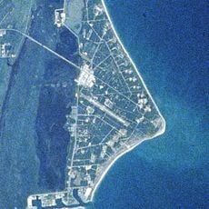
The Banana River is a lagoon system stretching roughly 50 kilometers along Florida's eastern coast, forming a natural barrier between Merritt Island and the mainland. The waterway consists of several interconnected bays accessible through numerous public boat ramps and access points throughout Brevard County.

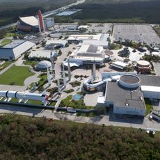
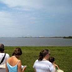
The waterway served as a vital shipping and trade route until the Kennedy Space Center's construction in 1964 divided it into northern and southern sections. This infrastructure change reshaped the region's geography and how water traffic moved through the lagoon system.

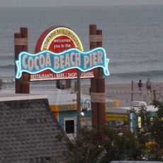
The waterway is woven into the daily lives of local fishing communities, where people gather to share their catches and boating experiences. Waters here reflect the long-standing relationship between residents and the sea.

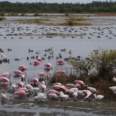
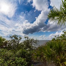
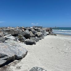
The waterway is suitable for boating, fishing, and wildlife viewing, especially during warmer months when conditions are favorable. Visitors should check local tide patterns at public access points before heading out on the water.

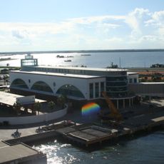
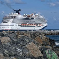
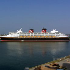
Specialized locks at Port Canaveral allow vessels to pass directly between the lagoon and the Atlantic Ocean, creating a rare connection between two different water systems. This engineering feature quietly shapes how maritime traffic uses the waterway today.

The community of curious travelers

AroundUs brings together thousands of curated places, local tips, and hidden gems, enriched daily by 60,000 contributors worldwide.

Start exploring
Location
GPS coordinates
28.45602,-80.62763
Latest update
December 7, 2025 20:41
Around this place
Cape Canaveral Space Force Station
United States of America

Cape Canaveral Space Force Station

6.1 km
Kennedy Space Center Visitor Complex
United States of America

Kennedy Space Center Visitor Complex

9.2 km

Space Mirror Memorial
United States of America

Space Mirror Memorial

9.4 km
Merritt Island National Wildlife Refuge
United States of America

Merritt Island National Wildlife Refuge

7.8 km
Operations and Checkout Building
United States of America

Operations and Checkout Building

7.8 km
Mercury Control Center
United States of America

Mercury Control Center

4.5 km
Cape Canaveral Light
United States of America

Cape Canaveral Light

8.3 km
Cape Canaveral Space Force Museum
United States of America

Cape Canaveral Space Force Museum

5.7 km
Space Shuttle Atlantis
United States of America

Space Shuttle Atlantis

9.3 km
Manatee Sanctuary Park
United States of America

Manatee Sanctuary Park

6.9 km
The Wizard of OZ Museum
United States of America

The Wizard of OZ Museum

8.5 km
Hangar AE
United States of America

Hangar AE

5.6 km
Disney Cruise Line Terminal
United States of America

Disney Cruise Line Terminal

4.8 km
Porcher House
United States of America

Porcher House

14.2 km
St. Luke's Episcopal Church and Cemetery
United States of America

St. Luke's Episcopal Church and Cemetery

8.8 km
Dr. George E. Hill House
United States of America

Dr. George E. Hill House

11.2 km
J. R. Field Homestead
United States of America

J. R. Field Homestead

10.8 km
City Point Community Church
United States of America

City Point Community Church

12.8 km
Mercury Monument
United States of America

Mercury Monument

8.2 km
Sands Space History Center
United States of America

Sands Space History Center

4.9 km
Cape Canaveral Space Force Museum
United States of America

Cape Canaveral Space Force Museum

5.7 km
Jetty Park Beach
United States of America

Jetty Park Beach

6.6 km
Cocoa Beach Pier
United States of America

Cocoa Beach Pier

10.2 km
Conrad Creek
United States of America

Conrad Creek

14.1 km
Jetty Park Road
United States of America

Jetty Park Road

6.2 km
Cape Canaveral Public Library
United States of America

Cape Canaveral Public Library

8.3 km
West Basin
United States of America

West Basin

4.8 km
Show the full map
Reviews
Share your experience

No review yet

Discussions
Start a discussion...

No discussion yet

« Banana River - Lagoon system in Brevard County, Florida, United States » is provided by Around Us (aroundus.com). Images and texts are derived from Wikimedia project under a Creative Commons license. You are allowed to copy, distribute, and modify copies of this page, under the conditions set by the license, as long as this note is clearly visible.

Discover hidden gems everywhere you go!

From secret cafés to breathtaking viewpoints, skip the crowded tourist spots and find places that match your style. Our app makes it easy with voice search, smart filtering, route optimization, and insider tips from travelers worldwide. Download now for the complete mobile experience.

Around Us App Screenshot

A unique approach to discovering new places

Le Figaro

All the places worth exploring

France Info

A tailor-made excursion in just a few clicks

20 Minutes

Around Us
Travel Guide & Maps
Download

Send to your phone

QR Code
1

Open the camera app on your mobile.

2

Point at the QR code with your camera. A notification will appear.

3

Tap the notification to open the link.