Enable Location

We need your location to show you interesting places around you

Discover nearby places

Find interesting locations and hidden gems around you

Precise directions

Get accurate directions and distances to places

Your location is never shared with other users. It's only used when you tap the location button.

Hangar AE

Log in to your account

Start exploring — it's free

Trusted by 61,598 travelers worldwide

Continue with Google
Continue with Apple
or

We will send you a code to connect

By continuing, you accept our Terms and Conditions and our Privacy Policy

Check your inbox

We've sent a pincode in your inbox. Please enter the code below.

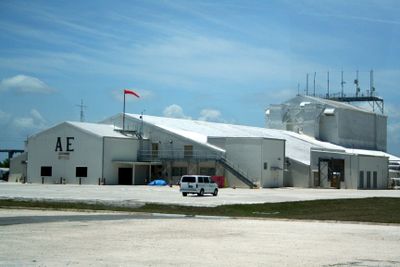
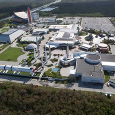
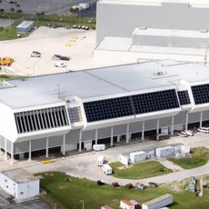
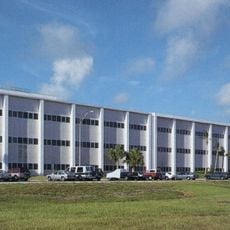
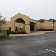
Hangar AE, NASA communications center in Cape Canaveral Space Force Station, United States

Description

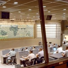
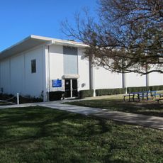
Hangar AE is a control center at Cape Canaveral containing three launch vehicle data centers and a Mission Director's Center for monitoring space missions. The building features advanced communication systems that process real-time voice, data, and video information during launch operations, with each control room designed to accommodate up to 30 personnel.

History

The building was constructed in 1959 for Department of Defense missile programs and was acquired by NASA in 1960. It was then modified to support monitoring of unmanned space missions and remains in operation for that purpose today.

Culture

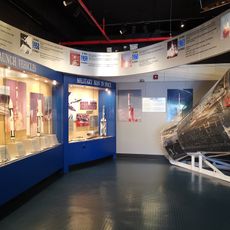
This facility acts as a nerve center for tracking unmanned spacecraft and represents how different space programs work together. Visitors can observe how controllers monitor launches in real time and receive data streams from multiple launch sites across the country.

Practical

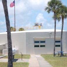
Access to this facility is restricted to authorized personnel only, as it remains an active space operations center. Visitors interested in touring the site should contact Cape Canaveral in advance to inquire about available viewing opportunities and security requirements.

Did you know?

The facility houses a specialized clean room with horizontal laminar flow systems designed to handle sensitive data processing during missions. This technical capability allows the center to receive and process telemetry simultaneously from launch sites scattered throughout the nation.

Location
Inception
1958
GPS coordinates
28.48992,-80.58506
Latest update
December 14, 2025 12:26

AroundUs brings together thousands of curated places, local tips, and hidden gems, enriched daily by 60,000 contributors worldwide. Discover all places nearby (Brevard County).

Around this place
Vehicle Assembly Building
United States of America

Vehicle Assembly Building

12.5 km
Cape Canaveral Space Force Station
United States of America

Cape Canaveral Space Force Station

721 m
Crawler-transporter
United States of America

Crawler-transporter

13 km
Kennedy Space Center Visitor Complex
United States of America

Kennedy Space Center Visitor Complex

10.2 km

Space Mirror Memorial
United States of America

Space Mirror Memorial

10.2 km
Rocco A. Petrone Launch Control Center
United States of America

Rocco A. Petrone Launch Control Center

12.3 km
Merritt Island National Wildlife Refuge
United States of America

Merritt Island National Wildlife Refuge

8.5 km
Operations and Checkout Building
United States of America

Operations and Checkout Building

7.1 km
Mercury Control Center
United States of America

Mercury Control Center

3 km
Cape Canaveral Light
United States of America

Cape Canaveral Light

5.2 km
Cape Canaveral Space Force Museum
United States of America

Cape Canaveral Space Force Museum

5.3 km
Space Shuttle Atlantis
United States of America

Space Shuttle Atlantis

10.1 km
Launch Complex 39 Press Site
United States of America

Launch Complex 39 Press Site

11.9 km
Manatee Sanctuary Park
United States of America

Manatee Sanctuary Park

11.1 km
John F. Kennedy Space Center MPS
United States of America

John F. Kennedy Space Center MPS

12.4 km
The Wizard of OZ Museum
United States of America

The Wizard of OZ Museum

12.2 km
Disney Cruise Line Terminal
United States of America

Disney Cruise Line Terminal

9.6 km
St. Luke's Episcopal Church and Cemetery
United States of America

St. Luke's Episcopal Church and Cemetery

13.5 km
Mercury Monument
United States of America

Mercury Monument

3.1 km
Sands Space History Center
United States of America

Sands Space History Center

8.3 km
Cape Canaveral Space Force Museum
United States of America

Cape Canaveral Space Force Museum

5.5 km
Jetty Park Beach
United States of America

Jetty Park Beach

9.3 km
Conrad Creek
United States of America

Conrad Creek

10.1 km
Jetty Park Road
United States of America

Jetty Park Road

9.3 km
Jack Davis Island
United States of America

Jack Davis Island

11.5 km
Cape Canaveral Public Library
United States of America

Cape Canaveral Public Library

11.9 km
West Basin
United States of America

West Basin

9.5 km
Show the full map
« Hangar AE - NASA communications center in Cape Canaveral Space Force Station, United States » is provided by Around Us (aroundus.com). Images and texts are derived from Wikimedia project under a Creative Commons license. You are allowed to copy, distribute, and modify copies of this page, under the conditions set by the license, as long as this note is clearly visible.

Discover hidden gems everywhere you go!

From secret cafés to breathtaking viewpoints, skip the crowded tourist spots and find places that match your style. Our app makes it easy with voice search, smart filtering, route optimization, and insider tips from travelers worldwide. Download now for the complete mobile experience.

Around Us App Screenshot

A unique approach to discovering new places

Le Figaro

All the places worth exploring

France Info

A tailor-made excursion in just a few clicks

20 Minutes

Around Us
Travel Guide & Maps
Download

Send to your phone

QR Code
1

Open the camera app on your mobile.

2

Point at the QR code with your camera. A notification will appear.

3

Tap the notification to open the link.