Enable Location

We need your location to show you interesting places around you

Discover nearby places

Find interesting locations and hidden gems around you

Precise directions

Get accurate directions and distances to places

Your location is never shared with other users. It's only used when you tap the location button.

Bridgeport

Log in to your account

Start exploring — it's free

Trusted by 65,286 travelers worldwide

Continue with Google
Continue with Apple
or

We will send you a code to connect

By continuing, you accept our Terms and Conditions and our Privacy Policy

Check your inbox

We've sent a pincode in your inbox. Please enter the code below.

Discussion Reviews 2 Photos
47.8k Popularity

Bridgeport, Residential neighborhood in South Side Chicago, United States.

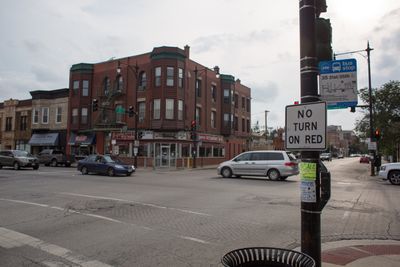
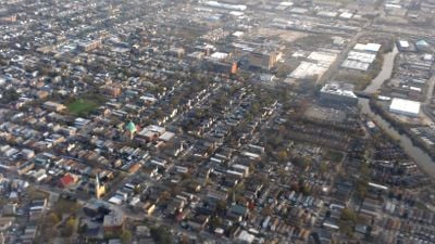
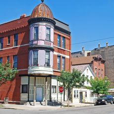
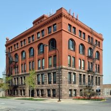
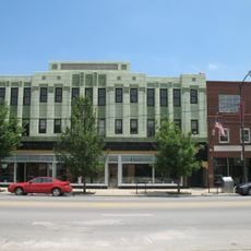
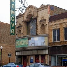
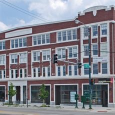
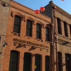
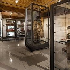
Bridgeport is a residential neighborhood on Chicago's South Side located between the Chicago River and Pershing Road. The area features historic buildings, local dining establishments, and art centers distributed throughout its blocks.

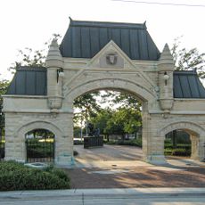
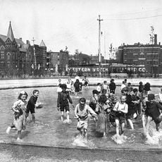
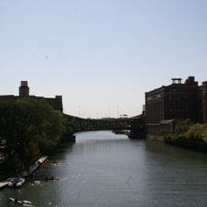
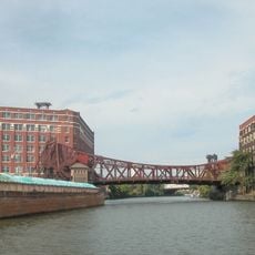
The neighborhood received its name in 1836 from a bridge spanning the Chicago River and became Chicago's first organized residential community. This early founding established it as a pioneer area in the city's growth and expansion.

The neighborhood takes its name from a bridge that once crossed the Chicago River, grounding its identity in a simple geographic feature. Residents from different backgrounds have shaped the community through their food businesses, shops, and places of worship visible throughout the streets.

The neighborhood is accessible by Chicago Transit Authority trains, with the Orange Line and Red Line providing connections to downtown and surrounding areas. Visitors can walk through the streets and explore local restaurants and art centers at their own pace.

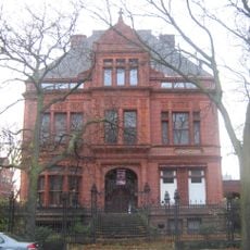
Five Chicago mayors made their homes in this neighborhood, connecting it deeply to the city's political life and leadership. This concentration of influential residents gave the area a distinctive role in shaping local government.

The community of curious travelers

AroundUs brings together thousands of curated places, local tips, and hidden gems, enriched daily by 60,000 contributors worldwide.

Start exploring
Location
Part of
Chicago, South Side, 11th Ward
Shares border with
Lower West Side, McKinley Park, New City, Fuller Park, Armour Square
GPS coordinates
41.83750,-87.64750
Latest update
March 5, 2026 21:06
Around this place
S. R. Crown Hall
United States of America

S. R. Crown Hall

1.7 km
Union Stock Yard Gate
United States of America

Union Stock Yard Gate

2.1 km
Pilsen Historic District
United States of America

Pilsen Historic District

2 km
Sydney Kent House
United States of America

Sydney Kent House

2 km
Illinois Institute of Technology Academic Campus
United States of America

Illinois Institute of Technology Academic Campus

1.6 km
Chicago Bee Building
United States of America

Chicago Bee Building

2.1 km
Armour Square Park
United States of America

Armour Square Park

1.2 km
United States of America

Chicago Maritime Museum

1 km
Spiegel Office Building
United States of America

Spiegel Office Building

877 m
Ramova Theater
United States of America

Ramova Theater

810 m
Overton Hygienic Building
United States of America

Overton Hygienic Building

2.1 km
Cermak Road Bridge Historic District
United States of America

Cermak Road Bridge Historic District

1.8 km
Central Manufacturing District–Original East Historic District
United States of America

Central Manufacturing District–Original East Historic District

1.2 km
United States of America

South Halsted Street Lift-Bridge

1.4 km
Chinese American Museum of Chicago
United States of America

Chinese American Museum of Chicago

1.9 km
United States of America

Taylor Lauridsen Park

2.2 km
Chicago Maritime Museum
United States of America

Chicago Maritime Museum

1 km
Cermak Road Bridge
United States of America

Cermak Road Bridge

1.8 km
Chicago & Alton Railroad Bridge
United States of America

Chicago & Alton Railroad Bridge

1.4 km

Chicago Art Department

2.1 km

Mana Contemporary

1.7 km
United States of America

Man on a Bench

1.7 km
United States of America

Dr. Sun Yat-Sen

1.6 km
United States of America

Julián Carrillo

2.2 km
United States of America

Confucius

2 km
United States of America

Canaryville

1.7 km
United States of America

Bridgeport

1.8 km
United States of America

Mural, Work of art

2.4 km
Show the full map
Reviews
Share your experience

No review yet

Discussions
Start a discussion...

No discussion yet

« Bridgeport - Residential neighborhood in South Side Chicago, United States » is provided by Around Us (aroundus.com). Images and texts are derived from Wikimedia project under a Creative Commons license. You are allowed to copy, distribute, and modify copies of this page, under the conditions set by the license, as long as this note is clearly visible.

Discover hidden gems everywhere you go!

From secret cafés to breathtaking viewpoints, skip the crowded tourist spots and find places that match your style. Our app makes it easy with voice search, smart filtering, route optimization, and insider tips from travelers worldwide. Download now for the complete mobile experience.

Around Us App Screenshot

A unique approach to discovering new places

Le Figaro

All the places worth exploring

France Info

A tailor-made excursion in just a few clicks

20 Minutes

Around Us
Travel Guide & Maps
Download

Send to your phone

QR Code
1

Open the camera app on your mobile.

2

Point at the QR code with your camera. A notification will appear.

3

Tap the notification to open the link.