Enable Location

We need your location to show you interesting places around you

Discover nearby places

Find interesting locations and hidden gems around you

Precise directions

Get accurate directions and distances to places

Your location is never shared with other users. It's only used when you tap the location button.

Log in to your account

Start exploring — it's free

Trusted by 64,606 travelers worldwide

Continue with Google
Continue with Apple
or

We will send you a code to connect

By continuing, you accept our Terms and Conditions and our Privacy Policy

Check your inbox

We've sent a pincode in your inbox. Please enter the code below.

Discussion Reviews Photo
10.7k Popularity

Clearing, Residential neighborhood in southwest Chicago, United States.

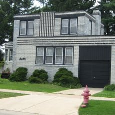
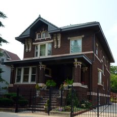
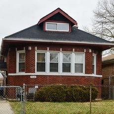
Clearing is a residential neighborhood in southwest Chicago located between 59th and 65th streets and bordered by Harlem Avenue and railroad tracks. The area includes a mix of housing types and has been shaped by its proximity to a major transportation hub.

The area was originally marshland before being drained and settled in the early 1900s. It became an independent town in 1912 and was annexed into Chicago in 1915.

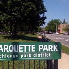
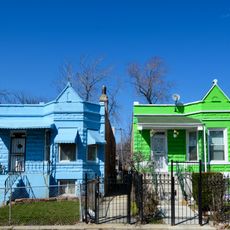
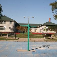
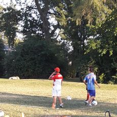
The name comes from the clearing of the original marshland that once covered the area, and today different communities live side by side in the neighborhood. People gather at local parks and community spaces for events and everyday activities.

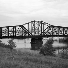
The neighborhood is well served by multiple bus lines that connect to downtown Chicago, making it easy to reach other parts of the city. Train access through nearby railroad tracks offers additional transportation options for residents and visitors.

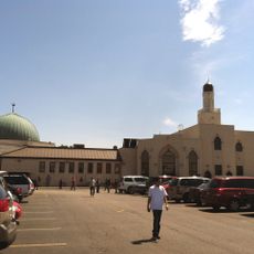
A significant portion of Chicago Midway International Airport extends into the southern part of this neighborhood. This airport presence has shaped the area's development and continues to influence local patterns today.

The community of curious travelers

AroundUs brings together thousands of curated places, local tips, and hidden gems, enriched daily by 60,000 contributors worldwide.

Start exploring
Location
GPS coordinates
41.78000,-87.76000
Latest update
December 10, 2025 15:52
Around this place
SeatGeek Stadium
United States of America

SeatGeek Stadium

4.2 km
Hawthorne Works
United States of America

Hawthorne Works

8 km
Coonley House
United States of America

Coonley House

7.3 km
United States of America

Chicago Motor Speedway

5.7 km
Spindle
United States of America

Spindle

8.5 km
Goldblatt's Building
United States of America

Goldblatt's Building

8.5 km
Marquette Park
United States of America

Marquette Park

4.9 km
K-Town Historic District
United States of America

K-Town Historic District

8.5 km
Mosque Foundation
United States of America

Mosque Foundation

7.3 km
Riverside Historic District
United States of America

Riverside Historic District

7.3 km
Hofmann Tower
United States of America

Hofmann Tower

6.8 km
F. F. Tomek House
United States of America

F. F. Tomek House

7.5 km
Haunted Trails
United States of America

Haunted Trails

4.7 km
J. Sterling Morton High School East Auditorium
United States of America

J. Sterling Morton High School East Auditorium

7.5 km
American State Bank
United States of America

American State Bank

8.3 km
Arthur J. Dunham House
United States of America

Arthur J. Dunham House

7 km
Cornell Square
United States of America

Cornell Square

7.8 km
Mr. Robert Silhan House
United States of America

Mr. Robert Silhan House

5.3 km
Anton Cermak House
United States of America

Anton Cermak House

8.4 km
Children's Museum in Oak Lawn
United States of America

Children's Museum in Oak Lawn

6.8 km
Central Berwyn Bungalow Historic District
United States of America

Central Berwyn Bungalow Historic District

7.8 km
DuPont-Whitehouse House
United States of America

DuPont-Whitehouse House

8.2 km
Central Manufacturing District–Pershing Road Development Historic District
United States of America

Central Manufacturing District–Pershing Road Development Historic District

8.5 km
Arcade Building
United States of America

Arcade Building

7.2 km
Auburn Gresham Bungalow Historic District
United States of America

Auburn Gresham Bungalow Historic District

8.1 km
Ehlert Park Splash Pad
United States of America

Ehlert Park Splash Pad

8 km
Apostolic House of Prayer
United States of America

Apostolic House of Prayer

8.1 km
Chicago & Western Indiana Railroad Bridge
United States of America

Chicago & Western Indiana Railroad Bridge

4.9 km
Show the full map
Reviews
Share your experience

No review yet

Discussions
Start a discussion...

No discussion yet

« Clearing - Residential neighborhood in southwest Chicago, United States » is provided by Around Us (aroundus.com). Images and texts are derived from Wikimedia project under a Creative Commons license. You are allowed to copy, distribute, and modify copies of this page, under the conditions set by the license, as long as this note is clearly visible.

Discover hidden gems everywhere you go!

From secret cafés to breathtaking viewpoints, skip the crowded tourist spots and find places that match your style. Our app makes it easy with voice search, smart filtering, route optimization, and insider tips from travelers worldwide. Download now for the complete mobile experience.

Around Us App Screenshot

A unique approach to discovering new places

Le Figaro

All the places worth exploring

France Info

A tailor-made excursion in just a few clicks

20 Minutes

Around Us
Travel Guide & Maps
Download

Send to your phone

QR Code
1

Open the camera app on your mobile.

2

Point at the QR code with your camera. A notification will appear.

3

Tap the notification to open the link.