Enable Location

We need your location to show you interesting places around you

Discover nearby places

Find interesting locations and hidden gems around you

Precise directions

Get accurate directions and distances to places

Your location is never shared with other users. It's only used when you tap the location button.

Humboldt Park

Log in to your account

Start exploring — it's free

Trusted by 61,585 travelers worldwide

Continue with Google
Continue with Apple
or

We will send you a code to connect

By continuing, you accept our Terms and Conditions and our Privacy Policy

Check your inbox

We've sent a pincode in your inbox. Please enter the code below.

Humboldt Park, Residential neighborhood on West Side of Chicago, United States.

Description

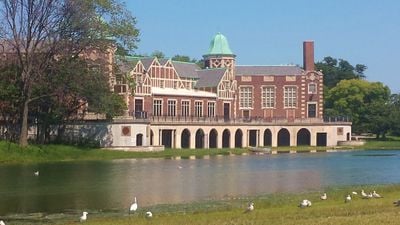
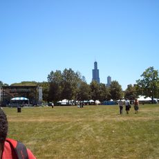
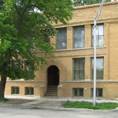
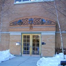
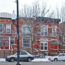
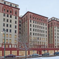
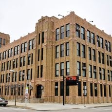
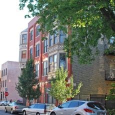
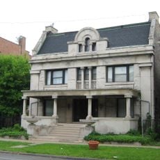
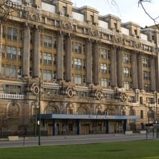
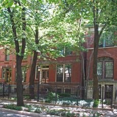
Humboldt Park is a residential area on the West Side of Chicago in the United States, extending over several blocks with brick and wooden houses. The streets are lined with trees, and a central park with lagoons and lawns provides open space within the built environment.

History

The area received its name after Alexander von Humboldt in 1869 and developed as a settlement following the Great Chicago Fire. Immigrants from Europe moved into the neighborhood, later followed by residents from the Caribbean who continued to shape it.

Culture

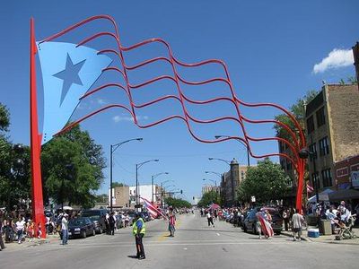
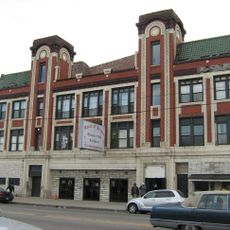
The area expresses its Puerto Rican character through murals, restaurants, and shops that remain visible along the streets. Visitors also notice the use of the name Paseo Boricua in this district, referring to its Caribbean roots.

Practical

Visitors reach the neighborhood using the Blue Line and bus routes that connect directly to downtown. The central park and sports facilities remain open throughout the day and offer opportunities for walking or resting.

Did you know?

Two large steel flags mark the entrance to the cultural district on Division Street, reaching a height of about 59 feet (18 meters). The flags remain visible from a distance and serve as a landmark in the western part of the city.

Location
Shares border with
Hermosa, Belmont Cragin, Austin, West Garfield Park, East Garfield Park, Logan Square, West Town, Near West Side
GPS coordinates
41.88000,-87.70000
Latest update
December 13, 2025 17:36

AroundUs brings together thousands of curated places, local tips, and hidden gems, enriched daily by 60,000 contributors worldwide. Discover all places nearby (Chicago).

Around this place
United Center
United States of America

United Center

2.1 km
Statue of Michael Jordan
United States of America

Statue of Michael Jordan

2.2 km
Garfield Park
United States of America

Garfield Park

1.6 km
Douglass Park
United States of America

Douglass Park

2.2 km
Garfield Park Conservatory
United States of America

Garfield Park Conservatory

1.7 km
Sears, Roebuck and Company Complex
United States of America

Sears, Roebuck and Company Complex

1.5 km
Humboldt Park
United States of America

Humboldt Park

3 km
Union Park
United States of America

Union Park

2.9 km
Central Park Theater
United States of America

Central Park Theater

1.6 km
St. Nicholas Cathedral
United States of America

St. Nicholas Cathedral

2.3 km
First Baptist Congregational Church
United States of America

First Baptist Congregational Church

2.7 km
Waller Apartments
United States of America

Waller Apartments

641 m
Ukrainian National Museum
United States of America

Ukrainian National Museum

2.1 km
Ukrainian Institute of Modern Art
United States of America

Ukrainian Institute of Modern Art

2.2 km
Leif Erikson Monument
United States of America

Leif Erikson Monument

3 km
Tri-Taylor Historic District
United States of America

Tri-Taylor Historic District

1.8 km
Guyon Hotel
United States of America

Guyon Hotel

2.2 km
Lucy Flower Technical High School for Girls
United States of America

Lucy Flower Technical High School for Girls

1.5 km
East Village Historic District
United States of America

East Village Historic District

3.1 km
King-Nash House
United States of America

King-Nash House

697 m
Midwest Athletic Club
United States of America

Midwest Athletic Club

1.8 km
Union Park Hotel
United States of America

Union Park Hotel

2.8 km
Henry E. Legler Regional Branch of the Chicago Public Library
United States of America

Henry E. Legler Regional Branch of the Chicago Public Library

2.1 km
Chicago Telephone Company Kedzie Exchange
United States of America

Chicago Telephone Company Kedzie Exchange

898 m
John H. Stroger, Jr. Hospital of Cook County
United States of America

John H. Stroger, Jr. Hospital of Cook County

2.3 km
Fritz Reuter Monument
United States of America

Fritz Reuter Monument

2.7 km
Jackson Boulevard District and Extension
United States of America

Jackson Boulevard District and Extension

2.9 km
World's Fair Bison
United States of America

World's Fair Bison

2.7 km
Show the full map
« Humboldt Park - Residential neighborhood on West Side of Chicago, United States » is provided by Around Us (aroundus.com). Images and texts are derived from Wikimedia project under a Creative Commons license. You are allowed to copy, distribute, and modify copies of this page, under the conditions set by the license, as long as this note is clearly visible.

Discover hidden gems everywhere you go!

From secret cafés to breathtaking viewpoints, skip the crowded tourist spots and find places that match your style. Our app makes it easy with voice search, smart filtering, route optimization, and insider tips from travelers worldwide. Download now for the complete mobile experience.

Around Us App Screenshot

A unique approach to discovering new places

Le Figaro

All the places worth exploring

France Info

A tailor-made excursion in just a few clicks

20 Minutes

Around Us
Travel Guide & Maps
Download

Send to your phone

QR Code
1

Open the camera app on your mobile.

2

Point at the QR code with your camera. A notification will appear.

3

Tap the notification to open the link.