Chest opened
+${chestReward.xp} XP
Explorer
NOUVEAU ×${chestReward.collectible.quantity}
tapez pour fermer
Chest locked

Open chests in the app

Around Us is built for your phone — chests unlock when you walk, explore and capture nearby places.

Enable Location

We need your location to show you interesting places around you

Discover nearby places

Find interesting locations and hidden gems around you

Precise directions

Get accurate directions and distances to places

Your location is never shared with other users. It's only used when you tap the location button.

Point of Rocks

Log in to your account

Start exploring — it's free

Trusted by 72,990 travelers worldwide

Continue with Google
Continue with Apple
or

We will send you a code to connect

By continuing, you accept our Terms and Conditions and our Privacy Policy

Check your inbox

We've sent a pincode in your inbox. Please enter the code below.

Discussion Reviews 1 Photos
17.9k Popularity

Point of Rocks, unincorporated community in Frederick County, Maryland, United States

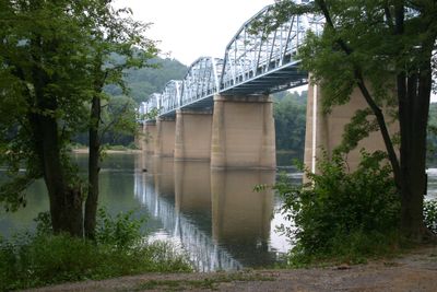
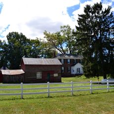
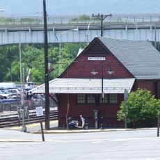
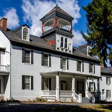
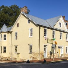
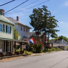
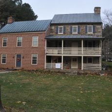
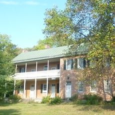
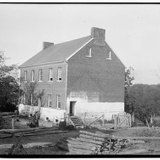
Point of Rocks is a small unincorporated community in Frederick County, Maryland, situated along the Potomac River near where it meets the Shenandoah River. The village contains historic structures dating to the 1800s, including a well-preserved train station that remains one of the most photographed railway buildings in the country.

The settlement originated in the early colonial period but grew significantly after the railroad and canal arrived in the 1830s, making it a busy commercial hub with hotels and shops. A major flood in 1936 with water levels reaching 41 feet devastated the community and marked the beginning of its decline as a trading center.

The site is easily accessible with parking for commuters and MARC train connections to Washington D.C. available year-round. On-site facilities include a small deli, restroom, and boat ramp, with additional amenities like a nearby campground and historic structures within walking distance.

The train station at Point of Rocks ranks among the most photographed railway buildings in the country, drawing photographers and rail enthusiasts to document its distinctive architecture. The location sits at the convergence of flood-prone waterways, a fact that shaped the community's repeated rebuilding and makes it a testament to human persistence in challenging geography.

The community of curious travelers

AroundUs brings together thousands of curated places, local tips, and hidden gems, enriched daily by 60,000 contributors worldwide.

Start exploring
Location
GPS coordinates
39.27583,-77.53944
Latest update
February 17, 2026 00:00
Around this place
Sugar Loaf Mountain
United States of America

Sugar Loaf Mountain

12.7 km
Monocacy Aqueduct
United States of America

Monocacy Aqueduct

9.5 km
United States of America

Gordon Strong Automobile Objective

12.7 km
Carrollton Manor
United States of America

Carrollton Manor

8.1 km
Rockland
United States of America

Rockland

12.5 km
Prospect Hall
United States of America

Prospect Hall

9.8 km
Temple Hall
United States of America

Temple Hall

10.5 km
Buckeystown Historic District
United States of America

Buckeystown Historic District

11 km
Brunswick Historic District
United States of America

Brunswick Historic District

8.4 km
Arcadia
United States of America

Arcadia

14.3 km
Point of Rocks Bridge
United States of America

Point of Rocks Bridge

561 m
Catoctin Creek Bridge
United States of America

Catoctin Creek Bridge

6.6 km
Poffenberger Road Bridge
United States of America

Poffenberger Road Bridge

12.1 km
St. Paul's Episcopal Church
United States of America

St. Paul's Episcopal Church

1.5 km
George Willard House
United States of America

George Willard House

9.9 km
Buckingham House and Industrial School Complex
United States of America

Buckingham House and Industrial School Complex

10.8 km
Annington
United States of America

Annington

12.4 km
Burkittsville Historic District
United States of America

Burkittsville Historic District

15 km
Taylorstown Historic District
United States of America

Taylorstown Historic District

3.9 km
Lovettsville Historic District
United States of America

Lovettsville Historic District

8.4 km
George Markell Farmstead
United States of America

George Markell Farmstead

14.7 km
Clapham's Ferry
United States of America

Clapham's Ferry

8.8 km
William Virts House
United States of America

William Virts House

14.7 km
George Widrick House
United States of America

George Widrick House

14.1 km
Temple Hall Farm
United States of America

Temple Hall Farm

10.6 km
Brunswick Heritage Museum
United States of America

Brunswick Heritage Museum

8.7 km
Lucketts School
United States of America

Lucketts School

6.8 km
Nolands Ferry I Archeological Site
United States of America

Nolands Ferry I Archeological Site

5.6 km
Show the full map
Reviews
Share your experience

No review yet

Discussions
Start a discussion...

No discussion yet

« Point of Rocks - unincorporated community in Frederick County, Maryland, United States » is provided by Around Us (aroundus.com). Images and texts are derived from Wikimedia project under a Creative Commons license. You are allowed to copy, distribute, and modify copies of this page, under the conditions set by the license, as long as this note is clearly visible.

Discover hidden gems everywhere you go!

From secret cafés to breathtaking viewpoints, skip the crowded tourist spots and find places that match your style. Our app makes it easy with voice search, smart filtering, route optimization, and insider tips from travelers worldwide. Download now for the complete mobile experience.

Around Us App Screenshot

A unique approach to discovering new places

Le Figaro

All the places worth exploring

France Info

A tailor-made excursion in just a few clicks

20 Minutes

Around Us
Travel Guide & Maps
Download

Send to your phone

QR Code
1

Open the camera app on your mobile.

2

Point at the QR code with your camera. A notification will appear.

3

Tap the notification to open the link.