Christiansted National Historic Site

Log in to your account

AroundUs is a community-driven map of interesting places, built by curious explorers like you. It grows with every review, story, and photo you share.
Connect to save your favorite spots, contribute locations, and create personalized routes.
Continue with Google
Continue with Apple
Continue with X
Continue with Facebook
Continue with email
By continuing, you accept our Terms and Conditions and our Privacy Policy
Create an account

Christiansted National Historic Site

Add to collection
Map
Suggest a change
Share

Christiansted National Historic Site, Danish colonial site in Christiansted, United States Virgin Islands

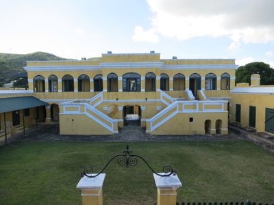
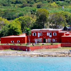
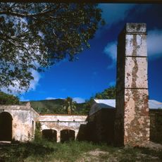
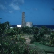
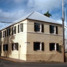
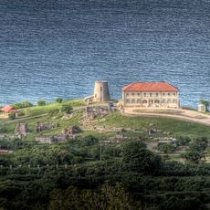
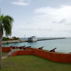
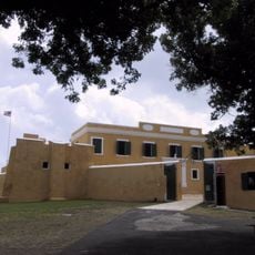
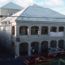
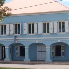
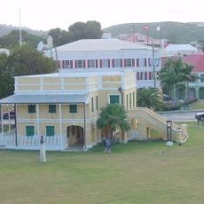
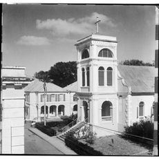
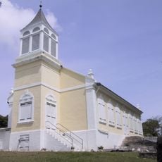
Christiansted National Historic Site is a waterfront complex with six structures from the colonial period, including Fort Christiansvaern and the Danish West India Company Warehouse. The buildings spread across the grounds and show through their layout and design how administration and trade operated during that time.

The structures date from when Denmark controlled the territory between 1733 and 1917, before selling the islands to the United States. The National Park Service took over the site in 1952 to preserve this chapter of colonial history.

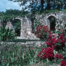
The buildings show how Europe, West Africa, and North America were connected through architecture and trade routes you can still observe today. The way the structures are arranged reveals the systems that moved people and goods across the ocean.

Visitors can walk through the buildings and find information stations throughout the grounds to help them get oriented. It is best to visit during cooler parts of the day, and you should bring comfortable shoes and sun protection.

The site is connected to Rachel Faucette, who was imprisoned in the fort in 1750 and later became the mother of founding figure Alexander Hamilton. Her story reveals how personal lives were intertwined with the colonial systems of that era.

Location: Christiansted

Operator: National Park Service

Website: https://nps.gov/chri

GPS coordinates: 17.74670,-64.70215

Latest update: December 9, 2025 18:49

Photos
Around this place
Salt River Bay National Historical Park and Ecological Preserve
United States of America

Salt River Bay National Historical Park and Ecological Preserve

7 km
Sandy Point National Wildlife Refuge
United States of America

Sandy Point National Wildlife Refuge

22.3 km
Fort Frederik
United States of America

Fort Frederik

19.5 km
Reef Bay Trail petroglyphs
United States of America

Reef Bay Trail petroglyphs

65.2 km
United States of America

Mount Eagle

11.7 km
Green Cay National Wildlife Refuge
United States of America

Green Cay National Wildlife Refuge

4.5 km
St. George Village Botanical Garden
United States of America

St. George Village Botanical Garden

14.6 km
Reef Bay Sugar Factory Historic District
United States of America

Reef Bay Sugar Factory Historic District

64.5 km
Hams Bluff Light
United States of America

Hams Bluff Light

18.2 km
Estate Judith's Fancy
United States of America

Estate Judith's Fancy

5.8 km
Danish West India and Guinea Company Warehouse
United States of America

Danish West India and Guinea Company Warehouse

58 m
Coakley Bay Estate
United States of America

Coakley Bay Estate

6.6 km
Frederiksted Historic District
United States of America

Frederiksted Historic District

20.4 km
Fort Christiansværn
United States of America

Fort Christiansværn

66 m
Slob Historic District
United States of America

Slob Historic District

8.4 km
Christiansted Historic District
United States of America

Christiansted Historic District

251 m
Estate Saint George Historic District
United States of America

Estate Saint George Historic District

13.9 km
Caribbean Museum Center for the Arts
United States of America

Caribbean Museum Center for the Arts

19.6 km
Danish Custom House
United States of America

Danish Custom House

42 m
Christiansted Lutheran Church
United States of America

Christiansted Lutheran Church

232 m
Den hellige treenighetskirke
United States of America

Den hellige treenighetskirke

19.2 km
Salt Pond Beach
United States of America

Salt Pond Beach

62.5 km
Turquoise Beach
United States of America

Turquoise Beach

65.5 km
St. Croix VLBA station
United States of America

St. Croix VLBA station

12.6 km
United States of America

West Beach

9.2 km
Tamarind Reef Beach
United States of America

Tamarind Reef Beach

4 km
Sprat Hall Beach
United States of America

Sprat Hall Beach

20.2 km
Strawberry Hill Historic District
United States of America

Strawberry Hill Historic District

6.4 km
Show the full map
Reviews

Visited this place? Tap the stars to rate it and share your experience / photos with the community! Try now! You can cancel it anytime.

« Christiansted National Historic Site - Danish colonial site in Christiansted, United States Virgin Islands » is provided by Around Us (aroundus.com). Images and texts are derived from Wikimedia project under a Creative Commons license. You are allowed to copy, distribute, and modify copies of this page, under the conditions set by the license, as long as this note is clearly visible.

Discover hidden gems everywhere you go!

From secret cafés to breathtaking viewpoints, skip the crowded tourist spots and find places that match your style. Our app makes it easy with voice search, smart filtering, route optimization, and insider tips from travelers worldwide. Download now for the complete mobile experience.

Around Us App Screenshot

A unique approach to discovering new places

Le Figaro

All the places worth exploring

France Info

A tailor-made excursion in just a few clicks

20 Minutes