Accokeek Creek Site

Log in to your account

AroundUs is a community-driven map of interesting places, built by curious explorers like you. It grows with every review, story, and photo you share.
Connect to save your favorite spots, contribute locations, and create personalized routes.
Continue with Google
Continue with Apple
Continue with X
Continue with Facebook
Continue with email
By continuing, you accept our Terms and Conditions and our Privacy Policy
Create an account
Add to collection
Map
Suggest a change
Share

Accokeek Creek Site, Archaeological site in Prince George's County, United States

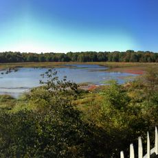
Accokeek Creek Site is an archaeological location along the Potomac River containing remains from Native American settlements spanning thousands of years. Excavations have uncovered building foundations, tools, pottery, and household items that show how people lived at different times in this area.

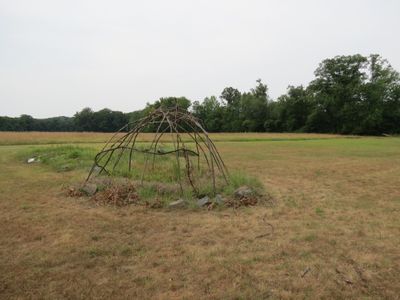
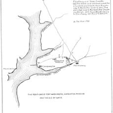
The location shows evidence of human presence extending back more than 4000 years, with a fortified village built around the 14th century. Systematic excavations in the 20th century documented these layers and shaped understanding of settlement patterns in the region.

Burial grounds near the village reveal how communities here honored their dead, placing copper ornaments and shell beads with the remains as offerings. These practices show the beliefs and social connections that mattered to the people who lived along this part of the river.

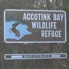
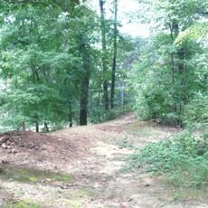
The site is located within a park setting with marked areas where visitors can view excavation locations and learn from displays. Educational programs and guided tours are available to help you understand the findings and their importance to local history.

Excavations here helped experts classify pottery across a large region and build a timeline for dating archaeological layers. These classification systems are still used today when dating discoveries throughout the area.

Location: Prince George's County

Part of: Piscataway Park

Address: 3400 Bryan Point Rd, Accokeek, MD 20607

GPS coordinates: 38.69603,-77.05183

Latest update: December 12, 2025 12:06

Photos
Around this place
Mount Vernon
United States of America

Mount Vernon

3.3 km
Gunston Hall
United States of America

Gunston Hall

10.1 km
George Washington's Mount Vernon
United States of America

George Washington's Mount Vernon

3.3 km
Fred W. Smith National Library for the Study of George Washington
United States of America

Fred W. Smith National Library for the Study of George Washington

3.7 km
Woodlawn
United States of America

Woodlawn

7.7 km
George Washington's Gristmill
United States of America

George Washington's Gristmill

7.1 km
Pope-Leighey House
United States of America

Pope-Leighey House

7.8 km
River Farm
United States of America

River Farm

5.2 km
Huntley Meadows Park
United States of America

Huntley Meadows Park

8.1 km
Fort Hunt
United States of America

Fort Hunt

2.1 km
Marshall Hall
United States of America

Marshall Hall

4.2 km
Fort Foote
United States of America

Fort Foote

8.1 km
Accotink Bay Wildlife Refuge
United States of America

Accotink Bay Wildlife Refuge

8.9 km
Fort Willard
United States of America

Fort Willard

9.7 km
Fort Washington Light
United States of America

Fort Washington Light

2.2 km
Hard Bargain Farm
United States of America

Hard Bargain Farm

981 m
Fort O'Rourke
United States of America

Fort O'Rourke

9.7 km
Tower House
United States of America

Tower House

2.2 km
Tauxemont Historic District
United States of America

Tauxemont Historic District

5.3 km
Tower House
United States of America

Tower House

2.2 km
Woodlawn Quaker Meetinghouse
United States of America

Woodlawn Quaker Meetinghouse

8.1 km
Warburton Manor
United States of America

Warburton Manor

3.9 km
St. Mark's Episcopal Church
United States of America

St. Mark's Episcopal Church

9.5 km
George Washington's Distillery & Gristmill
United States of America

George Washington's Distillery & Gristmill

7 km
Colonel John R. Byers Park
United States of America

Colonel John R. Byers Park

4.6 km
National Colonial Farm
United States of America

National Colonial Farm

1.7 km
Martha Washington Community Library
United States of America

Martha Washington Community Library

8.7 km
Sherwood Regional Library
United States of America

Sherwood Regional Library

5.7 km
Show the full map
Reviews

Visited this place? Tap the stars to rate it and share your experience / photos with the community! Try now! You can cancel it anytime.

« Accokeek Creek Site - Archaeological site in Prince George's County, United States » is provided by Around Us (aroundus.com). Images and texts are derived from Wikimedia project under a Creative Commons license. You are allowed to copy, distribute, and modify copies of this page, under the conditions set by the license, as long as this note is clearly visible.

Discover hidden gems everywhere you go!

From secret cafés to breathtaking viewpoints, skip the crowded tourist spots and find places that match your style. Our app makes it easy with voice search, smart filtering, route optimization, and insider tips from travelers worldwide. Download now for the complete mobile experience.

Around Us App Screenshot

A unique approach to discovering new places

Le Figaro

All the places worth exploring

France Info

A tailor-made excursion in just a few clicks

20 Minutes