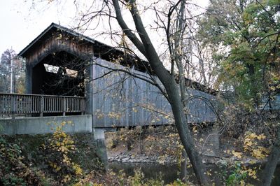
Ada Covered Bridge, Covered bridge in Ada Township, Michigan, US.
The Ada Covered Bridge is a wooden covered bridge in Ada Township, Michigan, crossing the Thornapple River near where it meets the Grand River. It has wooden side walls, a gabled roof, and a Brown truss frame that supports the deck.
The bridge was built in 1867 after Michigan state authorities approved local funding for river crossings in the area. A roof collapse and fire in 1979 destroyed much of the original structure, leading to a full reconstruction.
The bridge sits at a spot where walkers and cyclists often stop, making it a natural gathering point along the Thornapple River. Its wooden interior, with exposed beams overhead, gives it a feel that is very different from an ordinary road crossing.
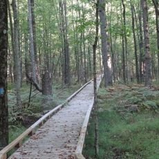
The bridge is open to walkers and cyclists year-round and sits in Ada Township, which is easy to reach by car. Visiting on a dry day is a good idea, as the riverside paths nearby can be slippery after rain.
Local farmers once placed heavy stones on the bridge deck to keep it from being swept away during seasonal floods on the Thornapple River. This low-tech method worked well enough that the practice was passed down across generations.
The community of curious travelers
AroundUs brings together thousands of curated places, local tips, and hidden gems, enriched daily by 60,000 contributors worldwide.