North Country Trail

Log in to your account

AroundUs is a community-driven map of interesting places, built by curious explorers like you. It grows with every review, story, and photo you share.
Connect to save your favorite spots, contribute locations, and create personalized routes.
Continue with Google
Continue with Apple
Continue with X
Continue with Facebook
Continue with email
By continuing, you accept our Terms and Conditions and our Privacy Policy
Create an account
Add to collection
Map
Suggest a change
Share

North Country Trail, National Scenic Trail in Michigan, United States

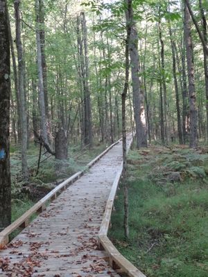
The North Country Trail is a long-distance hiking path that stretches over 4,800 miles from North Dakota to Vermont, connecting eight states across the country. The route winds through forests, around lakes, across grasslands, and links together different types of natural landscapes.

The path partly follows routes used by Native Americans and early settlers, as well as old railroad lines and trade routes from the 1800s. These historic pathways form the backbone of the route today.

The path travels through regions shaped by different communities, each with their own connection to the land and local traditions. Walkers encounter how people in these areas interact with forests, lakes, and grasslands as part of their daily lives.

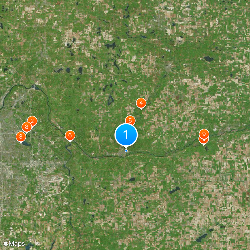
Hikers should check with visitor centers or use mobile applications before setting out to find maps, water sources, and camping areas along the route. The path is accessible in many places, though conditions vary by season and region.

The path crosses through more than 160 public lands managed at federal, state, and local levels, allowing hikers to experience several different ecosystems in one journey. This variety makes each section of the path feel like its own discovery.

Location: North Dakota

Location: Minnesota

Location: Wisconsin

Location: Michigan

Location: Ohio

Location: Pennsylvania

Location: New York

Operator: United States National Park Service;North Country Trail Association

Website: https://nps.gov/noco

GPS coordinates: 42.93450,-85.33780

Latest update: December 14, 2025 19:54

Photos
Around this place
Frederik Meijer Gardens & Sculpture Park
United States of America

Frederik Meijer Gardens & Sculpture Park

20.8 km
Ramona Park
United States of America

Ramona Park

22.7 km
Whites Bridge
United States of America

Whites Bridge

9.5 km
Fallasburg Bridge
United States of America

Fallasburg Bridge

5.2 km
Ada Covered Bridge
United States of America

Ada Covered Bridge

12.3 km
Ionia State Recreation Area
United States of America

Ionia State Recreation Area

16.6 km
First Protestant Reformed Church in Grand Rapids, Michigan
United States of America

First Protestant Reformed Church in Grand Rapids, Michigan

21.7 km
Sessions Schoolhouse
United States of America

Sessions Schoolhouse

16.8 km
Richardson Silk Mill
United States of America

Richardson Silk Mill

20.1 km
Ionia Downtown Commercial Historic District
United States of America

Ionia Downtown Commercial Historic District

22.7 km
William H. VanderHeyden House
United States of America

William H. VanderHeyden House

21.7 km
Fallasburg Historic District
United States of America

Fallasburg Historic District

5.4 km
Alvah N. Belding Memorial Library
United States of America

Alvah N. Belding Memorial Library

20.3 km
Thornapple River Drive Bridge
United States of America

Thornapple River Drive Bridge

12.5 km
Graham House
United States of America

Graham House

322 m
Ada-Lowell 5 Theatres
United States of America

Ada-Lowell 5 Theatres

2.1 km
Saranac Public Library
United States of America

Saranac Public Library

10.2 km
Robert W Graham Home Historical Marker
United States of America

Robert W Graham Home Historical Marker

278 m
Saranac Historical Marker
United States of America

Saranac Historical Marker

11 km
Lowell Showboat
United States of America

Lowell Showboat

75 m
Strand Theatre
United States of America

Strand Theatre

297 m
Hodenpyl Woods historical marker
United States of America

Hodenpyl Woods historical marker

21.6 km
East Grand Rapids Branch Library
United States of America

East Grand Rapids Branch Library

22.4 km
Cascade Township Branch
United States of America

Cascade Township Branch

13.9 km
East Grand Rapids Community Center
United States of America

East Grand Rapids Community Center

22.3 km
CSX Thornapple River Bridge
United States of America

CSX Thornapple River Bridge

13 km
Kentwood Branch
United States of America

Kentwood Branch

22.2 km
Cascade Township Hall Historical Marker
United States of America

Cascade Township Hall Historical Marker

13.2 km
Show the full map
Reviews

Visited this place? Tap the stars to rate it and share your experience / photos with the community! Try now! You can cancel it anytime.

« North Country Trail - National Scenic Trail in Michigan, United States » is provided by Around Us (aroundus.com). Images and texts are derived from Wikimedia project under a Creative Commons license. You are allowed to copy, distribute, and modify copies of this page, under the conditions set by the license, as long as this note is clearly visible.

Discover hidden gems everywhere you go!

From secret cafés to breathtaking viewpoints, skip the crowded tourist spots and find places that match your style. Our app makes it easy with voice search, smart filtering, route optimization, and insider tips from travelers worldwide. Download now for the complete mobile experience.

Around Us App Screenshot

A unique approach to discovering new places

Le Figaro

All the places worth exploring

France Info

A tailor-made excursion in just a few clicks

20 Minutes