Enable Location

We need your location to show you interesting places around you

Discover nearby places

Find interesting locations and hidden gems around you

Precise directions

Get accurate directions and distances to places

Your location is never shared with other users. It's only used when you tap the location button.

Agassiz Wilderness

Log in to your account

Start exploring — it's free

Trusted by 61,364 travelers worldwide

Continue with Google
Continue with Apple
or

We will send you a code to connect

By continuing, you accept our Terms and Conditions and our Privacy Policy

Check your inbox

We've sent a pincode in your inbox. Please enter the code below.

Agassiz Wilderness

Agassiz Wilderness, Protected wilderness area in Marshall County, Minnesota.

Description

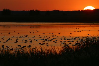
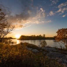
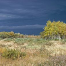
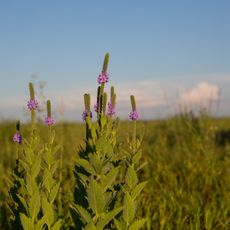
Agassiz Wilderness is a protected area in Marshall County, Minnesota, covering about 4,000 acres of forest, wetlands, and two natural lakes called Kuriko and Whiskey. The land features black spruce and tamarack trees mixed with bog areas that support diverse plant and animal communities.

History

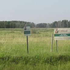
The refuge was established in 1937 to protect important wildlife habitats in the region. In 1976, a portion of the refuge gained wilderness designation, which brought stricter conservation rules to preserve the area for the future.

Culture

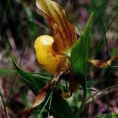
The landscape here honors Swiss naturalist Louis Agassiz and reflects a commitment to protecting rare northern habitats. Visitors can observe how different forest types and wetlands work together to support species found nowhere else in the region.

Practical

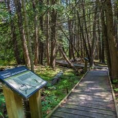
Access requires permits and is limited to certain seasons, mainly for hunting purposes. Visitors should know that camping is not allowed within the area, so day visits are the main option for those exploring the space.

Did you know?

This place contains the westernmost black spruce and tamarack bog formation in Minnesota, a rare forest feature of northern regions. This specialized environment makes it valuable for studying how northern forest types develop in their southwestern range limits.

Location
GPS coordinates
48.34470,-95.88330
Latest update
December 13, 2025 17:04

AroundUs brings together thousands of curated places, local tips, and hidden gems, enriched daily by 60,000 contributors worldwide. Discover all places nearby (Marshall County).

Around this place
Lake Bronson State Park
United States of America

Lake Bronson State Park

67.9 km
Zippel Bay State Park
United States of America

Zippel Bay State Park

95 km
Greater Grand Forks Greenway
United States of America

Greater Grand Forks Greenway

97 km
Manitoba Tall Grass Prairie Preserve
Canada

Manitoba Tall Grass Prairie Preserve

91.7 km
Agassiz National Wildlife Refuge
United States of America

Agassiz National Wildlife Refuge

5 km
Glacial Ridge National Wildlife Refuge
United States of America

Glacial Ridge National Wildlife Refuge

79.7 km
Hayes Lake State Park
United States of America

Hayes Lake State Park

41.6 km
Sorlie Memorial Bridge
United States of America

Sorlie Memorial Bridge

96.9 km
Cathedral of the Immaculate Conception
United States of America

Cathedral of the Immaculate Conception

82.4 km
Church of St. Peter-Catholic
United States of America

Church of St. Peter-Catholic

74.4 km
Clearwater Evangelical Lutheran Church
United States of America

Clearwater Evangelical Lutheran Church

47.1 km
Red Lake County Courthouse
United States of America

Red Lake County Courthouse

58.9 km
St. Nicholas Orthodox Church
United States of America

St. Nicholas Orthodox Church

82.3 km
Thief River Falls Public Library
United States of America

Thief River Falls Public Library

33.6 km
K. J. Taralseth Company
United States of America

K. J. Taralseth Company

68 km
Gran Evangelical Lutheran Church
United States of America

Gran Evangelical Lutheran Church

94 km
Roseau County Courthouse
United States of America

Roseau County Courthouse

56.5 km
J. Nelson Kelly House
United States of America

J. Nelson Kelly House

97.1 km
United States of America

Debs Consolidated School

88.4 km
Lake Bronson State Park WPA/Rustic Style Historic Resources
United States of America

Lake Bronson State Park WPA/Rustic Style Historic Resources

68.9 km
Old Mill State Park WPA/Rustic Style Historic Resources
United States of America

Old Mill State Park WPA/Rustic Style Historic Resources

51 km
Old Mill State Park
United States of America

Old Mill State Park

50.9 km
Peder Engelstad Pioneer Village
United States of America

Peder Engelstad Pioneer Village

34.6 km
Agassiz Headquarters Fire Observation Tower
United States of America

Agassiz Headquarters Fire Observation Tower

9 km
Faunce Lookout Tower
United States of America

Faunce Lookout Tower

74 km
Linder Fire Tower
United States of America

Linder Fire Tower

44.8 km
Prosper Lookout Tower
United States of America

Prosper Lookout Tower

94 km
Lawson Lookout Tower
United States of America

Lawson Lookout Tower

20.1 km
Show the full map
« Agassiz Wilderness - Protected wilderness area in Marshall County, Minnesota » is provided by Around Us (aroundus.com). Images and texts are derived from Wikimedia project under a Creative Commons license. You are allowed to copy, distribute, and modify copies of this page, under the conditions set by the license, as long as this note is clearly visible.

Discover hidden gems everywhere you go!

From secret cafés to breathtaking viewpoints, skip the crowded tourist spots and find places that match your style. Our app makes it easy with voice search, smart filtering, route optimization, and insider tips from travelers worldwide. Download now for the complete mobile experience.

Around Us App Screenshot

A unique approach to discovering new places

Le Figaro

All the places worth exploring

France Info

A tailor-made excursion in just a few clicks

20 Minutes

Around Us
Travel Guide & Maps
Download

Send to your phone

QR Code
1

Open the camera app on your mobile.

2

Point at the QR code with your camera. A notification will appear.

3

Tap the notification to open the link.