Enable Location

We need your location to show you interesting places around you

Discover nearby places

Find interesting locations and hidden gems around you

Precise directions

Get accurate directions and distances to places

Your location is never shared with other users. It's only used when you tap the location button.

Town of Alfred

Log in to your account

Start exploring — it's free

Trusted by 63,863 travelers worldwide

Continue with Google
Continue with Apple
or

We will send you a code to connect

By continuing, you accept our Terms and Conditions and our Privacy Policy

Check your inbox

We've sent a pincode in your inbox. Please enter the code below.

Discussion Reviews 1 Photos
13.4k Popularity

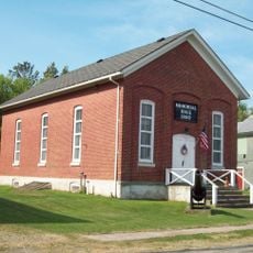
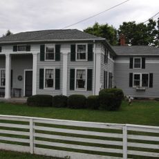
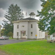
Town of Alfred, Rural township in Allegany County, United States.

Alfred is a rural township in eastern Allegany County, New York, situated within rolling Appalachian terrain. The landscape features forests, farmland, and scattered development across hillsides and valleys.

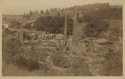
Alfred was established in 1807 as one of the original towns created when Allegany County was formed. The arrival of railroad transportation through the Erie Railroad depot in 1851 brought new opportunities for the area.

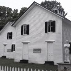
Two colleges shape daily life and the local economy, drawing students and workers who form a significant portion of the population. These institutions influence how the community functions and create gathering spaces throughout the year.

Getting around the hillsides requires a vehicle, as the township spreads across rural terrain with limited public transportation. Plan your visit outside the harshest winter months when roads are more passable and accessible.

A location called Tip Top on State Route 21 marks the highest point of the Erie Railroad line between New York City and Chicago. This peak represents a geographic turning point for the entire railroad corridor.

The community of curious travelers

AroundUs brings together thousands of curated places, local tips, and hidden gems, enriched daily by 60,000 contributors worldwide.

Start exploring
Location
GPS coordinates
42.25423,-77.79061
Latest update
December 7, 2025 20:40
Around this place
Bare Knuckle Boxing Hall of Fame
United States of America

Bare Knuckle Boxing Hall of Fame

28.3 km
Belvidere
United States of America

Belvidere

19.8 km
Stony Brook State Park
United States of America

Stony Brook State Park

30.7 km
Belmont Hotel
United States of America

Belmont Hotel

20.3 km
Canisteo Living Sign
United States of America

Canisteo Living Sign

14.6 km
Allen Steinheim Museum
United States of America

Allen Steinheim Museum

303 m
Hornell Public Library
United States of America

Hornell Public Library

13.7 km
Terra Cotta Building
United States of America

Terra Cotta Building

399 m
Caneadea Bridge
United States of America

Caneadea Bridge

32.9 km
Pioneer Farm
United States of America

Pioneer Farm

33.9 km
Alumni Hall
United States of America

Alumni Hall

267 m
Angelica Park Circle Historic District
United States of America

Angelica Park Circle Historic District

19.4 km
English Evangelical Lutheran Church of Dansville
United States of America

English Evangelical Lutheran Church of Dansville

34.7 km
Temple Beth-El
United States of America

Temple Beth-El

13.5 km
Alfred Village Historic District
United States of America

Alfred Village Historic District

178 m
Moses Van Campen House
United States of America

Moses Van Campen House

17.9 km
Belmont Grange No. 1243
United States of America

Belmont Grange No. 1243

20.8 km
Dansville Library
United States of America

Dansville Library

35.1 km
Friendship Free Library
United States of America

Friendship Free Library

28.9 km
Larrowe House
United States of America

Larrowe House

36.5 km
Belmont Literary and Historical Society Free Library
United States of America

Belmont Literary and Historical Society Free Library

20.5 km
Dansville Downtown Historic District
United States of America

Dansville Downtown Historic District

35 km
G.A.R. Memorial Hall
United States of America

G.A.R. Memorial Hall

36.5 km
William Hartman Farmstead
United States of America

William Hartman Farmstead

36.5 km
Scholes Library
United States of America

Scholes Library

299 m
Central Dining Hall
United States of America

Central Dining Hall

358 m
Old Allegany County Courthouse
United States of America

Old Allegany County Courthouse

19.4 km
Northrup Hill School District 10
United States of America

Northrup Hill School District 10

36.3 km
Show the full map
Reviews
Share your experience

No review yet

Discussions
Start a discussion...

No discussion yet

« Town of Alfred - Rural township in Allegany County, United States » is provided by Around Us (aroundus.com). Images and texts are derived from Wikimedia project under a Creative Commons license. You are allowed to copy, distribute, and modify copies of this page, under the conditions set by the license, as long as this note is clearly visible.

Discover hidden gems everywhere you go!

From secret cafés to breathtaking viewpoints, skip the crowded tourist spots and find places that match your style. Our app makes it easy with voice search, smart filtering, route optimization, and insider tips from travelers worldwide. Download now for the complete mobile experience.

Around Us App Screenshot

A unique approach to discovering new places

Le Figaro

All the places worth exploring

France Info

A tailor-made excursion in just a few clicks

20 Minutes

Around Us
Travel Guide & Maps
Download

Send to your phone

QR Code
1

Open the camera app on your mobile.

2

Point at the QR code with your camera. A notification will appear.

3

Tap the notification to open the link.