Chest opened
+${chestReward.xp} XP
Explorer
NOUVEAU ×${chestReward.collectible.quantity}
tapez pour fermer
Chest locked

Open chests in the app

Around Us is built for your phone — chests unlock when you walk, explore and capture nearby places.

Enable Location

We need your location to show you interesting places around you

Discover nearby places

Find interesting locations and hidden gems around you

Precise directions

Get accurate directions and distances to places

Your location is never shared with other users. It's only used when you tap the location button.

Log in to your account

Start exploring — it's free

Trusted by 72,890 travelers worldwide

Continue with Google
Continue with Apple
or

We will send you a code to connect

By continuing, you accept our Terms and Conditions and our Privacy Policy

Check your inbox

We've sent a pincode in your inbox. Please enter the code below.

Area 71
Discussion Reviews Photo
5.9k Popularity

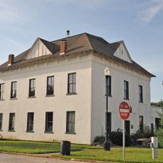
Area 71, Data center in Jane, Missouri, US.

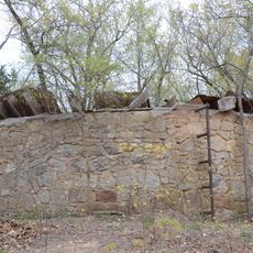
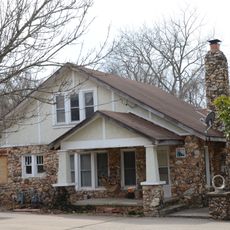
Area 71 is a data center in Jane, Missouri, built directly on bedrock in the far southwest corner of the state. It connects through copper cables, fiber optic lines, and satellite systems to support large-scale information processing.

The center was built near the Arkansas border, close to the old U.S. Route 71 that has run through this corner of the country since the early 1900s. The bedrock foundation of the site was a key reason for choosing this location over others.

Area 71 sits at the heart of how a major American retail chain runs its day-to-day operations, from tracking inventory to managing payments. Shoppers across the country interact with its systems every time they check out at a Walmart store.

This is a secure facility and is not open to the public for visits or tours. It sits in a remote part of southwest Missouri, so the surrounding area offers little in the way of nearby amenities.

Beyond payments and inventory, the facility also controls the background music played in Walmart stores and the time-tracking systems used by store employees. These everyday details of store life are all managed from this single location in rural Missouri.

The community of curious travelers

AroundUs brings together thousands of curated places, local tips, and hidden gems, enriched daily by 60,000 contributors worldwide.

Start exploring
Location
GPS coordinates
36.50080,-94.26460
Latest update
March 3, 2026 10:09
Around this place
Crystal Bridges Museum of American Art
United States of America

Crystal Bridges Museum of American Art

14.3 km
Mildred B. Cooper Memorial Chapel
United States of America

Mildred B. Cooper Memorial Chapel

4.2 km
Wonderland Cave
United States of America

Wonderland Cave

8.1 km
Lake Windsor
United States of America

Lake Windsor

4.8 km
Scott Family Amazeum
United States of America

Scott Family Amazeum

14.8 km
Big Sugar Creek State Park
United States of America

Big Sugar Creek State Park

13.7 km
Old High Middle School
United States of America

Old High Middle School

14.9 km
Jacobs Cavern
United States of America

Jacobs Cavern

12 km
Old McDonald County Courthouse
United States of America

Old McDonald County Courthouse

14.8 km
Powell Bridge
United States of America

Powell Bridge

14.8 km
21c Museum Hotel Bentonville
United States of America

21c Museum Hotel Bentonville

15 km
Rice House
United States of America

Rice House

14.5 km
New Home School and Church
United States of America

New Home School and Church

10.1 km
Linebarger House
United States of America

Linebarger House

14.9 km
Braithwaite House
United States of America

Braithwaite House

13.1 km
The Museum of Native American History
United States of America

The Museum of Native American History

14.7 km
Bella Vista Water Tank
United States of America

Bella Vista Water Tank

8.2 km
Bentonville West Central Avenue Historic District
United States of America

Bentonville West Central Avenue Historic District

15 km
Maxwell-Hinman House
United States of America

Maxwell-Hinman House

14.7 km
Banks House
United States of America

Banks House

10.6 km
Shady Grove School
United States of America

Shady Grove School

11.4 km
Blackwell-Paisley Cabin
United States of America

Blackwell-Paisley Cabin

8.3 km
Smith House
United States of America

Smith House

14.2 km
Hagler-Cole Cabin
United States of America

Hagler-Cole Cabin

8.8 km
Koons House
United States of America

Koons House

14.4 km
Pea Ridge Commercial Historic District
United States of America

Pea Ridge Commercial Historic District

14.4 km
Deaton Cabin
United States of America

Deaton Cabin

8.3 km
Bertschy House
United States of America

Bertschy House

14.4 km
Show the full map
Reviews
Share your experience

No review yet

Discussions
Start a discussion...

No discussion yet

« Area 71 - Data center in Jane, Missouri, US » is provided by Around Us (aroundus.com). Images and texts are derived from Wikimedia project under a Creative Commons license. You are allowed to copy, distribute, and modify copies of this page, under the conditions set by the license, as long as this note is clearly visible.

Discover hidden gems everywhere you go!

From secret cafés to breathtaking viewpoints, skip the crowded tourist spots and find places that match your style. Our app makes it easy with voice search, smart filtering, route optimization, and insider tips from travelers worldwide. Download now for the complete mobile experience.

Around Us App Screenshot

A unique approach to discovering new places

Le Figaro

All the places worth exploring

France Info

A tailor-made excursion in just a few clicks

20 Minutes

Around Us
Travel Guide & Maps
Download

Send to your phone

QR Code
1

Open the camera app on your mobile.

2

Point at the QR code with your camera. A notification will appear.

3

Tap the notification to open the link.