Chest opened
+${chestReward.xp} XP
Explorer
NOUVEAU ×${chestReward.collectible.quantity}
tapez pour fermer
Chest locked

Open chests in the app

Around Us is built for your phone — chests unlock when you walk, explore and capture nearby places.

Enable Location

We need your location to show you interesting places around you

Discover nearby places

Find interesting locations and hidden gems around you

Precise directions

Get accurate directions and distances to places

Your location is never shared with other users. It's only used when you tap the location button.

Arthurdale

Log in to your account

Start exploring — it's free

Trusted by 72,888 travelers worldwide

Continue with Google
Continue with Apple
or

We will send you a code to connect

By continuing, you accept our Terms and Conditions and our Privacy Policy

Check your inbox

We've sent a pincode in your inbox. Please enter the code below.

Discussion Reviews 1 Photos
27.8k Popularity

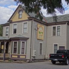
Arthurdale, New Deal homestead community in Preston County, United States

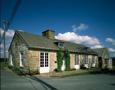
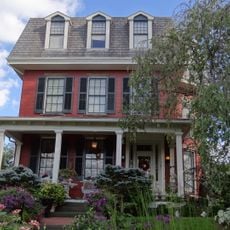
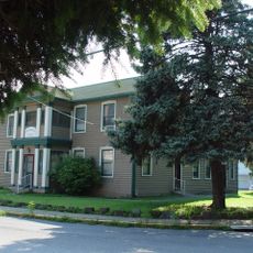
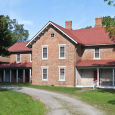
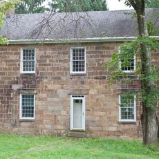
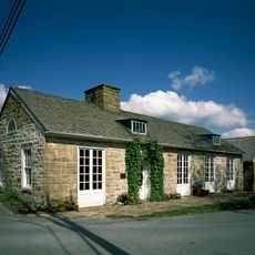
Arthurdale is a residential community of roughly 165 homes spread across rolling hills in Preston County, West Virginia. Each house was built with modern conveniences like indoor plumbing, heating systems, and electricity, which was remarkable for the time.

The settlement was created in 1933 as the first New Deal homestead project by the federal government to help 81 families from northwestern West Virginia during the Great Depression. The project marked a new approach to reviving rural economies through planned communities.

The Mountaineer Craftsmen's Cooperative produced furniture, fabric, and metalwork, with their pewter candlesticks representing American craftsmanship at the 1937 Paris World Fair.

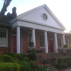
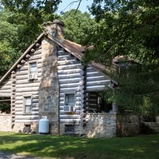
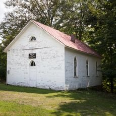
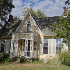
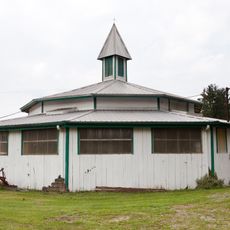
The New Deal Museum interprets this settlement's history through several restored buildings and original homes on the grounds. Visitors can explore the structures and learn about daily life as it was when families first arrived and settled here.

Eleanor Roosevelt visited this settlement more than 30 times between its founding and 1960, personally attending ceremonies and community events. Her repeated journeys from Washington D.C. demonstrated how central this project was to the Roosevelt administration's vision.

The community of curious travelers

AroundUs brings together thousands of curated places, local tips, and hidden gems, enriched daily by 60,000 contributors worldwide.

Start exploring
Location
GPS coordinates
39.49500,-79.81500
Latest update
December 20, 2025 13:18
Around this place
West Virginia Zoo
United States of America

West Virginia Zoo

6.5 km
Mont Chateau State Park
United States of America

Mont Chateau State Park

18.5 km
Henry Clay Furnace
United States of America

Henry Clay Furnace

17.1 km
Morgantown Lock and Dam
United States of America

Morgantown Lock and Dam

19.1 km
Elkins Coal and Coke Company Historic District
United States of America

Elkins Coal and Coke Company Historic District

5.6 km
Virginia Furnace
United States of America

Virginia Furnace

16.1 km
Alexander Wade House
United States of America

Alexander Wade House

19 km
Monongalia Arts Center
United States of America

Monongalia Arts Center

19.2 km
Vance Farmhouse
United States of America

Vance Farmhouse

19.2 km
South Park Historic District
United States of America

South Park Historic District

18.4 km
Kern's Fort
United States of America

Kern's Fort

18.5 km
Harner Homestead
United States of America

Harner Homestead

17 km
Waitman T. Willey House
United States of America

Waitman T. Willey House

19.1 km
Rogers House
United States of America

Rogers House

19.2 km
Greenmont Historic District
United States of America

Greenmont Historic District

18.6 km
Hackney House
United States of America

Hackney House

18.9 km
Cooper's Rock State Forest Superintendent's House and Garage
United States of America

Cooper's Rock State Forest Superintendent's House and Garage

18.7 km
Indian Rocks Dining Hall
United States of America

Indian Rocks Dining Hall

4.6 km
Harmony Grove Meeting House
United States of America

Harmony Grove Meeting House

19.3 km
James Clark McGrew House
United States of America

James Clark McGrew House

11.3 km
Chancery Hill Historic District
United States of America

Chancery Hill Historic District

19 km
Brown Building
United States of America

Brown Building

19.3 km
Camp Rhododendron
United States of America

Camp Rhododendron

15.8 km
Ford House
United States of America

Ford House

18.9 km
Judge Frank Cox House
United States of America

Judge Frank Cox House

18.8 km
Ralphsnyder Decagonal Barn
United States of America

Ralphsnyder Decagonal Barn

7.9 km
Col. Thomas Brown House
United States of America

Col. Thomas Brown House

2.2 km
Arthurdale Historic District
United States of America

Arthurdale Historic District

0 m
Show the full map
Reviews
Share your experience

No review yet

Discussions
Start a discussion...

No discussion yet

« Arthurdale - New Deal homestead community in Preston County, United States » is provided by Around Us (aroundus.com). Images and texts are derived from Wikimedia project under a Creative Commons license. You are allowed to copy, distribute, and modify copies of this page, under the conditions set by the license, as long as this note is clearly visible.

Discover hidden gems everywhere you go!

From secret cafés to breathtaking viewpoints, skip the crowded tourist spots and find places that match your style. Our app makes it easy with voice search, smart filtering, route optimization, and insider tips from travelers worldwide. Download now for the complete mobile experience.

Around Us App Screenshot

A unique approach to discovering new places

Le Figaro

All the places worth exploring

France Info

A tailor-made excursion in just a few clicks

20 Minutes

Around Us
Travel Guide & Maps
Download

Send to your phone

QR Code
1

Open the camera app on your mobile.

2

Point at the QR code with your camera. A notification will appear.

3

Tap the notification to open the link.