Enable Location

We need your location to show you interesting places around you

Discover nearby places

Find interesting locations and hidden gems around you

Precise directions

Get accurate directions and distances to places

Your location is never shared with other users. It's only used when you tap the location button.

Attleborough Falls Historic District

Log in to your account

Start exploring — it's free

Trusted by 62,900 travelers worldwide

Continue with Google
Continue with Apple
or

We will send you a code to connect

By continuing, you accept our Terms and Conditions and our Privacy Policy

Check your inbox

We've sent a pincode in your inbox. Please enter the code below.

Discussion Reviews 1 Photos
1.5k Popularity

Attleborough Falls Historic District, Historic district in North Attleborough, Massachusetts.

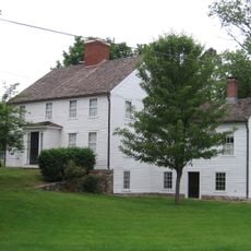
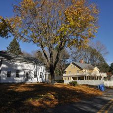
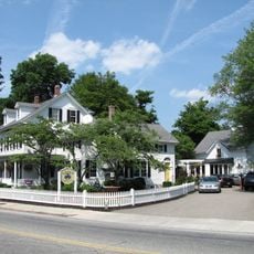
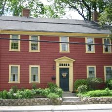
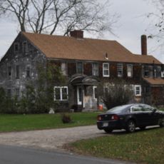
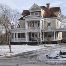
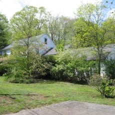
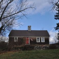
Attleborough Falls Historic District is a residential area in North Attleborough, Massachusetts, spread across a triangular area bounded by Ten Mile River, Mount Hope Street, and Towne Street. The neighborhood contains houses of different architectural styles built from about 1790 to 1890, including Federal, Greek Revival, Italianate, and Queen Anne residences.

The area developed during the mid-1800s as jewelry factories were established on the north side of Ten Mile River. This industrial growth attracted workers and factory owners who built the residential neighborhood with its varied housing types.

The neighborhood represents the evolution of American residential architecture through Federal, Greek Revival, Italianate, and Queen Anne style houses built between 1790 and 1890.

The neighborhood is best explored on foot since the streets form a compact triangular pattern. Visitors can view the architecture of individual houses along the main streets and move through the area on various walking routes.

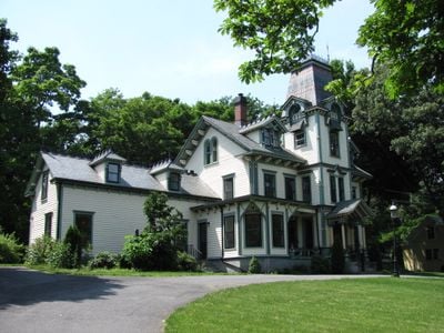
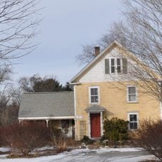
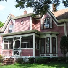
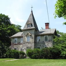
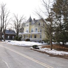
The Freeman House on Mount Hope Street was built in 1890 by jewelry factory owner B.S. Freeman and displays Queen Anne style at its most ornate. The house illustrates the wealth that the local jewelry industry brought to successful businesspeople.

The community of curious travelers

AroundUs brings together thousands of curated places, local tips, and hidden gems, enriched daily by 60,000 contributors worldwide.

Start exploring
Location
GPS coordinates
41.96833,-71.31861
Latest update
December 14, 2025 14:40
Around this place
Xfinity Center
United States of America

Xfinity Center

8.6 km
Capron Park Zoo
United States of America

Capron Park Zoo

3.8 km
Angle Tree Stone
United States of America

Angle Tree Stone

4.3 km
Providence Zen Center
United States of America

Providence Zen Center

9.3 km
Daggett House
United States of America

Daggett House

9.1 km
Arnold Mills Historic District
United States of America

Arnold Mills Historic District

6.3 km
Hebronville Mill Historic District
United States of America

Hebronville Mill Historic District

7.1 km
North Attleborough Town Center Historic District
United States of America

North Attleborough Town Center Historic District

2 km
Woodcock-Hatch-Maxcy House Historic District
United States of America

Woodcock-Hatch-Maxcy House Historic District

2.9 km
Blackinton Houses and Park
United States of America

Blackinton Houses and Park

3 km
South Washington Street Historic District
United States of America

South Washington Street Historic District

1.6 km
Fisher-Richardson House
United States of America

Fisher-Richardson House

8.8 km
Old Town Historic District
United States of America

Old Town Historic District

3.2 km
Brown House
United States of America

Brown House

8.7 km
Attleborough Falls Gasholder Building
United States of America

Attleborough Falls Gasholder Building

686 m
The Codding Farm
United States of America

The Codding Farm

2.7 km
John Cole Farm
United States of America

John Cole Farm

7.7 km
Capron House
United States of America

Capron House

2.3 km
First Parsonage for Second East Parish Church
United States of America

First Parsonage for Second East Parish Church

3.9 km
Cottage-Freeman Historic District
United States of America

Cottage-Freeman Historic District

673 m
Abiah Bliss House
United States of America

Abiah Bliss House

9.6 km
Commonwealth Avenue Historic District
United States of America

Commonwealth Avenue Historic District

707 m
Herbert A. Sadler House
United States of America

Herbert A. Sadler House

5.9 km
Patterson Brothers Commercial Building and House
United States of America

Patterson Brothers Commercial Building and House

9.5 km
Capt. Joel Robinson House
United States of America

Capt. Joel Robinson House

3.6 km
Whipple-Jenckes House
United States of America

Whipple-Jenckes House

7 km
Towne Street Historic District
United States of America

Towne Street Historic District

705 m
Old Attleboro Post Office
United States of America

Old Attleboro Post Office

4.1 km
Show the full map
« Attleborough Falls Historic District - Historic district in North Attleborough, Massachusetts » is provided by Around Us (aroundus.com). Images and texts are derived from Wikimedia project under a Creative Commons license. You are allowed to copy, distribute, and modify copies of this page, under the conditions set by the license, as long as this note is clearly visible.

Discover hidden gems everywhere you go!

From secret cafés to breathtaking viewpoints, skip the crowded tourist spots and find places that match your style. Our app makes it easy with voice search, smart filtering, route optimization, and insider tips from travelers worldwide. Download now for the complete mobile experience.

Around Us App Screenshot

A unique approach to discovering new places

Le Figaro

All the places worth exploring

France Info

A tailor-made excursion in just a few clicks

20 Minutes

Around Us
Travel Guide & Maps
Download

Send to your phone

QR Code
1

Open the camera app on your mobile.

2

Point at the QR code with your camera. A notification will appear.

3

Tap the notification to open the link.