Ashokan Reservoir, Water reservoir in Ulster County, United States
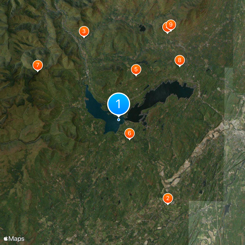
The Ashokan Reservoir stretches roughly 13 kilometers in length and covers about 34 square kilometers across the Catskill Mountains, divided by a concrete separator into two basins. The western basin sits deeper and collects water from several mountain streams, while the eastern basin is shallower and acts as a settling area before the water moves south.
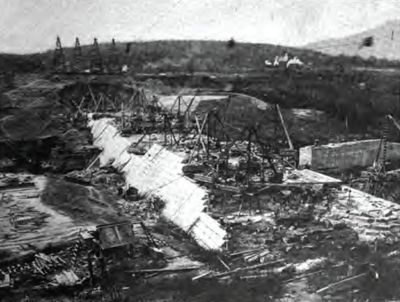
Work between 1907 and 1915 relocated several communities and flooded existing towns to create the water supply system for New York City. Engineers diverted rivers and built dams that ranked among the largest earthworks of their time.
The name comes from the language of native people and means "Place of Fish", a reference visitors can still see today in the waters where anglers line the shores. Local families and fishermen often return to the same quiet spots along the banks where trout move through the cool depths.
Visitors need a free access permit from NYC DEP to fish along the shores, where brown trout, rainbow trout and smallmouth bass are found. Access is available from several parking areas along the dam roads, open during daylight hours and offering views across both basins.
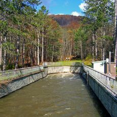
The water flows through the 148-kilometer Catskill Aqueduct to New York City by gravity alone, without the use of pumps. This system delivers roughly 40 percent of the daily drinking water needs for city residents with mountain water from the Catskills.
The community of curious travelers
AroundUs brings together thousands of curated places, local tips, and hidden gems, enriched daily by 60,000 contributors worldwide.