Enable Location

We need your location to show you interesting places around you

Discover nearby places

Find interesting locations and hidden gems around you

Precise directions

Get accurate directions and distances to places

Your location is never shared with other users. It's only used when you tap the location button.

Log in to your account

Start exploring — it's free

Trusted by 61,983 travelers worldwide

Continue with Google
Continue with Apple
or

We will send you a code to connect

By continuing, you accept our Terms and Conditions and our Privacy Policy

Check your inbox

We've sent a pincode in your inbox. Please enter the code below.

Badlands Wilderness

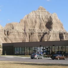
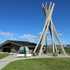
Badlands Wilderness, US Wilderness Area in Pennington County, South Dakota.

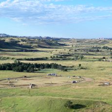
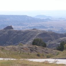
Badlands Wilderness is a protected natural area featuring deep canyons, exposed rock formations, and numerous hiking trails through prairie landscapes. The terrain is characterized by irregular rock structures and open grasslands that extend across vast distances.

Congress designated this area as an official Wilderness Area in 1976 to protect the natural landscape. This designation followed the Wilderness Act and recognized the need to preserve the original terrain for future generations.

The Lakota people named this region 'mako sica' because of its difficult terrain and harsh conditions. The lands were essential for hunting and gathering activities over many generations.

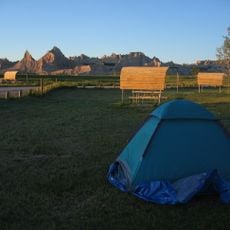
Visitors should bring plenty of water and navigation tools since trail markers are sparse throughout the area. Preparation and a good map are essential for exploring safely and finding your way.

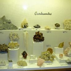
The area contains extensive fossil beds where paleontologists have discovered numerous prehistoric remains. These specimens are preserved within the layered rock formations and provide insights into ancient life.

The community of curious travelers

AroundUs brings together thousands of curated places, local tips, and hidden gems, enriched daily by 60,000 contributors worldwide.

Start exploring
Inception
1976
GPS coordinates
43.83560,-102.35100
Latest update
December 11, 2025 11:09
Around this place
Wall Drug
United States of America

Wall Drug

19.6 km
Minuteman Missile National Historic Site
United States of America

Minuteman Missile National Historic Site

18.6 km
Hotel Alex Johnson
United States of America

Hotel Alex Johnson

75.3 km
South Dakota Air and Space Museum
United States of America

South Dakota Air and Space Museum

66.7 km
Rapid City High School
United States of America

Rapid City High School

75.2 km
The Journey Museum and Gardens
United States of America

The Journey Museum and Gardens

75 km
Rapid City Public Library
United States of America

Rapid City Public Library

75.4 km
Cathedral of Our Lady of Perpetual Help
United States of America

Cathedral of Our Lady of Perpetual Help

74.5 km
Badlands Observatory
United States of America

Badlands Observatory

24.7 km
Prairie Homestead
United States of America

Prairie Homestead

35.9 km
O'Harra Stadium
United States of America

O'Harra Stadium

73.2 km
Church of the Immaculate Conception
United States of America

Church of the Immaculate Conception

75 km
Pennington County Courthouse
United States of America

Pennington County Courthouse

74.9 km
Carnegie Public Library Building
United States of America

Carnegie Public Library Building

75.3 km
Wasta Rest Stop Tipis
United States of America

Wasta Rest Stop Tipis

26.3 km
Hermosa Masonic Lodge
United States of America

Hermosa Masonic Lodge

67.5 km
Prairie Edge Trading Company and Galleries
United States of America

Prairie Edge Trading Company and Galleries

75.4 km
Mt. Moriah Masonic Lodge No. 155
United States of America

Mt. Moriah Masonic Lodge No. 155

67.5 km
Quinn Methodist Church
United States of America

Quinn Methodist Church

24.7 km
Rapid City Masonic Temple
United States of America

Rapid City Masonic Temple

75.4 km
Ben Reifel Visitor Center
United States of America

Ben Reifel Visitor Center

34.3 km
Elks Theatre
United States of America

Elks Theatre

75.3 km
Wasta Rest Stop Tip–Eastbound
United States of America

Wasta Rest Stop Tip–Eastbound

26.3 km
Sage Creek Campground
United States of America

Sage Creek Campground

8.2 km
Cedar Pass Campground
United States of America

Cedar Pass Campground

33.8 km
Minuteman Missile National Historic Site Visitor Center
United States of America

Minuteman Missile National Historic Site Visitor Center

36.1 km
Wasta Rest Stop Tipi–Westbound
United States of America

Wasta Rest Stop Tipi–Westbound

26.4 km
Ancient Hunters Overlook
United States of America

Ancient Hunters Overlook

10.5 km
Show the full map
« Badlands Wilderness - US Wilderness Area in Pennington County, South Dakota » is provided by Around Us (aroundus.com). Images and texts are derived from Wikimedia project under a Creative Commons license. You are allowed to copy, distribute, and modify copies of this page, under the conditions set by the license, as long as this note is clearly visible.

Discover hidden gems everywhere you go!

From secret cafés to breathtaking viewpoints, skip the crowded tourist spots and find places that match your style. Our app makes it easy with voice search, smart filtering, route optimization, and insider tips from travelers worldwide. Download now for the complete mobile experience.

Around Us App Screenshot

A unique approach to discovering new places

Le Figaro

All the places worth exploring

France Info

A tailor-made excursion in just a few clicks

20 Minutes

Around Us
Travel Guide & Maps
Download

Send to your phone

QR Code
1

Open the camera app on your mobile.

2

Point at the QR code with your camera. A notification will appear.

3

Tap the notification to open the link.