Chest opened
+${chestReward.xp} XP
Explorer
NOUVEAU ×${chestReward.collectible.quantity}
tapez pour fermer
Chest locked

Open chests in the app

Around Us is built for your phone — chests unlock when you walk, explore and capture nearby places.

Enable Location

We need your location to show you interesting places around you

Discover nearby places

Find interesting locations and hidden gems around you

Precise directions

Get accurate directions and distances to places

Your location is never shared with other users. It's only used when you tap the location button.

Log in to your account

Start exploring — it's free

Trusted by 72,978 travelers worldwide

Continue with Google
Continue with Apple
or

We will send you a code to connect

By continuing, you accept our Terms and Conditions and our Privacy Policy

Check your inbox

We've sent a pincode in your inbox. Please enter the code below.

Bee Creek Massacre
Discussion Reviews Photo
3.7k Popularity

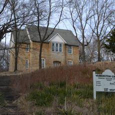
Bee Creek Massacre, Civil War execution site near Weston, Missouri.

Bee Creek Massacre is a Civil War execution site located near Weston in Missouri. The killing took place at a bridge crossing over the creek in December 1861.

The killings happened as tensions between Union forces and Southern sympathizers in Missouri escalated during the early Civil War. This incident reflected the violence that marked the struggle for control in the border state.

The incident represents the complex relationships between Union forces and Confederate sympathizers in Missouri during the American Civil War period.

The location sits along modern Missouri Route 45 near Bee Creek, north of Weston. The area is open land and relatively accessible for visitors.

Accounts reveal that soldiers used blood as a marking to leave their sign at the bridge after the execution. This brutal practice demonstrates the raw violence of the conflict in this border region.

The community of curious travelers

AroundUs brings together thousands of curated places, local tips, and hidden gems, enriched daily by 60,000 contributors worldwide.

Start exploring
Location
GPS coordinates
39.38200,-94.86700
Latest update
December 11, 2025 18:10
Around this place
U.S. Disciplinary Barracks Cemetery
United States of America

U.S. Disciplinary Barracks Cemetery

5 km
Fort Leavenworth National Cemetery
United States of America

Fort Leavenworth National Cemetery

6.4 km
Weston Bend State Park
United States of America

Weston Bend State Park

1.4 km
Leavenworth National Cemetery
United States of America

Leavenworth National Cemetery

11.7 km
United States of America

National Golf Club of Kansas City

22.5 km
Centennial Bridge
United States of America

Centennial Bridge

6.8 km
Lewis and Clark State Park
United States of America

Lewis and Clark State Park

23.9 km
C.W. Parker Carousel Museum
United States of America

C.W. Parker Carousel Museum

8.1 km
Combined Arms Research Library
United States of America

Combined Arms Research Library

5.8 km
Leavenworth Riverfront Community Center
United States of America

Leavenworth Riverfront Community Center

7.9 km
Richard Allen Cultural Center
United States of America

Richard Allen Cultural Center

7.6 km
Kansas and Missouri Bridge
United States of America

Kansas and Missouri Bridge

5.2 km
Nathaniel H. Burt House
United States of America

Nathaniel H. Burt House

9.5 km
Frederick Krause Mansion
United States of America

Frederick Krause Mansion

7.6 km
Benjamin Banneker School
United States of America

Benjamin Banneker School

26.3 km
Mackay Building
United States of America

Mackay Building

26.8 km
Carnegie Arts Center of Leavenworth
United States of America

Carnegie Arts Center of Leavenworth

8.7 km
St. Patrick's Catholic Church
United States of America

St. Patrick's Catholic Church

23.9 km
United States of America

TWA Administrative Offices Building

18.3 km
First Presbyterian Church, Leavenworth
United States of America

First Presbyterian Church, Leavenworth

8.6 km
Washington Chapel C.M.E. Church
United States of America

Washington Chapel C.M.E. Church

26 km
Weston Historic District
United States of America

Weston Historic District

4.6 km
Pleasant Ridge United Baptist Church
United States of America

Pleasant Ridge United Baptist Church

5.6 km
Hund School
United States of America

Hund School

11.3 km
Leavenworth Performing Arts Center
United States of America

Leavenworth Performing Arts Center

8.3 km
Platte County Courthouse
United States of America

Platte County Courthouse

7.6 km
Missouri District Warehouse
United States of America

Missouri District Warehouse

7.6 km
Strike Zone Bowling Center
United States of America

Strike Zone Bowling Center

6.7 km
Show the full map
Reviews
Share your experience

No review yet

Discussions
Start a discussion...

No discussion yet

« Bee Creek Massacre - Civil War execution site near Weston, Missouri » is provided by Around Us (aroundus.com). Images and texts are derived from Wikimedia project under a Creative Commons license. You are allowed to copy, distribute, and modify copies of this page, under the conditions set by the license, as long as this note is clearly visible.

Discover hidden gems everywhere you go!

From secret cafés to breathtaking viewpoints, skip the crowded tourist spots and find places that match your style. Our app makes it easy with voice search, smart filtering, route optimization, and insider tips from travelers worldwide. Download now for the complete mobile experience.

Around Us App Screenshot

A unique approach to discovering new places

Le Figaro

All the places worth exploring

France Info

A tailor-made excursion in just a few clicks

20 Minutes

Around Us
Travel Guide & Maps
Download

Send to your phone

QR Code
1

Open the camera app on your mobile.

2

Point at the QR code with your camera. A notification will appear.

3

Tap the notification to open the link.