Beallsville Historic District

Log in to your account

AroundUs is a community-driven map of interesting places, built by curious explorers like you. It grows with every review, story, and photo you share.
Connect to save your favorite spots, contribute locations, and create personalized routes.
Continue with Google
Continue with Apple
Continue with X
Continue with Facebook
Continue with email
By continuing, you accept our Terms and Conditions and our Privacy Policy
Create an account
Add to collection
Map
Suggest a change
Share

Beallsville Historic District, National Register Historic District in Beallsville, US.

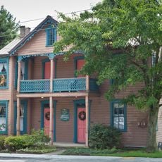
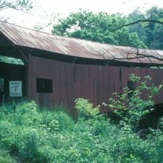
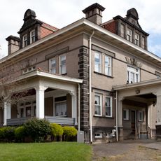
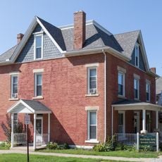
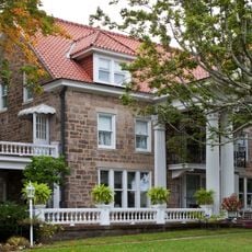
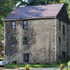
Beallsville Historic District is a preserved area with 91 buildings featuring Federal and Greek Revival styles along the historic National Road in Pennsylvania. The structures are spread across 40 acres and display architecture from different periods of the 1800s.

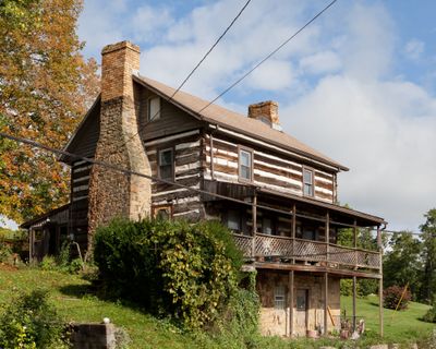
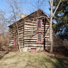
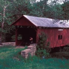
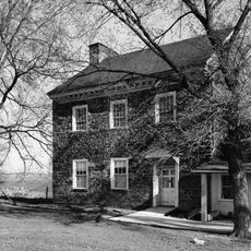
The area was founded by Zephaniah Beall, whose log house from 1788 still stands and is among the oldest structures in the district. Many more buildings appeared during the National Road's peak years from 1818 to 1852, when the route served as a major travel corridor.

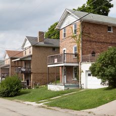
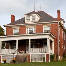
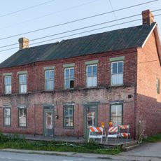
The area contains homes, shops, and the Beallsville Methodist Church from 1874 that show how people built their community in the 1800s. These buildings reflect the way settlements developed along major trade routes.

You can view most buildings in the district from the outside while walking through the streets and observing the different architectural styles. The best way to explore the area is by taking a leisurely walk, since the buildings are easy to reach on foot.

A cast iron milestone from 1835 stands in the district and is one of only 21 remaining markers preserved along Pennsylvania's National Road. This rare marker reminds visitors of the era when travelers tracked their progress on this route.

Location: Beallsville

Architectural style: Greek Revival architecture, Renaissance Revival architecture

GPS coordinates: 40.06500,-80.02306

Latest update: December 14, 2025 12:20

Photos
Around this place
Dunlap's Creek Bridge
United States of America

Dunlap's Creek Bridge

12.5 km
Brownsville Bridge
United States of America

Brownsville Bridge

12.3 km
Regester Log House
United States of America

Regester Log House

6.3 km
Huffman Distillery and Chopping Mill
United States of America

Huffman Distillery and Chopping Mill

7.4 km
Old Main
United States of America

Old Main

11.7 km
Scenery Hill Historic District
United States of America

Scenery Hill Historic District

4.7 km
Horn Davis Overholtzer Bridge
United States of America

Horn Davis Overholtzer Bridge

7.2 km
Molly Fleming House
United States of America

Molly Fleming House

12.2 km
Ulery Mill
United States of America

Ulery Mill

7.5 km
California Area Public Library
United States of America

California Area Public Library

11.4 km
Centerville Historic District
United States of America

Centerville Historic District

4.6 km
Philip Friend House
United States of America

Philip Friend House

8.7 km
Martin's Mill Covered Bridge
United States of America

Martin's Mill Covered Bridge

10.9 km
Marianna Historic District
United States of America

Marianna Historic District

8 km
Frank L. Ross Farm
United States of America

Frank L. Ross Farm

12 km
Hughes Covered Bridge
United States of America

Hughes Covered Bridge

12.2 km
Thomas H. Thompson House
United States of America

Thomas H. Thompson House

12.4 km
Jennings-Gallagher House
United States of America

Jennings-Gallagher House

11.3 km
Joseph Dorsey House
United States of America

Joseph Dorsey House

9.8 km
Welsh-Emery House
United States of America

Welsh-Emery House

2.5 km
Kinder's Mill
United States of America

Kinder's Mill

4.7 km
Cerl Wright Covered Bridge
United States of America

Cerl Wright Covered Bridge

10.7 km
Ringland Tavern
United States of America

Ringland Tavern

4.4 km
Harrison House
United States of America

Harrison House

6.6 km
Arboreto de la universidad de California en Pensilvania
United States of America

Arboreto de la universidad de California en Pensilvania

11.8 km
National Pike Steam Gas and Horse Association
United States of America

National Pike Steam Gas and Horse Association

8.1 km
Hepner–Bailey Field at Adamson Stadium
United States of America

Hepner–Bailey Field at Adamson Stadium

10.7 km
Maxwell Lock & Dam
United States of America

Maxwell Lock & Dam

8.8 km
Show the full map
Reviews

Visited this place? Tap the stars to rate it and share your experience / photos with the community! Try now! You can cancel it anytime.

« Beallsville Historic District - National Register Historic District in Beallsville, US » is provided by Around Us (aroundus.com). Images and texts are derived from Wikimedia project under a Creative Commons license. You are allowed to copy, distribute, and modify copies of this page, under the conditions set by the license, as long as this note is clearly visible.

Discover hidden gems everywhere you go!

From secret cafés to breathtaking viewpoints, skip the crowded tourist spots and find places that match your style. Our app makes it easy with voice search, smart filtering, route optimization, and insider tips from travelers worldwide. Download now for the complete mobile experience.

Around Us App Screenshot

A unique approach to discovering new places

Le Figaro

All the places worth exploring

France Info

A tailor-made excursion in just a few clicks

20 Minutes