Billerica Mills Historic District

Log in to your account

AroundUs is a community-driven map of interesting places, built by curious explorers like you. It grows with every review, story, and photo you share.
Connect to save your favorite spots, contribute locations, and create personalized routes.
Continue with Google
Continue with Apple
Continue with X
Continue with Facebook
Continue with email
By continuing, you accept our Terms and Conditions and our Privacy Policy
Create an account
Add to collection
Map
Suggest a change
Share

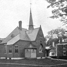
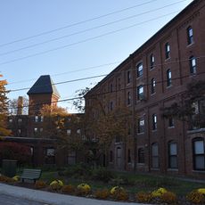
Billerica Mills Historic District, Industrial heritage site in North Billerica, Massachusetts, United States.

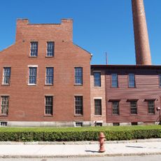
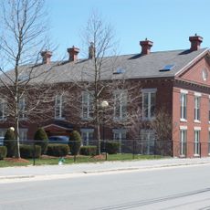
Billerica Mills Historic District is an industrial site in Massachusetts containing factory buildings and worker housing arranged between the Concord River and Rogers Street. The structures showcase Greek Revival architecture and encompass both production facilities and residential quarters built in the 1800s.

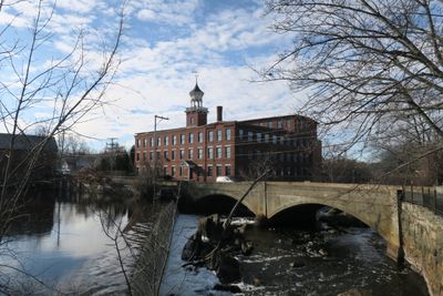
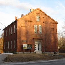
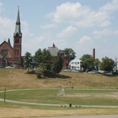
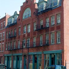
The Talbot brothers acquired land at Concord Falls from the Middlesex Canal Company in 1851 and launched textile operations that grew over following decades. The central brick building and its clock tower, completed between 1865 and 1870, marked the peak of the district's industrial expansion.

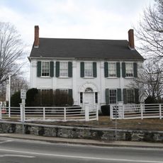
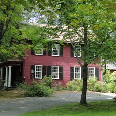
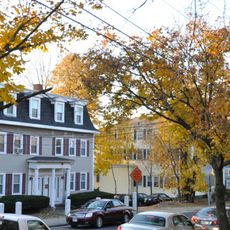
The mill complex shows how workers lived and labored in close proximity, with homes built alongside factories to create an integrated industrial community. This connection between residence and workplace still shapes how the district feels today.

Visitors can walk the site from Rogers Street to view the exterior structures and overall layout of the mills and homes. Note that exterior modifications to any buildings require approval from the Historic Districts Commission, so the area maintains its original appearance.

The central brick building with its clock tower continued making textiles until 1956, making it one of the last operating mills of its kind in the region. Its century-long run as an active production facility shows how industrial work sustained communities through major economic shifts.

Location: Massachusetts

GPS coordinates: 42.58972,-71.28556

Latest update: December 14, 2025 14:21

Photos
Around this place
Lowell National Historical Park
United States of America

Lowell National Historical Park

5.8 km
Middlesex Canal
United States of America

Middlesex Canal

287 m
Cross Point Lowell
United States of America

Cross Point Lowell

4.2 km
Lowell Cemetery
United States of America

Lowell Cemetery

4.4 km
Cawley Memorial Stadium
United States of America

Cawley Memorial Stadium

4.9 km
Edson Cemetery
United States of America

Edson Cemetery

3.5 km
Chelmsford Forum
United States of America

Chelmsford Forum

1.8 km
Manning Manse
United States of America

Manning Manse

1.5 km
Shedd Park
United States of America

Shedd Park

4.6 km
Lowell Post Office
United States of America

Lowell Post Office

6 km
Belvidere Hill Historic District
United States of America

Belvidere Hill Historic District

5.4 km
Billerica Public Library
United States of America

Billerica Public Library

3.7 km
Howe School
United States of America

Howe School

3.3 km
Fiske House
United States of America

Fiske House

5.5 km
Colburn School
United States of America

Colburn School

5.8 km
Rogers Fort Hill Park Historic District
United States of America

Rogers Fort Hill Park Historic District

5.1 km
Chelmsford Center Historic District
United States of America

Chelmsford Center Historic District

5.7 km
Wamesit Canal-Whipple Mill Industrial Complex
United States of America

Wamesit Canal-Whipple Mill Industrial Complex

4.9 km
Hoyt-Shedd Estate
United States of America

Hoyt-Shedd Estate

6 km
Andover Street Historic District
United States of America

Andover Street Historic District

6 km
Sabbath Day House
United States of America

Sabbath Day House

3.5 km
Deacon Samuel Hill House
United States of America

Deacon Samuel Hill House

6.1 km
Dutton-Holden Homestead
United States of America

Dutton-Holden Homestead

3.2 km
South Common Historic District
United States of America

South Common Historic District

5.7 km
Worcester House
United States of America

Worcester House

6.2 km
Washington Square Historic District
United States of America

Washington Square Historic District

6 km
Portuguese Colonial Wars and Carnation Revolution memorial
United States of America

Portuguese Colonial Wars and Carnation Revolution memorial

5.9 km
Howe Building
United States of America

Howe Building

6.1 km
Show the full map
Reviews

Visited this place? Tap the stars to rate it and share your experience / photos with the community! Try now! You can cancel it anytime.

« Billerica Mills Historic District - Industrial heritage site in North Billerica, Massachusetts, United States » is provided by Around Us (aroundus.com). Images and texts are derived from Wikimedia project under a Creative Commons license. You are allowed to copy, distribute, and modify copies of this page, under the conditions set by the license, as long as this note is clearly visible.

Discover hidden gems everywhere you go!

From secret cafés to breathtaking viewpoints, skip the crowded tourist spots and find places that match your style. Our app makes it easy with voice search, smart filtering, route optimization, and insider tips from travelers worldwide. Download now for the complete mobile experience.

Around Us App Screenshot

A unique approach to discovering new places

Le Figaro

All the places worth exploring

France Info

A tailor-made excursion in just a few clicks

20 Minutes