Enable Location

We need your location to show you interesting places around you

Discover nearby places

Find interesting locations and hidden gems around you

Precise directions

Get accurate directions and distances to places

Your location is never shared with other users. It's only used when you tap the location button.

Bull Shoals Lake

Log in to your account

Start exploring — it's free

Trusted by 61,980 travelers worldwide

Continue with Google
Continue with Apple
or

We will send you a code to connect

By continuing, you accept our Terms and Conditions and our Privacy Policy

Check your inbox

We've sent a pincode in your inbox. Please enter the code below.

Bull Shoals Lake

Bull Shoals Lake, Reservoir in the Ozark Mountains, Arkansas.

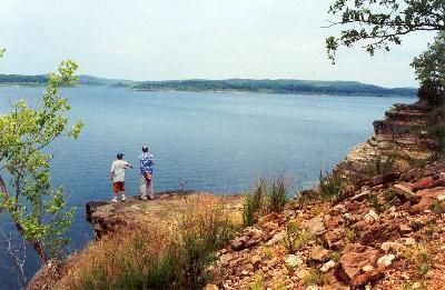
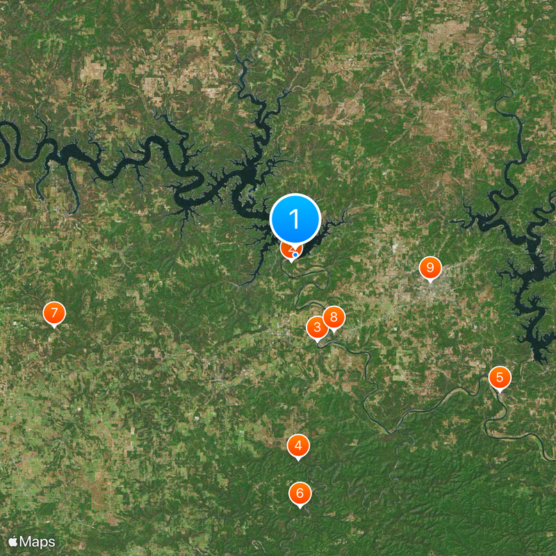
Bull Shoals Lake is a reservoir in the Ozark Mountains that stretches from Arkansas into Missouri. The water covers more than 18,000 hectares and has a shoreline extending over 1,600 kilometers.

The army built a dam on the White River in the late 1940s to control flooding and generate power. President Truman dedicated the structure in 1952 after the reservoir had formed.

Anglers come throughout the year to fish for bass and catfish in the clear waters. Many families use the boat ramps and spend weekends camping near the shore.

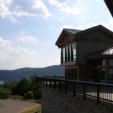
Parks around the reservoir offer campsites, boat ramps and swimming spots. Many areas stay open in winter, though most visitors come during spring and summer.

The bottom of the reservoir is mostly bare rock, so few plants grow underwater. The steep slopes around the water remain heavily wooded and largely undeveloped.

The community of curious travelers

AroundUs brings together thousands of curated places, local tips, and hidden gems, enriched daily by 60,000 contributors worldwide.

Start exploring
Location
GPS coordinates
36.36528,-92.57500
Latest update
December 20, 2025 11:43
Around this place
Bull Shoals-White River State Park
United States of America

Bull Shoals-White River State Park

966 m
Cotter Bridge
United States of America

Cotter Bridge

11.3 km
Rush Historic District
United States of America

Rush Historic District

25.9 km
Jacob Wolf House
United States of America

Jacob Wolf House

31.1 km
Buffalo River State Park
United States of America

Buffalo River State Park

32 km
Elliott and Anna Barham House
United States of America

Elliott and Anna Barham House

31.9 km
Cotter High School
United States of America

Cotter High School

10.8 km
Baxter County Courthouse
United States of America

Baxter County Courthouse

17.4 km
North Fork Bridge
United States of America

North Fork Bridge

30.9 km
Mountain Home Commercial Historic District
United States of America

Mountain Home Commercial Historic District

17.4 km
John Conkin and Clara Layton Harlin House
United States of America

John Conkin and Clara Layton Harlin House

29.7 km
Hirst-Mathew Hall
United States of America

Hirst-Mathew Hall

31 km
Case-Shiras-Dearmore House
United States of America

Case-Shiras-Dearmore House

17.6 km
Crooked Creek Bridge
United States of America

Crooked Creek Bridge

27.4 km
Cowdrey House
United States of America

Cowdrey House

18.3 km
Casey House
United States of America

Casey House

17.9 km
Cotter Water Tower
United States of America

Cotter Water Tower

10.9 km
Layton Building
United States of America

Layton Building

18.3 km
Rollins Hospital
United States of America

Rollins Hospital

11.7 km
Horace Mann School Historic District
United States of America

Horace Mann School Historic District

31.6 km
Fairview School Building
United States of America

Fairview School Building

4.4 km
Aggie Workshop
United States of America

Aggie Workshop

31 km
Davis House
United States of America

Davis House

31.2 km
Marion County Courthouse
United States of America

Marion County Courthouse

18.3 km
Buford School Building
United States of America

Buford School Building

18.6 km
Eros School Building
United States of America

Eros School Building

32 km
Carter-Jones House
United States of America

Carter-Jones House

18.2 km
Pyatt School Building
United States of America

Pyatt School Building

27.7 km
Show the full map
« Bull Shoals Lake - Reservoir in the Ozark Mountains, Arkansas » is provided by Around Us (aroundus.com). Images and texts are derived from Wikimedia project under a Creative Commons license. You are allowed to copy, distribute, and modify copies of this page, under the conditions set by the license, as long as this note is clearly visible.

Discover hidden gems everywhere you go!

From secret cafés to breathtaking viewpoints, skip the crowded tourist spots and find places that match your style. Our app makes it easy with voice search, smart filtering, route optimization, and insider tips from travelers worldwide. Download now for the complete mobile experience.

Around Us App Screenshot

A unique approach to discovering new places

Le Figaro

All the places worth exploring

France Info

A tailor-made excursion in just a few clicks

20 Minutes

Around Us
Travel Guide & Maps
Download

Send to your phone

QR Code
1

Open the camera app on your mobile.

2

Point at the QR code with your camera. A notification will appear.

3

Tap the notification to open the link.