Enable Location

We need your location to show you interesting places around you

Discover nearby places

Find interesting locations and hidden gems around you

Precise directions

Get accurate directions and distances to places

Your location is never shared with other users. It's only used when you tap the location button.

Log in to your account

Start exploring — it's free

Trusted by 61,982 travelers worldwide

Continue with Google
Continue with Apple
or

We will send you a code to connect

By continuing, you accept our Terms and Conditions and our Privacy Policy

Check your inbox

We've sent a pincode in your inbox. Please enter the code below.

Browne State Forest

Browne State Forest, Protected forest area in Essex County, Virginia, US.

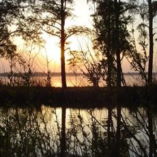
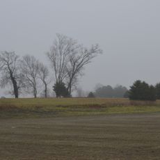
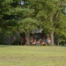
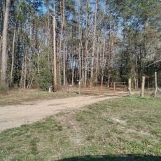
Browne State Forest is a protected area spanning approximately 129 acres in Essex County, Virginia, with loblolly pine woodland and wetland habitats. The forest connects directly to Dragon Run Swamp, creating a diverse ecosystem that supports varied plant and animal life.

The property passed to state ownership through a court auction in 1956 after the Browne family's involvement ended. Virginia formally designated it as a state forest in 2005, recognizing its ecological importance and protecting it for long-term conservation.

The forest serves as a living classroom where visitors observe active forest management and land stewardship practices in action. People come here to understand how forests are maintained and what role they play in protecting the region's natural systems.

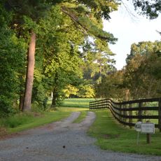
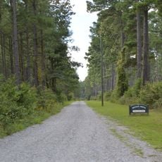
The forest opens daily from sunrise to sunset with basic parking for one vehicle near the gate entrance. Visitors should wear suitable footwear for wet conditions, as much of the terrain includes marshy areas and soft ground.

A fire tower relocated from King George County in the early 1960s stands along Route 604 within the forest. This relocated structure offers a glimpse into how forest management infrastructure has been adapted and preserved across the region over time.

The community of curious travelers

AroundUs brings together thousands of curated places, local tips, and hidden gems, enriched daily by 60,000 contributors worldwide.

Start exploring
Location
GPS coordinates
37.79040,-76.78050
Latest update
December 14, 2025 13:06
Around this place
Mount Airy
United States of America

Mount Airy

20.3 km
Belle Isle State Park
United States of America

Belle Isle State Park

16 km
Sabine Hall
United States of America

Sabine Hall

16.7 km
King William County Courthouse
United States of America

King William County Courthouse

23.4 km
Rappahannock River Valley National Wildlife Refuge
United States of America

Rappahannock River Valley National Wildlife Refuge

25 km
Chelsea
United States of America

Chelsea

22 km
Debtors' Prison
United States of America

Debtors' Prison

16.4 km
King and Queen Courthouse Green Historic District
United States of America

King and Queen Courthouse Green Historic District

16 km
Lansdowne
United States of America

Lansdowne

24.8 km
Tappahannock Historic District
United States of America

Tappahannock Historic District

16.7 km
Cherry Walk
United States of America

Cherry Walk

17 km
Linden Farm
United States of America

Linden Farm

17.1 km
Woodford
United States of America

Woodford

10.6 km
Upper Church, Stratton Major Parish
United States of America

Upper Church, Stratton Major Parish

20.9 km
Fort Mattapony
United States of America

Fort Mattapony

21.5 km
Newington Archaeological Site
United States of America

Newington Archaeological Site

17 km
Woodlawn
United States of America

Woodlawn

14 km
Bowlers Rock Light
United States of America

Bowlers Rock Light

5.7 km
Richmond County Courthouse
United States of America

Richmond County Courthouse

18.8 km
Sandwich
United States of America

Sandwich

24.9 km
Millers Tavern Rural Historic District
United States of America

Millers Tavern Rural Historic District

17 km
Village of Morattico Historic District
United States of America

Village of Morattico Historic District

13.3 km
Urbanna Historic District
United States of America

Urbanna Historic District

25 km
Wormeley Cottage
United States of America

Wormeley Cottage

24.8 km
Middlesex County Courthouse
United States of America

Middlesex County Courthouse

24.9 km
Marriott School
United States of America

Marriott School

24.2 km
Davis Beach
United States of America

Davis Beach

17.8 km
Menokin
United States of America

Menokin

24.4 km
Show the full map
« Browne State Forest - Protected forest area in Essex County, Virginia, US » is provided by Around Us (aroundus.com). Images and texts are derived from Wikimedia project under a Creative Commons license. You are allowed to copy, distribute, and modify copies of this page, under the conditions set by the license, as long as this note is clearly visible.

Discover hidden gems everywhere you go!

From secret cafés to breathtaking viewpoints, skip the crowded tourist spots and find places that match your style. Our app makes it easy with voice search, smart filtering, route optimization, and insider tips from travelers worldwide. Download now for the complete mobile experience.

Around Us App Screenshot

A unique approach to discovering new places

Le Figaro

All the places worth exploring

France Info

A tailor-made excursion in just a few clicks

20 Minutes

Around Us
Travel Guide & Maps
Download

Send to your phone

QR Code
1

Open the camera app on your mobile.

2

Point at the QR code with your camera. A notification will appear.

3

Tap the notification to open the link.