Enable Location

We need your location to show you interesting places around you

Discover nearby places

Find interesting locations and hidden gems around you

Precise directions

Get accurate directions and distances to places

Your location is never shared with other users. It's only used when you tap the location button.

City Island

Log in to your account

Start exploring — it's free

Trusted by 63,315 travelers worldwide

Continue with Google
Continue with Apple
or

We will send you a code to connect

By continuing, you accept our Terms and Conditions and our Privacy Policy

Check your inbox

We've sent a pincode in your inbox. Please enter the code below.

Discussion Reviews 1 Photos
8.6k Popularity

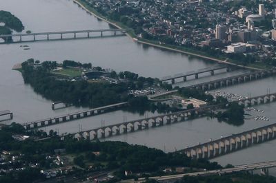
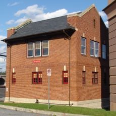
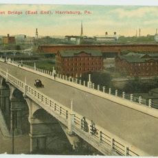
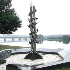
City Island, River island and recreation park in Harrisburg, United States.

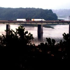
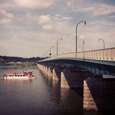
City Island is a river island in the Susquehanna with paved walking trails, a baseball stadium, boat docks, and sports fields for recreation. The island can be reached from both sides of Harrisburg and offers different areas for outdoor activities.

During World War II, the island served as a military training ground. It was later transformed into a recreation space for the region.

The baseball stadium hosts games of the Harrisburg Senators minor league team, drawing crowds of fans throughout the season. The island has become a gathering place where people come to watch games and spend time outdoors together.

The island has ample parking, public restrooms, and picnic areas along the paths. Visitors should be prepared for uneven ground and check conditions during bad weather, especially in spring months.

When spring floods arrive, the Susquehanna River can submerge parts of the island and create temporary waterfalls over the concrete paths. This seasonal display shows the river's power and how the landscape transforms with water flow.

The community of curious travelers

AroundUs brings together thousands of curated places, local tips, and hidden gems, enriched daily by 60,000 contributors worldwide.

Start exploring
Location
Elevation above the sea
93 m
GPS coordinates
40.25510,-76.88800
Latest update
December 21, 2025 16:05
Around this place
Pennsylvania State Capitol
United States of America

Pennsylvania State Capitol

1.1 km
Walnut Street Bridge
United States of America

Walnut Street Bridge

317 m
Pennsylvania State Capitol Complex
United States of America

Pennsylvania State Capitol Complex

1.2 km
Philadelphia & Reading Railroad Bridge
United States of America

Philadelphia & Reading Railroad Bridge

792 m
Cumberland Valley Railroad Bridge
United States of America

Cumberland Valley Railroad Bridge

397 m
Whitaker Center for Science and the Arts
United States of America

Whitaker Center for Science and the Arts

856 m
United States of America

Commonwealth

1.1 km
State Street Bridge
United States of America

State Street Bridge

1.5 km
Cathedral of Saint Patrick
United States of America

Cathedral of Saint Patrick

967 m
Simon Cameron House
United States of America

Simon Cameron House

793 m
Ronald Reagan Federal Building
United States of America

Ronald Reagan Federal Building

848 m
Market Street Bridge
United States of America

Market Street Bridge

332 m
St. Stephen's Episcopal Cathedral
United States of America

St. Stephen's Episcopal Cathedral

644 m
Dauphin County Courthouse
United States of America

Dauphin County Courthouse

590 m
Harris Switch Tower
United States of America

Harris Switch Tower

1.4 km
Mulberry Street Bridge
United States of America

Mulberry Street Bridge

1.3 km
Holocaust Memorial for the Commonwealth of Pennsylvania
United States of America

Holocaust Memorial for the Commonwealth of Pennsylvania

1.5 km
Harrisburg Midtown Arts Center
United States of America

Harrisburg Midtown Arts Center

1.4 km
Old Midtown Historic District
United States of America

Old Midtown Historic District

1.4 km
Harrisburg Technical High School
United States of America

Harrisburg Technical High School

1.1 km
John Wormley House
United States of America

John Wormley House

1.1 km
William R. Griffith House
United States of America

William R. Griffith House

635 m
Harrisburg Historic District
United States of America

Harrisburg Historic District

685 m
William Seel Building
United States of America

William Seel Building

976 m
State Museum of Pennsylvania
United States of America

State Museum of Pennsylvania

1.2 km
John Harris Bridge
United States of America

John Harris Bridge

1.2 km
M. Harvey Taylor Memorial Bridge
United States of America

M. Harvey Taylor Memorial Bridge

1.2 km
Old Downtown Harrisburg Commercial Historic District
United States of America

Old Downtown Harrisburg Commercial Historic District

912 m
Show the full map
Reviews
Share your experience

No review yet

Discussions
Start a discussion...

No discussion yet

« City Island - River island and recreation park in Harrisburg, United States » is provided by Around Us (aroundus.com). Images and texts are derived from Wikimedia project under a Creative Commons license. You are allowed to copy, distribute, and modify copies of this page, under the conditions set by the license, as long as this note is clearly visible.

Discover hidden gems everywhere you go!

From secret cafés to breathtaking viewpoints, skip the crowded tourist spots and find places that match your style. Our app makes it easy with voice search, smart filtering, route optimization, and insider tips from travelers worldwide. Download now for the complete mobile experience.

Around Us App Screenshot

A unique approach to discovering new places

Le Figaro

All the places worth exploring

France Info

A tailor-made excursion in just a few clicks

20 Minutes

Around Us
Travel Guide & Maps
Download

Send to your phone

QR Code
1

Open the camera app on your mobile.

2

Point at the QR code with your camera. A notification will appear.

3

Tap the notification to open the link.