Enable Location

We need your location to show you interesting places around you

Discover nearby places

Find interesting locations and hidden gems around you

Precise directions

Get accurate directions and distances to places

Your location is never shared with other users. It's only used when you tap the location button.

Coskata-Coatue Wildlife Refuge

Log in to your account

Start exploring — it's free

Trusted by 62,615 travelers worldwide

Continue with Google
Continue with Apple
or

We will send you a code to connect

By continuing, you accept our Terms and Conditions and our Privacy Policy

Check your inbox

We've sent a pincode in your inbox. Please enter the code below.

Coskata-Coatue Wildlife Refuge

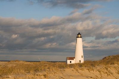
Coskata-Coatue Wildlife Refuge, Wildlife refuge on Nantucket Island, Massachusetts, United States.

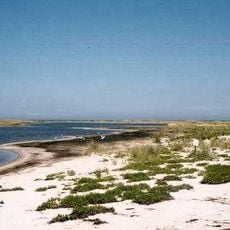
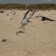
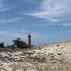
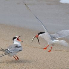
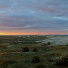
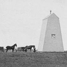
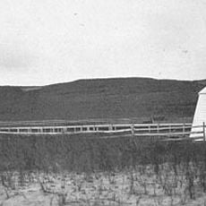
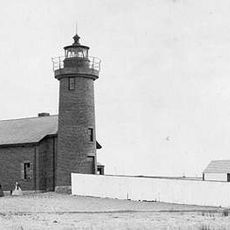
Coskata-Coatue Wildlife Refuge spreads across about 916 acres of barrier beach with dunes, salt marshes, and the largest red cedar woodland in New England. The landscape consists of flat, open spaces extending to the shoreline and mixing dry and wet habitats throughout.

The conservation effort started in 1974 when the Trustees of Reservations acquired the land to protect Nantucket Island's natural resources. This early commitment to preservation shaped how the site has been managed and maintained over the decades.

The name Coskata comes from the Wampanoag language and refers to a traditional fishing place used by Native American communities. When you walk through the refuge, you can sense the connection to the island's relationship with the water and its indigenous past.

Access to the refuge requires a four-wheel drive vehicle and an Oversand Vehicle Permit available at the Wauwinet Gatehouse from May through October. Planning your visit outside bird breeding season makes the trails more accessible and allows you to explore the refuge more freely.

The refuge uses managed retreat strategies and coastal management techniques to adapt to climate change impacts on its barrier beach and dune system. These approaches demonstrate how protected lands actively respond to rising sea levels and erosion rather than simply watching conditions change.

The community of curious travelers

AroundUs brings together thousands of curated places, local tips, and hidden gems, enriched daily by 60,000 contributors worldwide.

Start exploring
Location
GPS coordinates
41.35920,-70.01890
Latest update
December 13, 2025 12:23
Around this place
Chatham Light
United States of America

Chatham Light

35.2 km
Muskeget Island
United States of America

Muskeget Island

24 km
Brant Point Light
United States of America

Brant Point Light

9.8 km
Nantucket Whaling Museum
United States of America

Nantucket Whaling Museum

10.6 km
Coast Guard Station Chatham
United States of America

Coast Guard Station Chatham

35.2 km
Sankaty Head Light
United States of America

Sankaty Head Light

9.4 km
Jethro Coffin House
United States of America

Jethro Coffin House

10.9 km
Monomoy National Wildlife Refuge
United States of America

Monomoy National Wildlife Refuge

14.6 km
Great Point Light
United States of America

Great Point Light

4.2 km
Nantucket Historic District
United States of America

Nantucket Historic District

10.7 km
Monomoy Point Light
United States of America

Monomoy Point Light

22.4 km
West Dennis Light
United States of America

West Dennis Light

34.9 km
Nantucket National Wildlife Refuge
United States of America

Nantucket National Wildlife Refuge

3.1 km
Maria Mitchell Observatory
United States of America

Maria Mitchell Observatory

11.3 km
The Old Mill
United States of America

The Old Mill

11.4 km
Maria Mitchell Aquarium
United States of America

Maria Mitchell Aquarium

10.7 km
Stage Harbor Light
United States of America

Stage Harbor Light

33.5 km
Monomoy Wilderness
United States of America

Monomoy Wilderness

25.1 km
Bishop and Clerks Light
United States of America

Bishop and Clerks Light

30.7 km
Nantucket Harbor Range Lights
United States of America

Nantucket Harbor Range Lights

9.9 km
Louis Brandeis House
United States of America

Louis Brandeis House

35.1 km
Nantucket Beacon
United States of America

Nantucket Beacon

10.6 km
Old Village Historic District (Chatham, Massachusetts)
United States of America

Old Village Historic District (Chatham, Massachusetts)

35.6 km
Nantucket Cliff Range Lights
United States of America

Nantucket Cliff Range Lights

10.3 km
Half Way House
United States of America

Half Way House

35.6 km
South Harwich Methodist Church
United States of America

South Harwich Methodist Church

35.5 km
Captain James Berry House
United States of America

Captain James Berry House

35.5 km
Brant Point Light
United States of America

Brant Point Light

9.9 km
Show the full map
« Coskata-Coatue Wildlife Refuge - Wildlife refuge on Nantucket Island, Massachusetts, United States » is provided by Around Us (aroundus.com). Images and texts are derived from Wikimedia project under a Creative Commons license. You are allowed to copy, distribute, and modify copies of this page, under the conditions set by the license, as long as this note is clearly visible.

Discover hidden gems everywhere you go!

From secret cafés to breathtaking viewpoints, skip the crowded tourist spots and find places that match your style. Our app makes it easy with voice search, smart filtering, route optimization, and insider tips from travelers worldwide. Download now for the complete mobile experience.

Around Us App Screenshot

A unique approach to discovering new places

Le Figaro

All the places worth exploring

France Info

A tailor-made excursion in just a few clicks

20 Minutes

Around Us
Travel Guide & Maps
Download

Send to your phone

QR Code
1

Open the camera app on your mobile.

2

Point at the QR code with your camera. A notification will appear.

3

Tap the notification to open the link.