Enable Location

We need your location to show you interesting places around you

Discover nearby places

Find interesting locations and hidden gems around you

Precise directions

Get accurate directions and distances to places

Your location is never shared with other users. It's only used when you tap the location button.

DeJarnette's Tavern

Log in to your account

Start exploring — it's free

Trusted by 61,973 travelers worldwide

Continue with Google
Continue with Apple
or

We will send you a code to connect

By continuing, you accept our Terms and Conditions and our Privacy Policy

Check your inbox

We've sent a pincode in your inbox. Please enter the code below.

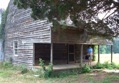
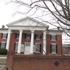
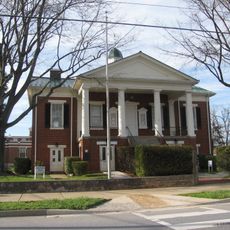
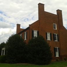
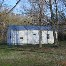
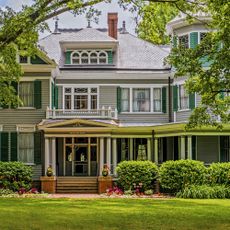
DeJarnette's Tavern, Colonial tavern in Halifax County, Virginia.

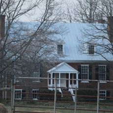
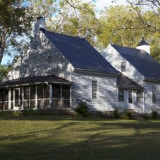
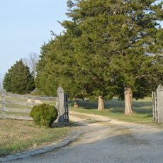
DeJarnette's Tavern is a colonial-era wooden building in Halifax County featuring a recessed entry porch, large communal rooms on the first floor, and residential quarters upstairs. The property spreads across several acres and includes supporting structures such as two tobacco barns, a chicken coop, and a log storage building.

The building was constructed in the 1780s and served as a stagecoach station and gathering place for soldiers during the Civil War. It played an important role in regional history as a hub for travelers and military activity.

The place served as a community gathering spot where people met and musicians played together for entertainment. It shaped the social life of the region through its role as a meeting place.

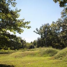
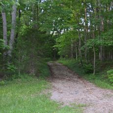
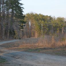
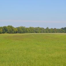
The property is located in a rural setting and is best explored on foot since the grounds spread across multiple buildings. Visitors should allow time to see the outbuildings like the storage structures, which show what daily life looked like in that period.

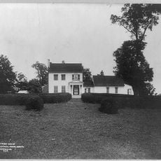
Owner Daniel DeJarnette descended from a Huguenot family that fled France in 1685 and later settled in America. Local stories recount how he obtained the property through an unusual contest, reflecting the adventurous spirit of his family line.

The community of curious travelers

AroundUs brings together thousands of curated places, local tips, and hidden gems, enriched daily by 60,000 contributors worldwide.

Start exploring
Location
GPS coordinates
37.01310,-79.00610
Latest update
December 14, 2025 18:00
Around this place
Red Hill Patrick Henry National Memorial
United States of America

Red Hill Patrick Henry National Memorial

9.8 km
Staunton River Battlefield State Park
United States of America

Staunton River Battlefield State Park

30.3 km
Avoca
United States of America

Avoca

26.8 km
Clarkton Bridge
United States of America

Clarkton Bridge

10.7 km
Caryswood
United States of America

Caryswood

32.8 km
Halifax County Courthouse
United States of America

Halifax County Courthouse

28.4 km
Shady Grove
United States of America

Shady Grove

18.1 km
Mansion Truss Bridge
United States of America

Mansion Truss Bridge

24.1 km
Campbell County Courthouse
United States of America

Campbell County Courthouse

30.6 km
Woodlawn
United States of America

Woodlawn

29.8 km
The Cove
United States of America

The Cove

23.2 km
Dr. Richard Thornton House
United States of America

Dr. Richard Thornton House

4.7 km
Collins Ferry Historic District
United States of America

Collins Ferry Historic District

4.3 km
Seaton
United States of America

Seaton

30.8 km
Charlotte Court House Historic District
United States of America

Charlotte Court House Historic District

32.5 km
Altavista Downtown Historic District
United States of America

Altavista Downtown Historic District

20.9 km
Locust Hill
United States of America

Locust Hill

23.5 km
Blenheim
United States of America

Blenheim

23.6 km
Wade Archeological Site
United States of America

Wade Archeological Site

30.3 km
Brookneal Historic District
United States of America

Brookneal Historic District

6.9 km
Town of Halifax Court House Historic District
United States of America

Town of Halifax Court House Historic District

28.3 km
Cat Rock Sluice of the Roanoke Navigation
United States of America

Cat Rock Sluice of the Roanoke Navigation

5.2 km
Gretna Commercial Historic District
United States of America

Gretna Commercial Historic District

32.3 km
Pleasant Grove
United States of America

Pleasant Grove

32.8 km
Hill Grove School
United States of America

Hill Grove School

22.5 km
Mountain Road Historic District
United States of America

Mountain Road Historic District

28.2 km
Thomas Claiborne Creasy House
United States of America

Thomas Claiborne Creasy House

32.4 km
Avoca Museum
United States of America

Avoca Museum

26.8 km
Show the full map
« DeJarnette's Tavern - Colonial tavern in Halifax County, Virginia » is provided by Around Us (aroundus.com). Images and texts are derived from Wikimedia project under a Creative Commons license. You are allowed to copy, distribute, and modify copies of this page, under the conditions set by the license, as long as this note is clearly visible.

Discover hidden gems everywhere you go!

From secret cafés to breathtaking viewpoints, skip the crowded tourist spots and find places that match your style. Our app makes it easy with voice search, smart filtering, route optimization, and insider tips from travelers worldwide. Download now for the complete mobile experience.

Around Us App Screenshot

A unique approach to discovering new places

Le Figaro

All the places worth exploring

France Info

A tailor-made excursion in just a few clicks

20 Minutes

Around Us
Travel Guide & Maps
Download

Send to your phone

QR Code
1

Open the camera app on your mobile.

2

Point at the QR code with your camera. A notification will appear.

3

Tap the notification to open the link.