Chest opened
+${chestReward.xp} XP
Explorer
NOUVEAU ×${chestReward.collectible.quantity}
tapez pour fermer

See the monuments around you in AR Open chests in the app

Around Us is built for your phone — point your camera at the streets and discover the monuments and places around you in augmented reality. Around Us is built for your phone — chests unlock when you walk, explore and capture nearby places.

•

Enable Location

We need your location to show you interesting places around you

Discover nearby places

Find interesting locations and hidden gems around you

Precise directions

Get accurate directions and distances to places

Your location is never shared with other users. It's only used when you tap the location button.

East Tennessee

Log in to your account

Start exploring — it's free

Trusted by 91,510 travelers worldwide

Continue with Google
Continue with Apple
or

We will send you a code to connect

By continuing, you accept our Terms and Conditions and our Privacy Policy

Check your inbox

We've sent a pincode in your inbox. Please enter the code below.

East Tennessee, Geographic region in eastern Tennessee, United States

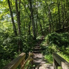
East Tennessee forms the eastern third of the state and spreads across 33 counties through three different landscapes: the Blue Ridge Mountains, the Ridge-and-Valley Appalachians, and the Cumberland Plateau. The topography shifts between steep forested slopes, long parallel valleys, and flat highlands with wide views.

The area stayed loyal to the Union during the Civil War while much of Tennessee joined the Confederacy. Delegates from the region tried without success to form their own separate state.

Traditional mountain music lives on in small communities where banjos and fiddles still appear at gatherings and festivals throughout the year. Many place names come from the Cherokee language and recall the original inhabitants of these valleys and ridges.

Major cities like Knoxville, Chattanooga, and the Tri-Cities offer hotels, gas stations, and grocery stores. Mountain roads can get slippery in rain and may have snow or ice in winter.

Oak Ridge in this region contains a laboratory that enriched uranium for the Manhattan Project during World War II. The facility still operates today and runs scientific research in nuclear energy and other fields.

The community of curious travelers

AroundUs brings together thousands of curated places, local tips, and hidden gems, enriched daily by 91,510 contributors worldwide.

Start exploring
Location
Shares border with
Middle Tennessee
GPS coordinates
35.79958,-83.76013
Latest update
October 17, 2026 23:34
Around this place
Kingston Pike
United States of America

Kingston Pike

15.1 mi
Sacred Heart Cathedral
United States of America

Sacred Heart Cathedral

16.1 mi
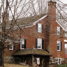
Daniel House
United States of America

Daniel House

13.6 mi
Bleak House
United States of America

Bleak House

15.1 mi
University of Tennessee Arboretum
United States of America

University of Tennessee Arboretum

29.1 mi
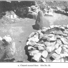
University of Tennessee Agriculture Farm Mound
United States of America

University of Tennessee Agriculture Farm Mound

14.4 mi
Crescent Bend
United States of America

Crescent Bend

14.9 mi
Statesview
United States of America

Statesview

19.1 mi
Avery Russell House
United States of America

Avery Russell House

23.2 mi
Knollwood
United States of America

Knollwood

16.8 mi
Westwood
United States of America

Westwood

14.8 mi
Strike & Spare Family Bowl
United States of America

Strike & Spare Family Bowl

20.8 mi
Boyd-Harvey House
United States of America

Boyd-Harvey House

23.7 mi
Ebenezer Mill
United States of America

Ebenezer Mill

19 mi
Benjamin Morton House
United States of America

Benjamin Morton House

15.5 mi
Ivan Racheff House
United States of America

Ivan Racheff House

16.5 mi
J. B. Jones House
United States of America

J. B. Jones House

27.1 mi
Strike & Spare Western Avenue
United States of America

Strike & Spare Western Avenue

18.9 mi
Sir Goony's Family Fun Center
United States of America

Sir Goony's Family Fun Center

22.6 mi
Freel Farm Mound Site
United States of America

Freel Farm Mound Site

28.3 mi
Samuel George House
United States of America

Samuel George House

13.9 mi
Love Shack
United States of America

Love Shack

21.1 mi
Middlebrook
United States of America

Middlebrook

16.7 mi
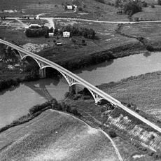
Dr. Herman Postma Memorial Solway Bridge
United States of America

Dr. Herman Postma Memorial Solway Bridge

27.7 mi
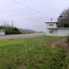
Bethel Valley Road Checking Station
United States of America

Bethel Valley Road Checking Station

28.7 mi
James Gillespie House
United States of America

James Gillespie House

18.6 mi
United States of America

Scenic viewpoint

15.2 mi
United States of America

Statue, Work of art

23.1 mi
Show the full map
Reviews
Share your experience

No review yet

Discussions
Start a discussion...

No discussion yet

« East Tennessee - Geographic region in eastern Tennessee, United States » is provided by Around Us (aroundus.com). Images and texts are derived from Wikimedia project under a Creative Commons license. You are allowed to copy, distribute, and modify copies of this page, under the conditions set by the license, as long as this note is clearly visible.

Discover hidden gems everywhere you go!

From secret cafés to breathtaking viewpoints, skip the crowded tourist spots and find places that match your style. Our app makes it easy with voice search, smart filtering, route optimization, and insider tips from travelers worldwide. Download now for the complete mobile experience.
Around Us App Screenshot
❝

A unique approach to discovering new places❞

— Le Figaro

❝

All the places worth exploring❞

— France Info

❝

A tailor-made excursion in just a few clicks❞

— 20 Minutes

Around Us
Travel Guide & Maps
Download

Send to your phone

QR Code
1

Open the camera app on your mobile.

2

Point at the QR code with your camera. A notification will appear.

3

Tap the notification to open the link.