Enable Location

We need your location to show you interesting places around you

Discover nearby places

Find interesting locations and hidden gems around you

Precise directions

Get accurate directions and distances to places

Your location is never shared with other users. It's only used when you tap the location button.

East Harbor State Park

Log in to your account

Start exploring — it's free

Trusted by 62,421 travelers worldwide

Continue with Google
Continue with Apple
or

We will send you a code to connect

By continuing, you accept our Terms and Conditions and our Privacy Policy

Check your inbox

We've sent a pincode in your inbox. Please enter the code below.

East Harbor State Park

East Harbor State Park, State park in Lakeside-Marblehead, US.

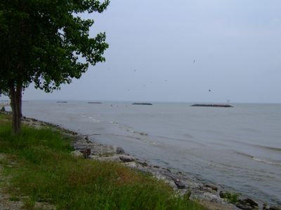
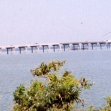
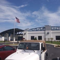
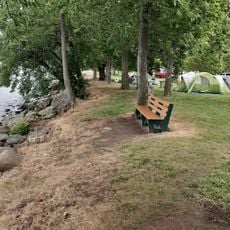
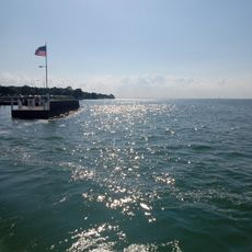
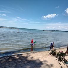
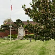
East Harbor State Park is a state park located along Lake Erie's southern shore in Ohio, featuring a sandy beach and extensive outdoor recreation areas. The grounds include spaces for swimming, boating, and camping, with trails winding through natural habitats.

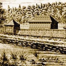
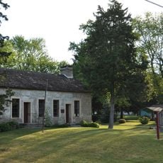
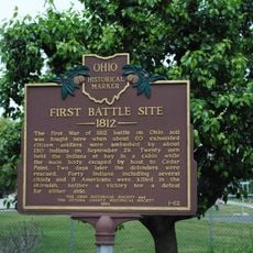
The area was originally home to the Ottawa and Wyandot tribes, who lived here alongside other indigenous peoples. After European settlement arrived, the swampy terrain was drained and the land was converted for farming.

The region developed into an agricultural area after swampland was cleared, with peach orchards and vineyards becoming part of the local identity. Visitors today can still see how farming traditions shaped the landscape around the shoreline.

The park is open year-round and offers both developed and basic camping options to suit different needs. Visitors should note that summer provides the best conditions for swimming and boating, while winter enables other outdoor pursuits.

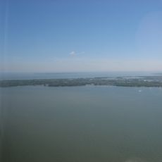
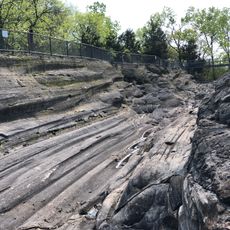
The park contains an important ecological feature: several island formations that provide habitat for birds and other wildlife. These islands are part of a larger ecosystem along Lake Erie and attract many birdwatchers throughout the year.

The community of curious travelers

AroundUs brings together thousands of curated places, local tips, and hidden gems, enriched daily by 60,000 contributors worldwide.

Start exploring
Location
Inception
1947
GPS coordinates
41.54760,-82.80990
Latest update
December 8, 2025 20:01
Around this place
Crystal Cave
United States of America

Crystal Cave

11.2 km
Marblehead Light
United States of America

Marblehead Light

8.3 km
African Safari Wildlife Park
United States of America

African Safari Wildlife Park

4.8 km
Marblehead Lighthouse
United States of America

Marblehead Lighthouse

8.2 km
Edison Bridge
United States of America

Edison Bridge

7.7 km
Kelleys Island State Park
United States of America

Kelleys Island State Park

11.1 km
South Bass Island Light
United States of America

South Bass Island Light

9.4 km
Inscription Rock
United States of America

Inscription Rock

9.9 km
Liberty Aviation Museum
United States of America

Liberty Aviation Museum

6.2 km
Catawba Island State Park
United States of America

Catawba Island State Park

5 km
Fort Sandoské
United States of America

Fort Sandoské

6.9 km
Port Clinton Light
United States of America

Port Clinton Light

11 km
Kelleys Island State Park Public Beach
United States of America

Kelleys Island State Park Public Beach

11.5 km
Port Clinton Public Swimming Beach
United States of America

Port Clinton Public Swimming Beach

10.4 km
Benajah Wolcott House
United States of America

Benajah Wolcott House

6.3 km
The Watering Hole Safari and Waterpark
United States of America

The Watering Hole Safari and Waterpark

4.8 km
First Congregational Church
United States of America

First Congregational Church

6.3 km
Lime Kiln Beach
United States of America

Lime Kiln Beach

9.4 km
Johnson's Island Confederate Cemetery
United States of America

Johnson's Island Confederate Cemetery

8.5 km
Orchestra Hall
United States of America

Orchestra Hall

5 km
North Swimming Beach
United States of America

North Swimming Beach

1.3 km
Marblehead Lighthouse State Park
United States of America

Marblehead Lighthouse State Park

8.2 km
Kelleys Island South Shore Historic District
United States of America

Kelleys Island South Shore Historic District

9.7 km
First Battle Site
United States of America

First Battle Site

6.6 km
Oak Point State Park
United States of America

Oak Point State Park

11.4 km
The Island House
United States of America

The Island House

9.7 km
Kellys Island Branch
United States of America

Kellys Island Branch

10.6 km
Glacial Grooves State Memorial
United States of America

Glacial Grooves State Memorial

11.5 km
Show the full map
« East Harbor State Park - State park in Lakeside-Marblehead, US » is provided by Around Us (aroundus.com). Images and texts are derived from Wikimedia project under a Creative Commons license. You are allowed to copy, distribute, and modify copies of this page, under the conditions set by the license, as long as this note is clearly visible.

Discover hidden gems everywhere you go!

From secret cafés to breathtaking viewpoints, skip the crowded tourist spots and find places that match your style. Our app makes it easy with voice search, smart filtering, route optimization, and insider tips from travelers worldwide. Download now for the complete mobile experience.

Around Us App Screenshot

A unique approach to discovering new places

Le Figaro

All the places worth exploring

France Info

A tailor-made excursion in just a few clicks

20 Minutes

Around Us
Travel Guide & Maps
Download

Send to your phone

QR Code
1

Open the camera app on your mobile.

2

Point at the QR code with your camera. A notification will appear.

3

Tap the notification to open the link.