Enable Location

We need your location to show you interesting places around you

Discover nearby places

Find interesting locations and hidden gems around you

Precise directions

Get accurate directions and distances to places

Your location is never shared with other users. It's only used when you tap the location button.

Fellsmere Park Parkways

Log in to your account

Start exploring — it's free

Trusted by 62,960 travelers worldwide

Continue with Google
Continue with Apple
or

We will send you a code to connect

By continuing, you accept our Terms and Conditions and our Privacy Policy

Check your inbox

We've sent a pincode in your inbox. Please enter the code below.

Discussion Reviews 1 Photos
1.4k Popularity

Fellsmere Park Parkways, Historic district parkways in Malden, Massachusetts.

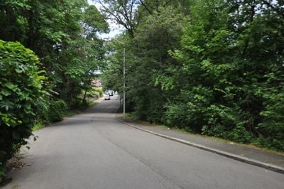
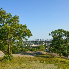
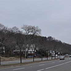
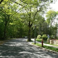
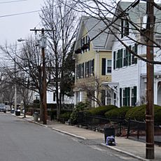
Fellsmere Park Parkways is a historic district featuring a central pond surrounded by carefully planned roads and green spaces. Two main border roads, West Border Road and Boundary Road, define the eastern and western boundaries of this landscape structure.

The parkways were designed by the Metropolitan Park Commission in 1913 as part of a larger network of green spaces connecting the Boston metropolitan area. This project reflected the era's focus on creating accessible outdoor spaces for communities.

The parkways reflect Frederick Law Olmsted's vision of landscape design, where natural elements are arranged to encourage outdoor recreation. Walking through the area, you notice how the roads frame the landscape to create a sense of connection with nature.

The parkways are easy to walk through, with clear pathways surrounding the pond and connecting the main border roads. The area is maintained by the Department of Conservation and Recreation working with the City of Malden, ensuring regular upkeep of the grounds.

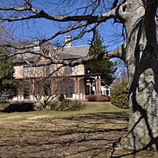
The land came from a donation by Elisha Converse after his rubber factory burned, and he initially intended to use the area as a water reservoir. This unexpected path from industrial disaster to public recreation space reveals a surprising origin story that few visitors know.

The community of curious travelers

AroundUs brings together thousands of curated places, local tips, and hidden gems, enriched daily by 60,000 contributors worldwide.

Start exploring
Location
GPS coordinates
42.42808,-71.08664
Latest update
December 14, 2025 16:41
Around this place
Isaac Royall House
United States of America

Isaac Royall House

2.8 km
Grandfather's House
United States of America

Grandfather's House

2.8 km
Peter Tufts House
United States of America

Peter Tufts House

1.9 km
Waitt's Mountain
United States of America

Waitt's Mountain

1.8 km
Fells Connector Parkways
United States of America

Fells Connector Parkways

1.9 km
Congregation Beth Israel
United States of America

Congregation Beth Israel

603 m
Converse Memorial Library
United States of America

Converse Memorial Library

1.7 km
Bell Rock Memorial Park
United States of America

Bell Rock Memorial Park

1.8 km
Unitarian Universalist Church of Medford and the Osgood House
United States of America

Unitarian Universalist Church of Medford and the Osgood House

2.5 km
Bell Rock Cemetery
United States of America

Bell Rock Cemetery

1.7 km
Middlesex Fells Reservation Parkways
United States of America

Middlesex Fells Reservation Parkways

2.3 km
Medford Pipe Bridge
United States of America

Medford Pipe Bridge

2.4 km
Isaac Hall House
United States of America

Isaac Hall House

2.3 km
Henry Bradlee Jr. House
United States of America

Henry Bradlee Jr. House

2.1 km
Albree-Hall-Lawrence House
United States of America

Albree-Hall-Lawrence House

2.8 km
Edward Oakes House
United States of America

Edward Oakes House

2.7 km
Old Ship Street Historic District
United States of America

Old Ship Street Historic District

1.8 km
United States Post Office–Medford Main
United States of America

United States Post Office–Medford Main

2.2 km
St. Paul's Parish Church
United States of America

St. Paul's Parish Church

891 m
John B. Angier House
United States of America

John B. Angier House

2.5 km
Hillside Avenue Historic District
United States of America

Hillside Avenue Historic District

2.3 km
Jonathan Wade House
United States of America

Jonathan Wade House

2.2 km
Bigelow Block
United States of America

Bigelow Block

2.2 km
Richard Pinkham House
United States of America

Richard Pinkham House

2.6 km
Odd Fellows Building
United States of America

Odd Fellows Building

1.6 km
Wilbur Fiske Haven House
United States of America

Wilbur Fiske Haven House

843 m
Waitt Brick Block
United States of America

Waitt Brick Block

1.5 km
Joseph K. Manning House
United States of America

Joseph K. Manning House

2.2 km
Show the full map
Reviews
Share your experience

No review yet

Discussions
Start a discussion...

No discussion yet

« Fellsmere Park Parkways - Historic district parkways in Malden, Massachusetts » is provided by Around Us (aroundus.com). Images and texts are derived from Wikimedia project under a Creative Commons license. You are allowed to copy, distribute, and modify copies of this page, under the conditions set by the license, as long as this note is clearly visible.

Discover hidden gems everywhere you go!

From secret cafés to breathtaking viewpoints, skip the crowded tourist spots and find places that match your style. Our app makes it easy with voice search, smart filtering, route optimization, and insider tips from travelers worldwide. Download now for the complete mobile experience.

Around Us App Screenshot

A unique approach to discovering new places

Le Figaro

All the places worth exploring

France Info

A tailor-made excursion in just a few clicks

20 Minutes

Around Us
Travel Guide & Maps
Download

Send to your phone

QR Code
1

Open the camera app on your mobile.

2

Point at the QR code with your camera. A notification will appear.

3

Tap the notification to open the link.