Enable Location

We need your location to show you interesting places around you

Discover nearby places

Find interesting locations and hidden gems around you

Precise directions

Get accurate directions and distances to places

Your location is never shared with other users. It's only used when you tap the location button.

Log in to your account

Start exploring — it's free

Trusted by 61,867 travelers worldwide

Continue with Google
Continue with Apple
or

We will send you a code to connect

By continuing, you accept our Terms and Conditions and our Privacy Policy

Check your inbox

We've sent a pincode in your inbox. Please enter the code below.

Fernwood State Forest

Fernwood State Forest, State forest in Jefferson County, Ohio, US

Description

Fernwood State Forest is a state-protected woodlands area in Ohio with forested ridges and valleys spread across several thousand acres. The property includes hiking trails of varying lengths, a family campground with basic facilities, and designated shooting ranges for recreational use.

History

The land was acquired in 1961 after being damaged by coal mining operations that had left the area degraded. Federal funding supported restoration work that gradually transformed the damaged landscape into the functioning forest that exists today.

Culture

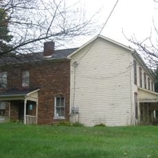
The visitor center offers educational programs where people learn about the forest's recovery from past mining and its current ecosystem. Families often use the trails and camping areas as a place to spend time together in nature away from daily routines.

Practical

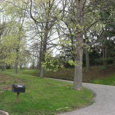
The campground offers family sites with basic amenities like picnic tables and fire pits for overnight stays in the woods. Multiple trails of different difficulty levels let visitors choose routes that match their fitness level and available time.

Did you know?

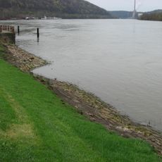
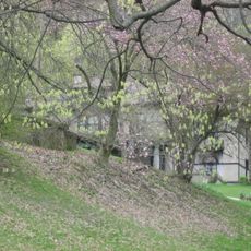
The forest sits on limestone bedrock that naturally neutralizes acidic water left behind from past coal mining activities in the region. This natural chemical process has allowed wildlife and plants to thrive despite the land's industrial history.

Location
GPS coordinates
40.32300,-80.71000
Latest update
December 14, 2025 16:40

AroundUs brings together thousands of curated places, local tips, and hidden gems, enriched daily by 60,000 contributors worldwide. Discover all places nearby (Jefferson County).

Around this place
Steubenville
United States of America

Steubenville

8.2 km
Veterans Memorial Bridge
United States of America

Veterans Memorial Bridge

10.4 km
Fort Steuben
United States of America

Fort Steuben

9.1 km
Fort Steuben Bridge
United States of America

Fort Steuben Bridge

10.4 km
Market Street Bridge
United States of America

Market Street Bridge

9.5 km
Holy Name Cathedral
United States of America

Holy Name Cathedral

8.5 km
Vancroft
United States of America

Vancroft

9.7 km
Marland Heights Park and Margaret Manson Weir Memorial Pool
United States of America

Marland Heights Park and Margaret Manson Weir Memorial Pool

13 km
Jefferson County Courthouse
United States of America

Jefferson County Courthouse

9.1 km
Wabash Bridge
United States of America

Wabash Bridge

9.3 km
People's Bank
United States of America

People's Bank

13.8 km
Schiappa Branch Library
United States of America

Schiappa Branch Library

6.1 km
Dr. George Rigas House
United States of America

Dr. George Rigas House

13.6 km
Federal Land Office
United States of America

Federal Land Office

9 km
Nicholls House and Woolen Mill Site
United States of America

Nicholls House and Woolen Mill Site

11.8 km
Elmhurst
United States of America

Elmhurst

10.1 km
Lucy Tarr Mansion
United States of America

Lucy Tarr Mansion

10.1 km
Gen. I.H. Duval Mansion
United States of America

Gen. I.H. Duval Mansion

10.3 km
Wellsburg Historic District
United States of America

Wellsburg Historic District

9.7 km
Beallmore
United States of America

Beallmore

10.1 km
Wellsburg Wharf
United States of America

Wellsburg Wharf

10.1 km
David and Lucy Tarr Fleming Mansion
United States of America

David and Lucy Tarr Fleming Mansion

10 km
Danforth Brown House
United States of America

Danforth Brown House

11.9 km
Harry and Louisiana Beall Paull Mansion
United States of America

Harry and Louisiana Beall Paull Mansion

10.3 km
John C. Reeves House
United States of America

John C. Reeves House

12.7 km
Kirker House
United States of America

Kirker House

10.1 km
Steubenville Railroad Bridge
United States of America

Steubenville Railroad Bridge

10.4 km
Federal Land Office
United States of America

Federal Land Office

9.1 km
Show the full map
« Fernwood State Forest - State forest in Jefferson County, Ohio, US » is provided by Around Us (aroundus.com). Images and texts are derived from Wikimedia project under a Creative Commons license. You are allowed to copy, distribute, and modify copies of this page, under the conditions set by the license, as long as this note is clearly visible.

Discover hidden gems everywhere you go!

From secret cafés to breathtaking viewpoints, skip the crowded tourist spots and find places that match your style. Our app makes it easy with voice search, smart filtering, route optimization, and insider tips from travelers worldwide. Download now for the complete mobile experience.

Around Us App Screenshot

A unique approach to discovering new places

Le Figaro

All the places worth exploring

France Info

A tailor-made excursion in just a few clicks

20 Minutes

Around Us
Travel Guide & Maps
Download

Send to your phone

QR Code
1

Open the camera app on your mobile.

2

Point at the QR code with your camera. A notification will appear.

3

Tap the notification to open the link.