Enable Location

We need your location to show you interesting places around you

Discover nearby places

Find interesting locations and hidden gems around you

Precise directions

Get accurate directions and distances to places

Your location is never shared with other users. It's only used when you tap the location button.

Puerto Ordaz

Log in to your account

Start exploring — it's free

Trusted by 63,140 travelers worldwide

Continue with Google
Continue with Apple
or

We will send you a code to connect

By continuing, you accept our Terms and Conditions and our Privacy Policy

Check your inbox

We've sent a pincode in your inbox. Please enter the code below.

Puerto Ordaz
Discussion Reviews 4 Photos
58k Popularity

Puerto Ordaz, Administrative division in Bolívar State, Venezuela

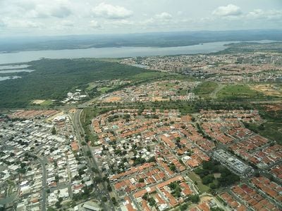
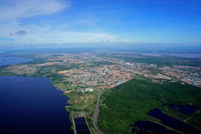
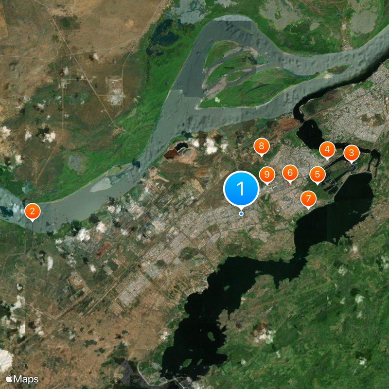
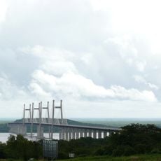
Puerto Ordaz forms the western half of Ciudad Guayana, where the Caroní River meets the Orinoco. The built-up area stretches along the river's south shore with industrial, commercial and residential zones separated by wide roads.

Mining and steel companies founded the town in 1952 to house workers for ore processing and steel production. The planning followed North American models because US corporations participated in its development.

The name honors Diego de Ordaz, a Spanish explorer who sailed the Orinoco in the 16th century. Streets follow a grid pattern with wide boulevards and green spaces between residential neighborhoods that still shape the urban layout today.

The center sits near the bridge over the Caroní that links both parts of Ciudad Guayana. Buses and taxis run between neighborhoods, and an airport is located on the eastern side of the agglomeration.

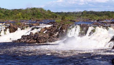
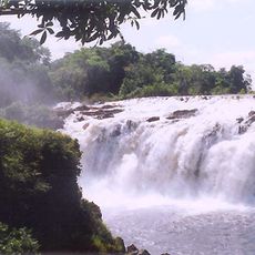
Two waterfalls, Cachamay and Llovizna, sit at the edge of the urban area where the Caroní flows through rock gorges. These natural sites lie a short distance from the center and contrast with the industrial plants nearby.

The community of curious travelers

AroundUs brings together thousands of curated places, local tips, and hidden gems, enriched daily by 60,000 contributors worldwide.

Start exploring
Location
Inception
January 1, 1952
Elevation above the sea
13 m
Part of
Ciudad Guayana
GPS coordinates
8.27504,-62.75583
Latest update
December 13, 2025 19:39
Reviews
Share your experience

No review yet

Discussions
Start a discussion...

No discussion yet

« Puerto Ordaz - Administrative division in Bolívar State, Venezuela » is provided by Around Us (aroundus.com). Images and texts are derived from Wikimedia project under a Creative Commons license. You are allowed to copy, distribute, and modify copies of this page, under the conditions set by the license, as long as this note is clearly visible.

Discover hidden gems everywhere you go!

From secret cafés to breathtaking viewpoints, skip the crowded tourist spots and find places that match your style. Our app makes it easy with voice search, smart filtering, route optimization, and insider tips from travelers worldwide. Download now for the complete mobile experience.

Around Us App Screenshot

A unique approach to discovering new places

Le Figaro

All the places worth exploring

France Info

A tailor-made excursion in just a few clicks

20 Minutes

Around Us
Travel Guide & Maps
Download

Send to your phone

QR Code
1

Open the camera app on your mobile.

2

Point at the QR code with your camera. A notification will appear.

3

Tap the notification to open the link.