Paco, Administrative district in central Manila, Philippines
Paco is an administrative district in central Manila that covers an area of 2.79 square kilometers. Residential neighborhoods and commercial zones are crossed by two waterways: the Estero de Paco and the Estero de Concordia.
Spanish Franciscan missionaries founded this settlement in 1580 and called it Dilao, a name taken from the Tagalog word for yellow because of the Amaryllis flowers that grew here. The area later became known as Paco as the community grew and developed.
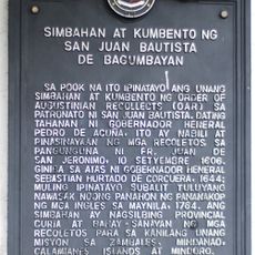
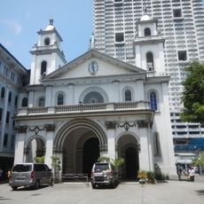
The San Fernando de Dilao Church, Sikh Temple, and Hindu Temple on Looban Street show the religious diversity found here. These different places of worship sit close together and shape how the neighborhood feels in daily life.
The Philippine National Railways station and multiple jeepney routes connect this district to other parts of Manila. Walking through the area, expect crowded streets during peak hours, especially in commercial zones.
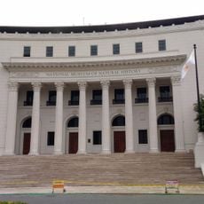
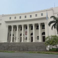
Paco Park was once a circular cemetery that held the remains of José Rizal before they were moved to Luneta Park. Today, this unusual round-shaped site still stands as a quiet reminder of that historical moment.
Location: Manila
GPS coordinates: 14.58300,120.98300
Latest update: December 7, 2025 10:05
Supreme Court of the Philippines
415 m
Old Legislative Building
475 m
National Museum of the Philippines
476 m
Department of Justice of the Philippines
416 m
National Museum of Natural History
93 m
National Museum of Anthropology
345 m
Torre de Manila
229 m
Apolinario Mabini historical marker
405 m
Manuel Araullo y Gonzales historical marker
186 m
Araullo High School historical marker
194 m
Church and Convent of Saint John the Baptist of Bagumbayan historical marker
464 m
Philippine Normal University historical marker
413 m
Plaza Olivia Salamanca historical marker
98 m
Rafael Palma historical marker
433 m
Thirteen Martyrs of Bagumbayan historical marker
413 m
The National Library historical marker
416 m
National Archives historical marker
475 m
League of Women Voters of the Philippines, Inc. historical marker
491 m
Casino Español de Manila historical marker
245 m
Manila Science High School historical marker
413 m
Adamson University historical marker
415 m
Central United Methodist Church historical marker
48 m
Luis Eligio Guerrero historical marker
472 m
San Vicente de Paul Church
370 m
Headquarters of the Manila Police Force historical marker
375 m
Philippine Normal College historical marker
415 m
Santa Isabel College historical marker
257 m
Church of San Vicente de Paul historical marker
391 mVisited this place? Tap the stars to rate it and share your experience / photos with the community! Try now! You can cancel it anytime.
Discover hidden gems everywhere you go!
From secret cafés to breathtaking viewpoints, skip the crowded tourist spots and find places that match your style. Our app makes it easy with voice search, smart filtering, route optimization, and insider tips from travelers worldwide. Download now for the complete mobile experience.
A unique approach to discovering new places❞
— Le Figaro
All the places worth exploring❞
— France Info
A tailor-made excursion in just a few clicks❞
— 20 Minutes