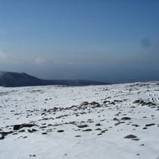
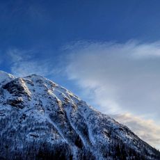
Kukisvumchorr, Mountain summit in Murmansk region, Russia.
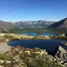
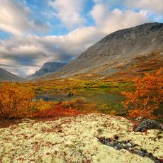
Koukisvoumtchorr is a mountain summit rising 1,158 meters above sea level on the Kola Peninsula, with rocky outcrops and alpine vegetation covering its slopes. The peak sits in an area marked by harsh conditions and typical mountain landscape features with varied rock formations.
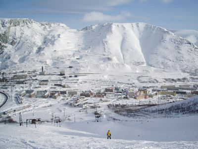
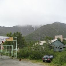
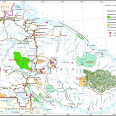
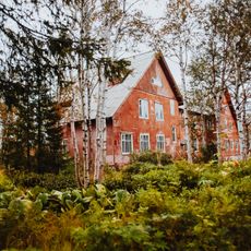
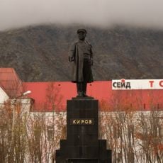
During the Soviet era, the area around this mountain was a major mining center with numerous mineral extraction operations. This industrial activity shaped the region for decades and left marks on both the landscape and settlement patterns.
The peak carries a name from the Saami language, showing the deep bond between indigenous peoples and the northern landscapes of the Kola Peninsula. When you walk through the area, you feel this historical connection between the people who have lived here for centuries and the land around them.
To reach the summit, travel by local roads from Kirovsk, with summer months from June to September offering the best hiking conditions. During this period, the paths are more accessible and weather remains more stable for a safer climb.
From the summit, you can see reindeer herds moving across the tundra, following migration patterns unchanged for centuries. These ancient routes remain active today and may be spotted while hiking.
GPS coordinates: 67.72797,33.66644
Latest update: December 10, 2025 16:20
Khibiny Mountains
2.5 km
N.A. Avrorin Polar-Alpine Botanic Garden-Institute
8.5 km
Khibiny National Park
8.1 km
Aikouayventchorr
14.2 km
Mount Alluaiv
38.7 km
Khibinogorsky Monastery
10.3 km
ΠΠ°ΠΌΡΡΠ½ΠΈΠΊ ΠΡΡΠΊΠΈΠ½Ρ
21.8 km
Π₯ΡΠ°ΠΌ ΠΠΎΠ²ΠΎΠΌΡΡΠ΅Π½ΠΈΠΊΠΎΠ² ΠΈ ΠΡΠΏΠΎΠ²Π΅Π΄Π½ΠΈΠΊΠΎΠ² Π ΠΎΡΡΠΈΠΉΡΠΊΠΈΡ
21.2 km
Π‘ΠΈΠΌΠ±ΠΎΠ·Π΅ΡΡΠΊΠΈΠΉ Π·Π°ΠΊΠ°Π·Π½ΠΈΠΊ
24.7 km
ΠΡΠ·Π΅ΠΉ Π³Π΅ΠΎΠ»ΠΎΠ³ΠΈΠΈ ΠΈ ΠΌΠΈΠ½Π΅ΡΠ°Π»ΠΎΠ³ΠΈΠΈ ΠΈΠΌΠ΅Π½ΠΈ Π. Π. ΠΠ΅Π»ΡΠΊΠΎΠ²Π°
20.9 km
Yuksporrlak
10.6 km
Apatity Lenin Monument
20.9 km
ΠΠ°ΠΌΡΡΠ½ΠΈΠΊ Π€Π΅ΡΡΠΌΠ°Π½Ρ
21.2 km
Π¦Π΅ΡΠΊΠΎΠ²Ρ Π£ΡΠΏΠ΅Π½ΠΈΡ ΠΡΠ΅ΡΠ²ΡΡΠΎΠΉ ΠΠΎΠ³ΠΎΡΠΎΠ΄ΠΈΡΡ
19.3 km
ΠΠΈΠ»ΠΎΠ΅ Π·Π΄Π°Π½ΠΈΠ΅ (ΠΠΎΠ½ΡΠ΅Π³ΠΎΡΡΠΊ)
39.5 km
ΠΠ΄Π°Π½ΠΈΠ΅ ΡΠ΅ΡΡΠΎΡΠ°Π½Π° Β«Π‘Π΅Π²Π΅ΡΒ»
39.8 km
ΠΠ΄Π°Π½ΠΈΠ΅ ΠΏΠΎΡΡΡ
39 km
ΠΠΈΠ»ΠΎΠ΅ Π·Π΄Π°Π½ΠΈΠ΅ Ρ Π±ΠΈΠ±Π»ΠΈΠΎΡΠ΅ΠΊΠΎΠΉ (ΠΠΎΠ½ΡΠ΅Π³ΠΎΡΡΠΊ)
39.1 km
ΠΠΎΠΌ ΡΠ΅Ρ Π½ΠΈΠΊΠΈ
39.2 km
ΠΠΎΠΌ, Π² ΠΊΠΎΡΠΎΡΠΎΠΌ Π² 1933-1935 Π³Π³. ΠΆΠΈΠ» ΠΈΠ½ΠΆΠ΅Π½Π΅Ρ-Π³Π΅ΠΎΠ»ΠΎΠ³, ΠΈΡΡΠ»Π΅Π΄ΠΎΠ²Π°ΡΠ΅Π»Ρ Π₯ΠΈΠ±ΠΈΠ½ ΠΡΠΈΠ³ΠΎΡΠΈΠΉ Π‘ΡΠ΅ΠΏΠ°Π½ΠΎΠ²ΠΈΡ ΠΡΠΎΠ½ΡΠ΅Π½ΠΊΠΎ
12.7 km
Π‘ΡΠ°ΡΡΠΉ ΠΊΠΎΡΠΏΡΡ ΡΠΊΠΎΠ»Ρ β 3 (ΠΠΎΠ½ΡΠ΅Π³ΠΎΡΡΠΊ)
38.2 km
ΠΠ΄Π°Π½ΠΈΠ΅ ΠΏΠ΅ΡΠ²ΠΎΠ³ΠΎ Π₯ΠΈΠ±ΠΈΠ½ΠΎΠ³ΠΎΡΡΠΊΠΎΠ³ΠΎ ΠΊΠΈΠ½ΠΎΡΠ΅Π°ΡΡΠ° Β«ΠΠΎΠ»ΡΡΠ΅Π²ΠΈΠΊΒ», ΠΏΠΎΡΡΡΠΎΠ΅Π½Π½ΠΎΠ³ΠΎ Π² 1933 Π³.
12.6 km
ΠΠ΄Π°Π½ΠΈΠ΅ ΠΎΠ±ΡΠ΅ΠΆΠΈΡΠΈΡ ΠΠΎΠ½ΡΠ΅Π³ΠΎΡΡΠΊΠΎΠ³ΠΎ ΠΏΠΎΠ»ΠΈΡΠ΅Ρ Π½ΠΈΡΠ΅ΡΠΊΠΎΠ³ΠΎ ΠΊΠΎΠ»Π»Π΅Π΄ΠΆΠ° (ΠΠΎΠ½ΡΠ΅Π³ΠΎΡΡΠΊ)
39.3 km
ΠΠ΄Π°Π½ΠΈΠ΅, Π² ΠΊΠΎΡΠΎΡΠΎΠΌ Π² 1930 Π³ΠΎΠ΄Ρ Π²ΡΡΡΡΠΏΠ°Π»ΠΈ Ρ Π΄ΠΎΠΊΠ»Π°Π΄Π°ΠΌΠΈ Π‘. Π. ΠΠΈΡΠΎΠ² ΠΈ Π. Π. Π€Π΅ΡΡΠΌΠ°Π½
8.1 km
ΠΠΎΡΠ°Π½ΠΈΡΠ΅ΡΠΊΠΈΠΉ ΡΠ°Π΄
8.7 km
ΠΠ»Π°Π²Π½ΡΠΉ Π»Π°Π±ΠΎΡΠ°ΡΠΎΡΠ½ΡΠΉ ΠΊΠΎΡΠΏΡΡ
8.5 km
ΠΠ°ΠΌΡΡΠ½ΠΈΠΊ Π‘. Π. ΠΠΈΡΠΎΠ²Ρ
12.6 km
ΠΠΈΠ»ΠΎΠΉ Π΄ΠΎΠΌ (ΠΠΎΠ½ΡΠ΅Π³ΠΎΡΡΠΊ)
38.9 kmVisited this place? Tap the stars to rate it and share your experience / photos with the community! Try now! You can cancel it anytime.
Discover hidden gems everywhere you go!
From secret cafΓ©s to breathtaking viewpoints, skip the crowded tourist spots and find places that match your style. Our app makes it easy with voice search, smart filtering, route optimization, and insider tips from travelers worldwide. Download now for the complete mobile experience.
A unique approach to discovering new placesβ
β Le Figaro
All the places worth exploringβ
β France Info
A tailor-made excursion in just a few clicksβ
β 20 Minutes