Chest opened
+${chestReward.xp} XP
Explorer
NOUVEAU ×${chestReward.collectible.quantity}
tapez pour fermer
Chest locked

Open chests in the app

Around Us is built for your phone — chests unlock when you walk, explore and capture nearby places.

Enable Location

We need your location to show you interesting places around you

Discover nearby places

Find interesting locations and hidden gems around you

Precise directions

Get accurate directions and distances to places

Your location is never shared with other users. It's only used when you tap the location button.

Log in to your account

Start exploring — it's free

Trusted by 72,881 travelers worldwide

Continue with Google
Continue with Apple
or

We will send you a code to connect

By continuing, you accept our Terms and Conditions and our Privacy Policy

Check your inbox

We've sent a pincode in your inbox. Please enter the code below.

Chivyrkuisky Isthmus
Discussion Reviews Photo
1.8k Popularity

Chivyrkuisky Isthmus, Protected land bridge in Zabaykalsky National Park, Russia

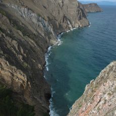
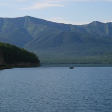
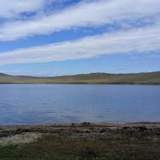
The Chivyrkuisky Isthmus is a land bridge connecting the Svyatoy Nos peninsula to Lake Baikal's eastern shore, featuring sandy beaches, wetlands, and areas with hot springs scattered throughout. The terrain varies in width and creates a diverse landscape shaped by natural geological processes.

Svyatoy Nos was once an island but gradually became connected to the mainland through sediment deposits from the Barguzin River over thousands of years. This natural transformation created the land bridge that exists today.

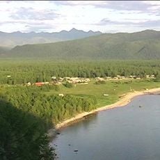
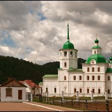
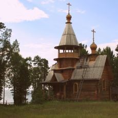
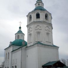
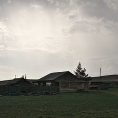
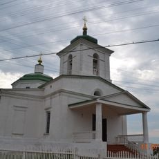
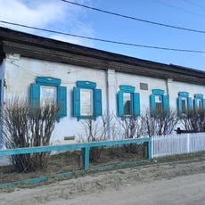
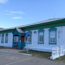
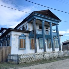
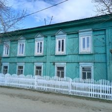
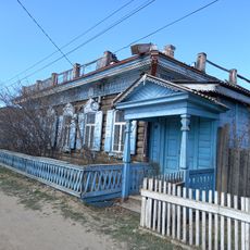
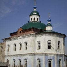
Local communities have long adapted to the unique conditions of Lake Baikal and developed sustainable relationships with its natural resources. This connection to the land remains visible in how people interact with the landscape today.

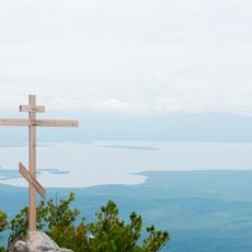
You need a permit from Zabaykalsky National Park to visit this area. The isthmus is best explored on foot or by boat, and summer months offer the easiest access for travel through the region.

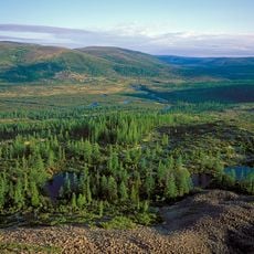
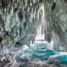
The Kulina marshes contain dozens of mud volcanoes, small openings in the ground where gas and hot water naturally emerge. A nearby village had to be relocated because residents faced hazards from these active geological features.

The community of curious travelers

AroundUs brings together thousands of curated places, local tips, and hidden gems, enriched daily by 60,000 contributors worldwide.

Start exploring
GPS coordinates
53.58800,108.99700
Latest update
December 14, 2025 11:41
Around this place
Lake Baikal
Russian Federation

Lake Baikal

73 km
Barguzin Nature Reserve
Russian Federation

Barguzin Nature Reserve

74.3 km
Baikal-Lena nature reserve
Russian Federation

Baikal-Lena nature reserve

101.4 km
Zabaykalsky
Russian Federation

Zabaykalsky

20.4 km
Russian Federation

Multilayer settlement "Sunny Mys"

162.5 km
At͡sagatskiĭ dat͡san
Russian Federation

At͡sagatskiĭ dat͡san

182.8 km
Aninsky datsan
Russian Federation

Aninsky datsan

156.8 km
Selenginsky Monastery
Russian Federation

Selenginsky Monastery

204.1 km
Egituysky datsan
Russian Federation

Egituysky datsan

172.4 km
Sretensky Convent
Russian Federation

Sretensky Convent

159.2 km
Arangatuy
Russian Federation

Arangatuy

5 km
Hanhoi
Russian Federation

Hanhoi

130.7 km
Ice cave on Olkhon island
Russian Federation

Ice cave on Olkhon island

107.8 km
Svetlaya Polyana
Russian Federation

Svetlaya Polyana

38.6 km
Спасская церковь (Турунтаево)
Russian Federation

Спасская церковь (Турунтаево)

179.6 km
Улан-Нур
Russian Federation

Улан-Нур

171.4 km
Спасо-Преображенская церковь (Баргузин)
Russian Federation

Спасо-Преображенская церковь (Баргузин)

42.7 km
Сретенская церковь
Russian Federation

Сретенская церковь

159.1 km
Nativity of Christ Church
Russian Federation

Nativity of Christ Church

52.5 km
Lesovozny
Russian Federation

Lesovozny

201.9 km
Церковь святителя Николая (Троицкое)
Russian Federation

Церковь святителя Николая (Троицкое)

204.1 km
Дом Бутлицкого (Баргузин)
Russian Federation

Дом Бутлицкого (Баргузин)

42.4 km
Торговое здание купца Лозовского (Баргузин)
Russian Federation

Торговое здание купца Лозовского (Баргузин)

42.6 km
Здание банка (Баргузин)
Russian Federation

Здание банка (Баргузин)

42.4 km
Дом, в котором жил в ссылке большевик К. Грабовский (Баргузин)
Russian Federation

Дом, в котором жил в ссылке большевик К. Грабовский (Баргузин)

42.4 km
Дом Сиротина (Баргузин)
Russian Federation

Дом Сиротина (Баргузин)

42.3 km
Церковь Богоявления (Ильинка)
Russian Federation

Церковь Богоявления (Ильинка)

199.5 km
Cape Burkhan
Russian Federation

Cape Burkhan

118.1 km
Show the full map
Reviews
Share your experience

No review yet

Discussions
Start a discussion...

No discussion yet

« Chivyrkuisky Isthmus - Protected land bridge in Zabaykalsky National Park, Russia » is provided by Around Us (aroundus.com). Images and texts are derived from Wikimedia project under a Creative Commons license. You are allowed to copy, distribute, and modify copies of this page, under the conditions set by the license, as long as this note is clearly visible.

Discover hidden gems everywhere you go!

From secret cafés to breathtaking viewpoints, skip the crowded tourist spots and find places that match your style. Our app makes it easy with voice search, smart filtering, route optimization, and insider tips from travelers worldwide. Download now for the complete mobile experience.

Around Us App Screenshot

A unique approach to discovering new places

Le Figaro

All the places worth exploring

France Info

A tailor-made excursion in just a few clicks

20 Minutes

Around Us
Travel Guide & Maps
Download

Send to your phone

QR Code
1

Open the camera app on your mobile.

2

Point at the QR code with your camera. A notification will appear.

3

Tap the notification to open the link.