Vitberget, mountain in Sweden
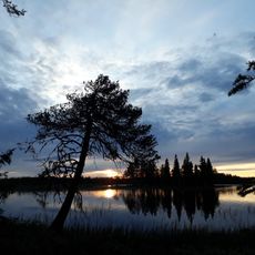
Vitberget is a mountain in Norrbotten and reaches 594 meters, making it the highest point in the region. The terrain features six peaks with valleys between them, surrounded by forests of spruce, birch, and pine trees, along with bogs and streams.
The nature reserve was established in 1997 and expanded in 2009. A fire watch tower once stood on the highest peak, and though the structure is gone, its foundation remains as evidence of the mountain's past role in protecting the forest and community.
The mountain holds significance for the local Sámi people, who have traditionally used the land for reindeer herding and forest gathering. Today, it serves as a place where visitors can observe how the landscape and its resources connect to the life and heritage of the region.
The trail to the summit starts from a small parking area on the west side and runs about two kilometers, with weak trail markings that require careful attention. Weather conditions on the exposed peak can change quickly, so visitors should prepare accordingly.
A rare lichen called långskägg grows on old spruce trees in long strands and is found in only a few places in the region. Its presence indicates that parts of the forest are very old and support special ecosystems with important plants and animals.
The community of curious travelers
AroundUs brings together thousands of curated places, local tips, and hidden gems, enriched daily by 60,000 contributors worldwide.