Enable Location

We need your location to show you interesting places around you

Discover nearby places

Find interesting locations and hidden gems around you

Precise directions

Get accurate directions and distances to places

Your location is never shared with other users. It's only used when you tap the location button.

Bartková

Log in to your account

Start exploring — it's free

Trusted by 62,119 travelers worldwide

Continue with Google
Continue with Apple
or

We will send you a code to connect

By continuing, you accept our Terms and Conditions and our Privacy Policy

Check your inbox

We've sent a pincode in your inbox. Please enter the code below.

Bartková

Bartková, Mountain summit in Low Tatras, Slovakia.

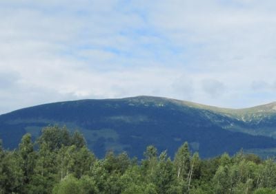
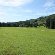
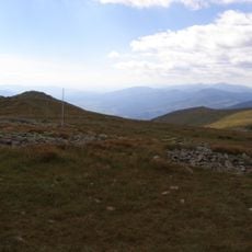
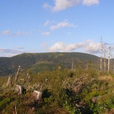
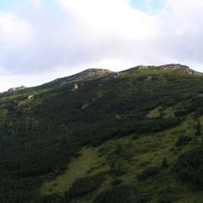
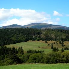
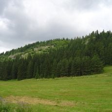
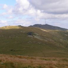
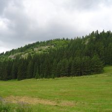
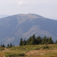
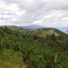
Bartková is a mountain summit in the Low Tatras that forms part of the main ridge of the Kráľovohoľské Tatry range, positioned between the peaks of Andrejcová and Orlová. The summit reaches 1,790 meters and features grassy slopes that offer open views across the surrounding terrain.

The mountain lies along the Cesta hrdinov SNP route, a symbolic path connected to Slovakia's liberation movement during World War II. Its position along this historic trail links it to the nation's wartime resistance efforts.

Local shepherds maintain traditional grazing practices on the grassy slopes of Bartková, preserving centuries-old agricultural methods of the region.

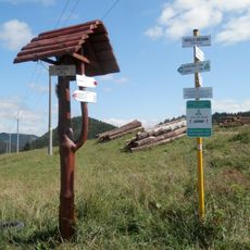
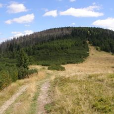
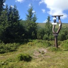
Marked hiking trails approach the summit from several directions, with the main red route ascending from Priehybka saddle and Ždiarske sedlo. The hike demands moderate fitness and suits visitors with basic mountain walking experience.

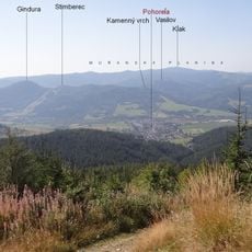
The mountain serves as a watershed dividing water flow into two river systems: northern slopes feed the Ždiarsky stream flowing into the Čierny Váh, while southern waters contribute to the Hron river through Kopanický stream. This division marks the boundary between two distinct hydrographic basins.

The community of curious travelers

AroundUs brings together thousands of curated places, local tips, and hidden gems, enriched daily by 60,000 contributors worldwide.

Start exploring
GPS coordinates
48.89205,20.07428
Latest update
December 14, 2025 20:01
« Bartková - Mountain summit in Low Tatras, Slovakia » is provided by Around Us (aroundus.com). Images and texts are derived from Wikimedia project under a Creative Commons license. You are allowed to copy, distribute, and modify copies of this page, under the conditions set by the license, as long as this note is clearly visible.

Discover hidden gems everywhere you go!

From secret cafés to breathtaking viewpoints, skip the crowded tourist spots and find places that match your style. Our app makes it easy with voice search, smart filtering, route optimization, and insider tips from travelers worldwide. Download now for the complete mobile experience.

Around Us App Screenshot

A unique approach to discovering new places

Le Figaro

All the places worth exploring

France Info

A tailor-made excursion in just a few clicks

20 Minutes

Around Us
Travel Guide & Maps
Download

Send to your phone

QR Code
1

Open the camera app on your mobile.

2

Point at the QR code with your camera. A notification will appear.

3

Tap the notification to open the link.