Chest opened
+${chestReward.xp} XP
Explorer
NOUVEAU ×${chestReward.collectible.quantity}
tapez pour fermer
Chest locked

Open chests in the app

Around Us is built for your phone — chests unlock when you walk, explore and capture nearby places.

Enable Location

We need your location to show you interesting places around you

Discover nearby places

Find interesting locations and hidden gems around you

Precise directions

Get accurate directions and distances to places

Your location is never shared with other users. It's only used when you tap the location button.

Nan River

Log in to your account

Start exploring — it's free

Trusted by 72,876 travelers worldwide

Continue with Google
Continue with Apple
or

We will send you a code to connect

By continuing, you accept our Terms and Conditions and our Privacy Policy

Check your inbox

We've sent a pincode in your inbox. Please enter the code below.

Nan River
Discussion Reviews 1 Photos
17.9k Popularity

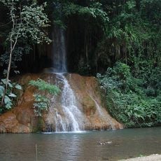
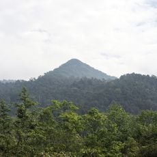
Nan River, Major river system in northern Thailand

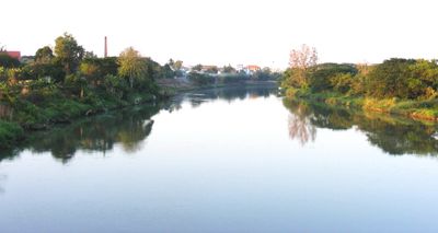
The Nan River is a major waterway in northern Thailand that flows 740 kilometers from the Luang Prabang Range through several provinces before joining the Ping River at Pak Nam Pho. The water moves through agricultural zones and shaped valleys with visible banks that vary in width and vegetation.

Archaeological finds near Phitsanulok show that early people settled along the river during the Stone Age, making it one of the region's oldest inhabited zones. These discoveries reveal how the waterway has long been essential for human settlement.

Families in Phitsanulok continue to live in floating houses along the waterway, a way of life that shapes how communities gather and work together daily. The river remains central to how residents organize their homes and livelihoods.

Water from the river irrigates farmland throughout the region, supplying rice paddies and farming communities with the moisture they need to grow crops. Travelers passing through will see irrigation channels and green fields that show how farming depends on this waterway.

The Naresuan Dam, built between 1976 and 1985, controls water flow and protects communities downstream from flooding. This structure changed how the region manages water, allowing better balance across seasons.

The community of curious travelers

AroundUs brings together thousands of curated places, local tips, and hidden gems, enriched daily by 60,000 contributors worldwide.

Start exploring
Location
Part of
Chao Phraya basin
GPS coordinates
19.38560,101.10170
Latest update
December 7, 2025 19:23
Reviews
Share your experience

No review yet

Discussions
Start a discussion...

No discussion yet

« Nan River - Major river system in northern Thailand » is provided by Around Us (aroundus.com). Images and texts are derived from Wikimedia project under a Creative Commons license. You are allowed to copy, distribute, and modify copies of this page, under the conditions set by the license, as long as this note is clearly visible.

Discover hidden gems everywhere you go!

From secret cafés to breathtaking viewpoints, skip the crowded tourist spots and find places that match your style. Our app makes it easy with voice search, smart filtering, route optimization, and insider tips from travelers worldwide. Download now for the complete mobile experience.

Around Us App Screenshot

A unique approach to discovering new places

Le Figaro

All the places worth exploring

France Info

A tailor-made excursion in just a few clicks

20 Minutes

Around Us
Travel Guide & Maps
Download

Send to your phone

QR Code
1

Open the camera app on your mobile.

2

Point at the QR code with your camera. A notification will appear.

3

Tap the notification to open the link.