Dunstanburgh Castle
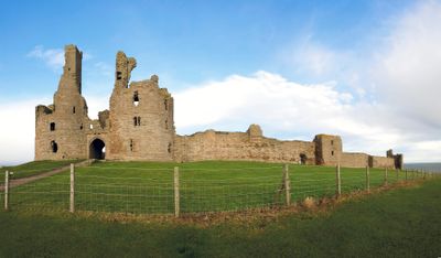
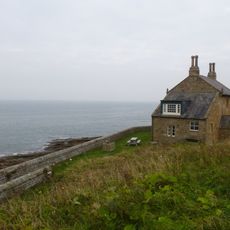
Dunstanburgh Castle, Medieval castle ruins in Craster, England
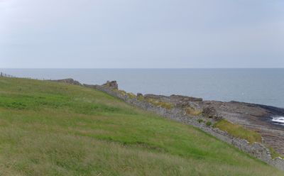
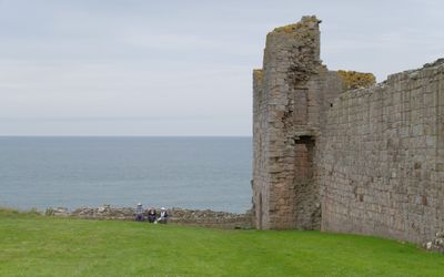
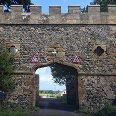
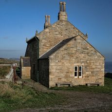
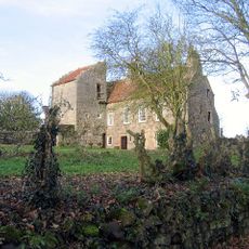
Dunstanburgh Castle is a medieval fortress in ruins along the Northumberland coast, featuring a distinctive twin-towered gatehouse and substantial stone walls that define its perimeter. The remains cover a large area and show how castles were built to control and defend a strategic coastal position.
The fortress was founded in 1313 by Thomas of Lancaster as a political statement against King Edward II, and later saw fierce fighting during the Wars of the Roses. These conflicts marked the building and left visible traces that remain in the ruins today.
Locals and visitors see the fortress as a symbol of medieval power and resilience along this stretch of coast. Walking through the remaining walls, people connect with the stories of those who lived and defended this place centuries ago.
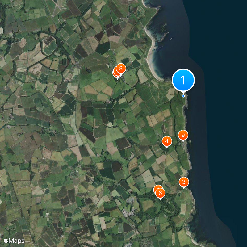
To reach the fortress, a coastal walk of about 1.3 miles (2 km) from Craster village is required, with parking available there. Sturdy footwear and weatherproof clothing are advisable, as the exposed coastal path can be windy and the ground uneven.
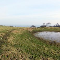
An Iron Age fortification once occupied this site, and its foundations were later incorporated into the castle's design. This demonstrates how different periods recognized the strategic value of this coastal location.
Location: Craster
Inception: 1313
Website: https://english-heritage.org.uk/visit/places/dunstanburgh-castle
GPS coordinates: 55.48850,-1.59351
Latest update: December 20, 2025 01:22
Howick Hall
4.3 km
Howick house
3.8 km
Craster Tower
2.2 km
Embleton Tower
2.8 km
Church of St Michael and All Angels
4.4 km
Church of the Holy Trinity, Embleton
2.8 km
Embleton United Reformed Church
2.8 km
St Peter the Fisherman
1.9 km
Ship Inn
3.3 km
Saint Mary the Virgin
3.7 km
Village Pump
2.8 km
The Bathing House
4.2 km
Signpost At Road Junction South Of Rock Farm
5.6 km
Outbuilding South West Of The Bathing House
4.2 km
Defended settlement, 600m south east of Red Stead
5.4 km
Watch House Enclosure Wall With Attached Outbuildings
3.6 km
Former Goods Shed On East Of Railway Immediately North Of B 1340
4.7 km
Nos 1 And 2 And Garage Adjacent To Ship Inn
3.3 km
Milepost 100 Metres South Of Newtonbarns
4.6 km
Gateway Spanning Road To North Of Craster Tower
2.2 km
Mile Post 700 Metres North Of Prickly Bridge
4.3 km
Wall And Steps To East Of The Bathing House
4.2 km
Stableyard Buildings At East End Of Howick Hall
4.3 km
Road Bridge And Footbridge 320 Metres South East Of Howick Hall
4.5 km
Howick Hall Centre Block And Link Galleries
4.3 km
Dunstan Hall
1.9 km
Howick Hall West Wing
4.3 km
Dovecote at rear of Number 4
2.5 kmVisited this place? Tap the stars to rate it and share your experience / photos with the community! Try now! You can cancel it anytime.
Discover hidden gems everywhere you go!
From secret cafés to breathtaking viewpoints, skip the crowded tourist spots and find places that match your style. Our app makes it easy with voice search, smart filtering, route optimization, and insider tips from travelers worldwide. Download now for the complete mobile experience.
A unique approach to discovering new places❞
— Le Figaro
All the places worth exploring❞
— France Info
A tailor-made excursion in just a few clicks❞
— 20 Minutes