Chest opened
+${chestReward.xp} XP
Explorer
NOUVEAU ×${chestReward.collectible.quantity}
tapez pour fermer
Chest locked

Open chests in the app

Around Us is built for your phone — chests unlock when you walk, explore and capture nearby places.

Enable Location

We need your location to show you interesting places around you

Discover nearby places

Find interesting locations and hidden gems around you

Precise directions

Get accurate directions and distances to places

Your location is never shared with other users. It's only used when you tap the location button.

Kankakee River

Log in to your account

Start exploring — it's free

Trusted by 72,891 travelers worldwide

Continue with Google
Continue with Apple
or

We will send you a code to connect

By continuing, you accept our Terms and Conditions and our Privacy Policy

Check your inbox

We've sent a pincode in your inbox. Please enter the code below.

Kankakee River
Discussion Reviews 1 Photos
19k Popularity

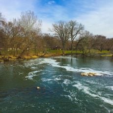
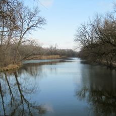
Kankakee River, River system in northeastern Illinois, United States

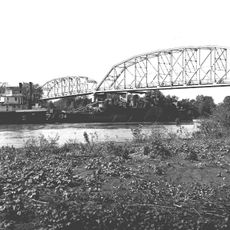
The Kankakee River is a river system in northeastern Illinois that flows about 135 miles from South Bend, Indiana, to its mouth at the Des Plaines River. Together with the Des Plaines, it forms the Illinois River, a major waterway in the region.

French explorer Robert Cavelier traveled the river in 1679, establishing a key water passage between the Great Lakes and the Mississippi River systems. This route became essential for early European trade and exploration in North America.

Indigenous peoples lived and traded along the river for centuries before European arrival. The river remains part of the regional identity and continues to draw people seeking connection with the landscape.

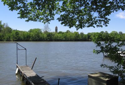
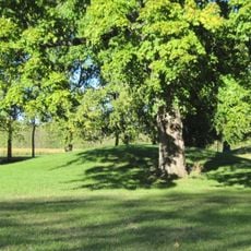
The river has several access points through Kankakee River State Park for canoeing, fishing, and hiking. Plan your visit based on the season and water conditions, as these can affect outdoor activities.

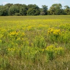
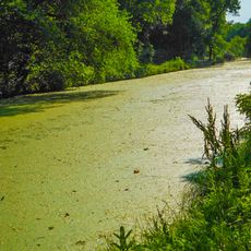
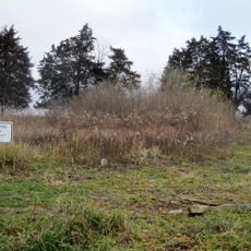
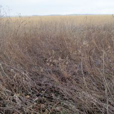
Before early 20th-century drainage projects, this area was the Grand Kankakee Marsh, one of North America's largest wetland systems. Today, wet meadows and nature preserves along the river echo what once existed across the landscape.

The community of curious travelers

AroundUs brings together thousands of curated places, local tips, and hidden gems, enriched daily by 60,000 contributors worldwide.

Start exploring
Location
GPS coordinates
41.39040,-88.26030
Latest update
December 7, 2025 10:08
Around this place
Midewin National Tallgrass Prairie
United States of America

Midewin National Tallgrass Prairie

12.5 km
Abraham Lincoln National Cemetery
United States of America

Abraham Lincoln National Cemetery

11.2 km
Gemini Giant
United States of America

Gemini Giant

13.5 km
United States of America

Kankakee Torrent

5.3 km
United States of America

Goose Lake Prairie State Natural Area

4 km
Des Plaines State Fish and Wildlife Area
United States of America

Des Plaines State Fish and Wildlife Area

4.2 km
Channahon State Park
United States of America

Channahon State Park

4.7 km
Gebhard Woods State Park
United States of America

Gebhard Woods State Park

15.1 km
Eagle Hotel
United States of America

Eagle Hotel

13.2 km
Briscoe Mounds
United States of America

Briscoe Mounds

4.7 km
Coleman Hardware Company Building
United States of America

Coleman Hardware Company Building

14.6 km
Dresden Island Lock and Dam Historic District
United States of America

Dresden Island Lock and Dam Historic District

2 km
Morris Bridge
United States of America

Morris Bridge

14.1 km
White and Company's Goose Lake Tile Works
United States of America

White and Company's Goose Lake Tile Works

6.9 km
Morris Wide Water Canal Boat Site
United States of America

Morris Wide Water Canal Boat Site

12.2 km
Small–Towle House
United States of America

Small–Towle House

13.3 km
White and Company's Goose Lake Stoneware Manufactury
United States of America

White and Company's Goose Lake Stoneware Manufactury

7 km
Mural, Work of art
United States of America

Mural, Work of art

7.3 km
United States of America

Elvis

14.6 km
United States of America

Gemini Giant

13.5 km
United States of America

Dollinger Family Farm

2.5 km
United States of America

Braidwood Zoo Animal Sculptures

14.6 km
United States of America

Statue, Work of art

11.9 km
United States of America

CSX Morris Depot

13.9 km
United States of America

Shelter, overlook

1.8 km
United States of America

Scenic viewpoint

8.5 km
United States of America

Scenic viewpoint

1.8 km
United States of America

Scenic viewpoint

11.9 km
Show the full map
Reviews
Share your experience

No review yet

Discussions
Start a discussion...

No discussion yet

« Kankakee River - River system in northeastern Illinois, United States » is provided by Around Us (aroundus.com). Images and texts are derived from Wikimedia project under a Creative Commons license. You are allowed to copy, distribute, and modify copies of this page, under the conditions set by the license, as long as this note is clearly visible.

Discover hidden gems everywhere you go!

From secret cafés to breathtaking viewpoints, skip the crowded tourist spots and find places that match your style. Our app makes it easy with voice search, smart filtering, route optimization, and insider tips from travelers worldwide. Download now for the complete mobile experience.

Around Us App Screenshot

A unique approach to discovering new places

Le Figaro

All the places worth exploring

France Info

A tailor-made excursion in just a few clicks

20 Minutes

Around Us
Travel Guide & Maps
Download

Send to your phone

QR Code
1

Open the camera app on your mobile.

2

Point at the QR code with your camera. A notification will appear.

3

Tap the notification to open the link.