Dresden Island Lock and Dam Historic District

Log in to your account

AroundUs is a community-driven map of interesting places, built by curious explorers like you. It grows with every review, story, and photo you share.
Connect to save your favorite spots, contribute locations, and create personalized routes.
Continue with Google
Continue with Apple
Continue with X
Continue with Facebook
Continue with email
By continuing, you accept our Terms and Conditions and our Privacy Policy
Create an account
Add to collection
Map
Suggest a change
Share

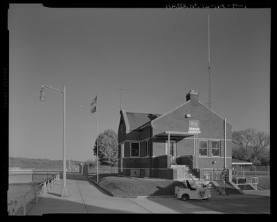
Dresden Island Lock and Dam Historic District, Lock complex on Illinois River in Morris, United States.

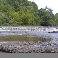
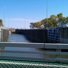
The Dresden Island Lock and Dam Historic District is a lock complex on the Illinois River that moves vessels between different water levels using nine large gates and eighteen smaller gates. The structure spans across the river and includes a concrete gravity dam connected to the historical Illinois and Michigan Canal embankment.

Construction of the lock complex started in 1929 under Illinois state management and was completed in 1933 with federal government support. The project was part of efforts to make the Illinois River navigable for larger vessels and improve transportation connections across the country.

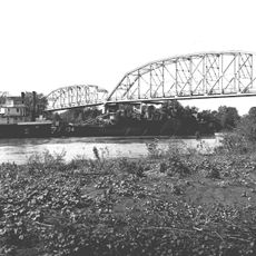
The site reflects the role water transportation once played in connecting communities across the region. You can see how the lock remains a working part of the landscape where people still engage with the Illinois River and its history.

You can walk around the area and watch lock operations from several viewpoints, especially when vessels pass through. Weather conditions like storms or high water levels may affect visibility, so visiting during calm weather is more enjoyable.

Engineer Walter Mickle Smith designed the structure with an arched gravity dam that connects directly to the historic Illinois and Michigan Canal embankment. This direct connection links two waterways from different historical periods at a single location.

Location: Morris

Architects: Walter Mickle Smith

Elevation above the sea: 156 m

GPS coordinates: 41.39980,-88.28132

Latest update: December 14, 2025 18:42

Photos
Around this place
Chicagoland Speedway
United States of America

Chicagoland Speedway

20.5 km
United States of America

Mazon Creek

10.3 km
Abraham Lincoln National Cemetery
United States of America

Abraham Lincoln National Cemetery

13 km
Gemini Giant
United States of America

Gemini Giant

15.5 km
United States of America

Kankakee Torrent

6.3 km
Harrah's Joliet
United States of America

Harrah's Joliet

21.7 km
Rialto Square Theatre
United States of America

Rialto Square Theatre

21.8 km
Cathedral of St. Raymond Nonnatus
United States of America

Cathedral of St. Raymond Nonnatus

21.3 km
Hiram B. Scutt Mansion
United States of America

Hiram B. Scutt Mansion

21.4 km
United States of America

Argosy Empress Casino

14.4 km
United States of America

Goose Lake Prairie State Natural Area

3.8 km
Joliet East Side Historic District
United States of America

Joliet East Side Historic District

21.8 km
Des Plaines State Fish and Wildlife Area
United States of America

Des Plaines State Fish and Wildlife Area

6 km
Channahon State Park
United States of America

Channahon State Park

5.3 km
Gebhard Woods State Park
United States of America

Gebhard Woods State Park

13.7 km
Brandon Road Lock and Dam
United States of America

Brandon Road Lock and Dam

18.8 km
Christ Episcopal Church
United States of America

Christ Episcopal Church

21.6 km
Briscoe Mounds
United States of America

Briscoe Mounds

5.5 km
Joliet YMCA
United States of America

Joliet YMCA

22 km
Upper Bluff Historic District
United States of America

Upper Bluff Historic District

21.1 km
United States Post Office
United States of America

United States Post Office

22 km
Morris Bridge
United States of America

Morris Bridge

12.8 km
Morris Wide Water Canal Boat Site
United States of America

Morris Wide Water Canal Boat Site

10.8 km
White and Company's Goose Lake Tile Works
United States of America

White and Company's Goose Lake Tile Works

6.7 km
Small–Towle House
United States of America

Small–Towle House

15.3 km
White and Company's Goose Lake Stoneware Manufactury
United States of America

White and Company's Goose Lake Stoneware Manufactury

6.8 km
Brandon Road Bridge
United States of America

Brandon Road Bridge

18.7 km
Morris Theater
United States of America

Morris Theater

12.7 km
Show the full map
Reviews

Visited this place? Tap the stars to rate it and share your experience / photos with the community! Try now! You can cancel it anytime.

« Dresden Island Lock and Dam Historic District - Lock complex on Illinois River in Morris, United States » is provided by Around Us (aroundus.com). Images and texts are derived from Wikimedia project under a Creative Commons license. You are allowed to copy, distribute, and modify copies of this page, under the conditions set by the license, as long as this note is clearly visible.

Discover hidden gems everywhere you go!

From secret cafés to breathtaking viewpoints, skip the crowded tourist spots and find places that match your style. Our app makes it easy with voice search, smart filtering, route optimization, and insider tips from travelers worldwide. Download now for the complete mobile experience.

Around Us App Screenshot

A unique approach to discovering new places

Le Figaro

All the places worth exploring

France Info

A tailor-made excursion in just a few clicks

20 Minutes