Enable Location

We need your location to show you interesting places around you

Discover nearby places

Find interesting locations and hidden gems around you

Precise directions

Get accurate directions and distances to places

Your location is never shared with other users. It's only used when you tap the location button.

Union County

Log in to your account

Start exploring — it's free

Trusted by 62,796 travelers worldwide

Continue with Google
Continue with Apple
or

We will send you a code to connect

By continuing, you accept our Terms and Conditions and our Privacy Policy

Check your inbox

We've sent a pincode in your inbox. Please enter the code below.

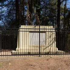
Union County, County in southern Arkansas, United States

Union County is a county in southern Arkansas located along the central southern border of the state, spanning across an extensive area. The region is crossed by major highways and contains a regional airport that connects the area to other parts of the region.

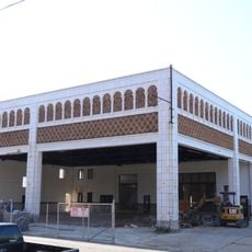
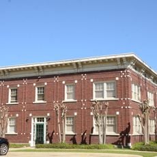
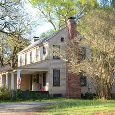
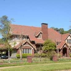
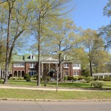
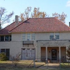
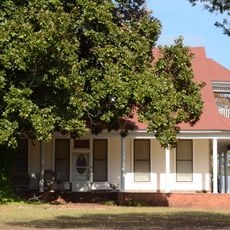
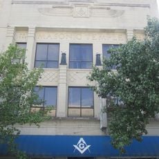
The discovery of oil near El Dorado in 1921 fundamentally changed the region and transformed it into a petroleum production center. Within a few years, many companies emerged that shaped the local economy and brought rapid growth to the area.

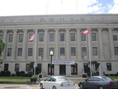
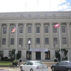
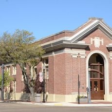
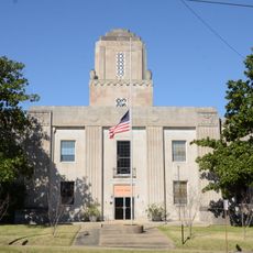
The county courthouse showcases 40 limestone columns in the ionic style, marble interiors, and art deco details that emerged during the 1920s oil boom. These architectural features reveal how prosperity shaped local building and the pride residents took in their public structures.

The South Arkansas Regional Airport provides air connections, and several highways cross through the area for ground travel. Visitors should plan to travel by car, as this is the most practical way to explore different locations across this large county.

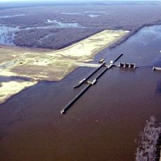
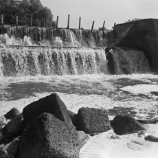
The Felsenthal National Wildlife Refuge contains the world's largest green-tree reservoir, a rare type of wetland that supports diverse animal species year-round. This protected area offers visitors a chance to experience an unusual water landscape found nowhere else.

The community of curious travelers

AroundUs brings together thousands of curated places, local tips, and hidden gems, enriched daily by 60,000 contributors worldwide.

Start exploring
Location
Inception
November 2, 1829
Capital city
El Dorado
Shares border with
Ouachita County, Columbia County, Calhoun County, Bradley County, Ashley County, Morehouse Parish, Union Parish, Claiborne Parish
GPS coordinates
33.18722,-92.59139
Latest update
December 7, 2025 20:25
Around this place
Felsenthal National Wildlife Refuge
United States of America

Felsenthal National Wildlife Refuge

43.3 km
J.T. Murphy No 1 Crater
United States of America

J.T. Murphy No 1 Crater

18.9 km
El Dorado Confederate Monument
United States of America

El Dorado Confederate Monument

7.3 km
Exchange Bank building
United States of America

Exchange Bank building

7.3 km
Dual State Monument
United States of America

Dual State Monument

28.6 km
Rialto Theatre
United States of America

Rialto Theatre

7.2 km
Union County Courthouse
United States of America

Union County Courthouse

7.3 km
Griffin Auto Company Building
United States of America

Griffin Auto Company Building

7.1 km
J.H. McWilliams House
United States of America

J.H. McWilliams House

7.2 km
El Dorado Apartments
United States of America

El Dorado Apartments

6.8 km
Joel Smith House
United States of America

Joel Smith House

8 km
Charles H. Murphy, Sr., House
United States of America

Charles H. Murphy, Sr., House

7.4 km
Henry Crawford McKinney House
United States of America

Henry Crawford McKinney House

7 km
Ouachita River Lock and Dam No. 8
United States of America

Ouachita River Lock and Dam No. 8

17.2 km
Bank of Commerce
United States of America

Bank of Commerce

7.4 km
Willett House
United States of America

Willett House

20.9 km
First Presbyterian Church
United States of America

First Presbyterian Church

7.1 km
Newton House Museum
United States of America

Newton House Museum

7.3 km
Capt. John T. Burkett House
United States of America

Capt. John T. Burkett House

34 km
Randolph James House
United States of America

Randolph James House

7.5 km
El Dorado Junior College Building
United States of America

El Dorado Junior College Building

7.4 km
D. McDonald House
United States of America

D. McDonald House

23.3 km
W. F. & Estelle McWilliams House
United States of America

W. F. & Estelle McWilliams House

7.5 km
Dunn House
United States of America

Dunn House

39.4 km
Municipal Building
United States of America

Municipal Building

7.3 km
Smith-McCurry House
United States of America

Smith-McCurry House

3.8 km
Masonic Temple
United States of America

Masonic Temple

7.3 km
Mount Moriah Masonic Lodge No. 18
United States of America

Mount Moriah Masonic Lodge No. 18

23.8 km
Show the full map
« Union County - County in southern Arkansas, United States » is provided by Around Us (aroundus.com). Images and texts are derived from Wikimedia project under a Creative Commons license. You are allowed to copy, distribute, and modify copies of this page, under the conditions set by the license, as long as this note is clearly visible.

Discover hidden gems everywhere you go!

From secret cafés to breathtaking viewpoints, skip the crowded tourist spots and find places that match your style. Our app makes it easy with voice search, smart filtering, route optimization, and insider tips from travelers worldwide. Download now for the complete mobile experience.

Around Us App Screenshot

A unique approach to discovering new places

Le Figaro

All the places worth exploring

France Info

A tailor-made excursion in just a few clicks

20 Minutes

Around Us
Travel Guide & Maps
Download

Send to your phone

QR Code
1

Open the camera app on your mobile.

2

Point at the QR code with your camera. A notification will appear.

3

Tap the notification to open the link.