Enable Location

We need your location to show you interesting places around you

Discover nearby places

Find interesting locations and hidden gems around you

Precise directions

Get accurate directions and distances to places

Your location is never shared with other users. It's only used when you tap the location button.

Southgate

Log in to your account

Start exploring — it's free

Trusted by 63,911 travelers worldwide

Continue with Google
Continue with Apple
or

We will send you a code to connect

By continuing, you accept our Terms and Conditions and our Privacy Policy

Check your inbox

We've sent a pincode in your inbox. Please enter the code below.

Discussion Reviews 1 Photos
18k Popularity

Southgate, city in Wayne County, Michigan, United States

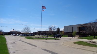
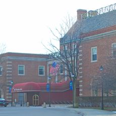
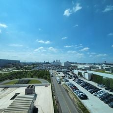
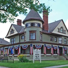
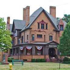
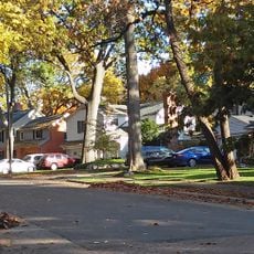
Southgate is a city in Wayne County, Michigan, spanning about 6.5 square miles across a flat landscape. The city features residential neighborhoods, commercial areas with shops and restaurants, and parks connected by a straightforward grid-pattern street system.

Southgate was founded in the late 1790s when Pierre Michel Campau settled in the area, with farming as the main livelihood. The city grew rapidly after World War II as suburban development expanded, and its name referenced the location south of Detroit.

The name Southgate refers to the city's location south of Detroit, reflecting its role as a suburban gateway. Today, residents and visitors experience a welcoming community where people gather at local shops, parks, and city events throughout the year.

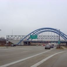
The city is easiest to navigate by car since a grid street pattern makes finding your way straightforward, and Interstate 75 runs through the area. Public bus routes connect it to Detroit and surrounding communities if you prefer not to drive.

The city's name comes from a 1950s plan for a shopping center in the southeast corner, which the first mayor Thomas J. Anderson deliberately chose. The Southgate Shopping Center that later opened became a gathering place for shopping and socializing for decades.

The community of curious travelers

AroundUs brings together thousands of curated places, local tips, and hidden gems, enriched daily by 60,000 contributors worldwide.

Start exploring
Location
Inception
October 1958
Elevation above the sea
180 m
GPS coordinates
42.20528,-83.19806
Latest update
February 17, 2026 00:00
Around this place
The Henry Ford
United States of America

The Henry Ford

11.3 km
Automotive Hall of Fame
United States of America

Automotive Hall of Fame

11.3 km
Uniroyal Giant Tire
United States of America

Uniroyal Giant Tire

7.3 km
Grosse Ile
United States of America

Grosse Ile

8.9 km
The Dearborn Inn
United States of America

The Dearborn Inn

10.5 km
Ste. Claire
United States of America

Ste. Claire

8.7 km
Detroit River International Wildlife Refuge
United States of America

Detroit River International Wildlife Refuge

5.5 km
Gateway Bridge
United States of America

Gateway Bridge

8.9 km
Grosse Ile Toll Bridge
United States of America

Grosse Ile Toll Bridge

4.8 km
Ford Rouge Factory Tour
United States of America

Ford Rouge Factory Tour

11.2 km
Wayne County Bridge
United States of America

Wayne County Bridge

8.8 km
West Jefferson Avenue–Rouge River Bridge
United States of America

West Jefferson Avenue–Rouge River Bridge

10.1 km
East River Road Historic District
United States of America

East River Road Historic District

10 km
Grassy Island
United States of America

Grassy Island

5.6 km
George P. MacNichol House
United States of America

George P. MacNichol House

4.1 km
St. James Episcopal Church
United States of America

St. James Episcopal Church

10.1 km
Ford-Bacon House
United States of America

Ford-Bacon House

4.1 km
Marx House
United States of America

Marx House

4.1 km
Fort Street–Pleasant Street and Norfolk & Western Railroad Viaduct
United States of America

Fort Street–Pleasant Street and Norfolk & Western Railroad Viaduct

9.7 km
Mellus Newspapers Building
United States of America

Mellus Newspapers Building

5.5 km
John and Emma Lacey Eberts House
United States of America

John and Emma Lacey Eberts House

3.9 km
Wyandotte Odd Fellows Temple
United States of America

Wyandotte Odd Fellows Temple

4 km
Grassy Island Light
United States of America

Grassy Island Light

5.8 km
Black Oak Heritage Park
Canada

Black Oak Heritage Park

11.4 km
Parke Lane Road–Thorofare Canal Bridge
United States of America

Parke Lane Road–Thorofare Canal Bridge

6.1 km
Springwells Park Historic District
United States of America

Springwells Park Historic District

11.4 km
Ferry Street–Thorofare Canal Bridge
United States of America

Ferry Street–Thorofare Canal Bridge

8.2 km
R.P. McMurphy's
United States of America

R.P. McMurphy's

4 km
Show the full map
Reviews
Share your experience

No review yet

Discussions
Start a discussion...

No discussion yet

« Southgate - city in Wayne County, Michigan, United States » is provided by Around Us (aroundus.com). Images and texts are derived from Wikimedia project under a Creative Commons license. You are allowed to copy, distribute, and modify copies of this page, under the conditions set by the license, as long as this note is clearly visible.

Discover hidden gems everywhere you go!

From secret cafés to breathtaking viewpoints, skip the crowded tourist spots and find places that match your style. Our app makes it easy with voice search, smart filtering, route optimization, and insider tips from travelers worldwide. Download now for the complete mobile experience.

Around Us App Screenshot

A unique approach to discovering new places

Le Figaro

All the places worth exploring

France Info

A tailor-made excursion in just a few clicks

20 Minutes

Around Us
Travel Guide & Maps
Download

Send to your phone

QR Code
1

Open the camera app on your mobile.

2

Point at the QR code with your camera. A notification will appear.

3

Tap the notification to open the link.