Enable Location

We need your location to show you interesting places around you

Discover nearby places

Find interesting locations and hidden gems around you

Precise directions

Get accurate directions and distances to places

Your location is never shared with other users. It's only used when you tap the location button.

Gratiot County

Log in to your account

Start exploring — it's free

Trusted by 62,416 travelers worldwide

Continue with Google
Continue with Apple
or

We will send you a code to connect

By continuing, you accept our Terms and Conditions and our Privacy Policy

Check your inbox

We've sent a pincode in your inbox. Please enter the code below.

Gratiot County, Administrative county in central Michigan, US

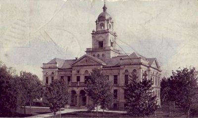
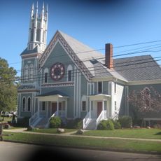
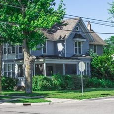
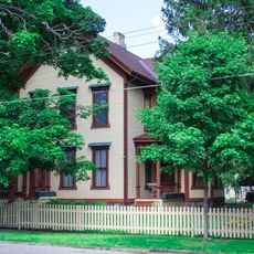
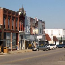
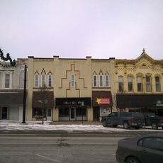
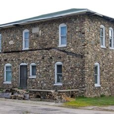
Gratiot County is an administrative division in central Michigan combining farmland, residential communities, and small towns across its area. Ithaca serves as the county seat, functioning as the administrative hub for the various townships and municipalities within it.

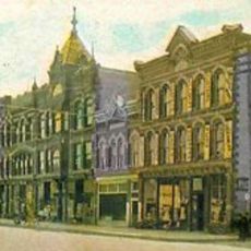
The county was established by Michigan state legislature in 1855 and named after Captain Charles Gratiot, a military officer who oversaw an early frontier post. Initial settlement by farmers from the Northeast following the Erie Canal's opening shaped its agricultural character.

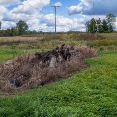
The name comes from Captain Charles Gratiot, a military officer from the early American period. Today, the landscape reflects its farming roots, with open fields and rural communities defining how people live and work across the region.

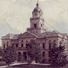
The county government maintains offices in Ithaca where residents can access administrative services across the different townships and municipalities. Getting around the area works best with your own vehicle, as the region is spread out and not easily walkable.

A large wind energy project launched in 2012 illustrates the region's shift toward renewable power sources. The tall wind turbines scattered across the farmland now define much of the landscape visitors see when traveling through.

The community of curious travelers

AroundUs brings together thousands of curated places, local tips, and hidden gems, enriched daily by 60,000 contributors worldwide.

Start exploring
Location
Inception
1855
Capital city
Ithaca
Shares border with
Midland County, Clinton County, Isabella County, Saginaw County, Montcalm County, Shiawassee County, Ionia County
GPS coordinates
43.29000,-84.60000
Latest update
December 7, 2025 19:24
Around this place
Mount Pleasant Indian Industrial Boarding School
United States of America

Mount Pleasant Indian Industrial Boarding School

39.3 km
Soaring Eagle Waterpark
United States of America

Soaring Eagle Waterpark

37.5 km
Alma Downtown Historic District
United States of America

Alma Downtown Historic District

11.1 km
Mount Pleasant Downtown Historic District
United States of America

Mount Pleasant Downtown Historic District

37.8 km
Grist Mill Bridge, Dam and Mill Site
United States of America

Grist Mill Bridge, Dam and Mill Site

27.3 km
Michigan Condensed Milk Factory
United States of America

Michigan Condensed Milk Factory

38 km
Wright Opera House
United States of America

Wright Opera House

11.1 km
Lincoln Road–Pine River Bridge
United States of America

Lincoln Road–Pine River Bridge

21.3 km
First Congregational Church of Ovid
United States of America

First Congregational Church of Ovid

36.6 km
East Ward School
United States of America

East Ward School

32.4 km
Gratiot County Courthouse
United States of America

Gratiot County Courthouse

391 m
Union School
United States of America

Union School

32.7 km
Doughty House
United States of America

Doughty House

37.9 km
The Sweeney House
United States of America

The Sweeney House

37.6 km
Giles Gilbert House
United States of America

Giles Gilbert House

38.9 km
Ithaca Downtown Historic District
United States of America

Ithaca Downtown Historic District

575 m
Parshallburg Bridge
United States of America

Parshallburg Bridge

41.1 km
Saint Louis Downtown Historic District
United States of America

Saint Louis Downtown Historic District

13.3 km
Ball Road-Little Salt Creek Bridge
United States of America

Ball Road-Little Salt Creek Bridge

25.5 km
Kelly/Shorts Stadium
United States of America

Kelly/Shorts Stadium

34.9 km
Saint John's Church Historical Marker
United States of America

Saint John's Church Historical Marker

32.2 km
St. Johns Cinema
United States of America

St. Johns Cinema

31.3 km
St. John the Baptist Catholic Church Complex
United States of America

St. John the Baptist Catholic Church Complex

29.8 km
Saint Johns
United States of America

Saint Johns

32.3 km
Clinton Theater
United States of America

Clinton Theater

32.3 km
Paine-Gillam-Scott House Historical Marker
United States of America

Paine-Gillam-Scott House Historical Marker

32.4 km
Briggs Public Library
United States of America

Briggs Public Library

32 km
MacLachlan Sanitarium
United States of America

MacLachlan Sanitarium

15.9 km
Show the full map
Administrative divisions
« Gratiot County - Administrative county in central Michigan, US » is provided by Around Us (aroundus.com). Images and texts are derived from Wikimedia project under a Creative Commons license. You are allowed to copy, distribute, and modify copies of this page, under the conditions set by the license, as long as this note is clearly visible.

Discover hidden gems everywhere you go!

From secret cafés to breathtaking viewpoints, skip the crowded tourist spots and find places that match your style. Our app makes it easy with voice search, smart filtering, route optimization, and insider tips from travelers worldwide. Download now for the complete mobile experience.

Around Us App Screenshot

A unique approach to discovering new places

Le Figaro

All the places worth exploring

France Info

A tailor-made excursion in just a few clicks

20 Minutes

Around Us
Travel Guide & Maps
Download

Send to your phone

QR Code
1

Open the camera app on your mobile.

2

Point at the QR code with your camera. A notification will appear.

3

Tap the notification to open the link.